Piney River (Tye River tributary)

Last updated
Piney River
Country United States
Physical characteristics
Main source Virginia

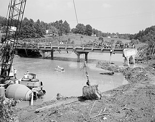
The Piney River is a 16.5-mile-long (26.6 km) [1] tributary of the Tye River in the U.S. state of Virginia. It is part of the James River watershed.

Tye River river in the United States of America

The Tye River is a 35.4-mile-long (57.0 km) tributary of the James River in central Virginia in the United States. Originating on the eastern slope of the Blue Ridge Mountains in Nelson County, and fed by the Piney and Buffalo rivers, by way of the James River it is part of the watershed of the Chesapeake Bay.

U.S. state constituent political entity of the United States

In the United States, a state is a constituent political entity, of which there are currently 50. Bound together in a political union, each state holds governmental jurisdiction over a separate and defined geographic territory and shares its sovereignty with the federal government. Due to this shared sovereignty, Americans are citizens both of the federal republic and of the state in which they reside. State citizenship and residency are flexible, and no government approval is required to move between states, except for persons restricted by certain types of court orders. Four states use the term commonwealth rather than state in their full official names.

Virginia State of the United States of America

Virginia, officially the Commonwealth of Virginia, is a state in the Southeastern and Mid-Atlantic regions of the United States located between the Atlantic Coast and the Appalachian Mountains. The geography and climate of the Commonwealth are shaped by the Blue Ridge Mountains and the Chesapeake Bay, which provide habitat for much of its flora and fauna. The capital of the Commonwealth is Richmond; Virginia Beach is the most populous city, and Fairfax County is the most populous political subdivision. The Commonwealth's estimated population as of 2018 is over 8.5 million.

The river rises in the Blue Ridge Mountains at the confluence of its North and South forks. For its entire length it forms the boundary between Amherst and Nelson counties. It flows southeast into the Virginia Piedmont, passing the villages of Lowesville and Piney River. It joins the Tye River 3 miles (5 km) upstream from the village of Tye River.

Blue Ridge Mountains mountain range

The Blue Ridge Mountains are a physiographic province of the larger Appalachian Mountains range. The mountain range is located in the eastern United States, and extends 550 miles southwest from southern Pennsylvania through Maryland, West Virginia, Virginia, North Carolina, South Carolina, Tennessee and Georgia. This province consists of northern and southern physiographic regions, which divide near the Roanoke River gap. To the west of the Blue Ridge, between it and the bulk of the Appalachians, lies the Great Appalachian Valley, bordered on the west by the Ridge and Valley province of the Appalachian range.

Amherst County, Virginia County in the United States

Amherst County is a county, located in the Piedmont region and near the center of the Commonwealth of Virginia in the United States. The county is part of the Lynchburg, VA Metropolitan Statistical Area, and its county seat is also called Amherst.

Nelson County, Virginia County in the United States

Nelson County is a county located in the Commonwealth of Virginia. As of the 2010 census, the population was 15,020. Its county seat is Lovingston.

See also

Related Research Articles

The Hardware River is a 23.3-mile-long (37.5 km) tributary of the James River in central Virginia in the United States. It is part of the watershed of Chesapeake Bay.

The Mechums River is a 25.5-mile-long (41.0 km) tributary of the South Fork of the Rivanna River in central Virginia in the United States. Via the Rivanna and James rivers, it is part of the watershed of Chesapeake Bay.

The Willis River is a 61.8-mile-long (99.5 km) tributary of the James River in central Virginia in the United States. Via the James River, it is part of the watershed of Chesapeake Bay.

The Rockfish River is a 28.7-mile-long (46.2 km) tributary of the James River in central Virginia in the United States. Via the James River, it is part of the watershed of the Chesapeake Bay.

Bearwallow Creek is a 4.3-mile-long (6.9 km) tributary stream of Tearcoat Creek, itself a tributary of the North River, making it a part of the Potomac River and Chesapeake Bay watersheds. Bearwallow Creek is located in Hampshire County, West Virginia. It rises on Chestnut Oak Ridge, from which it flows southwest along the ridge's eastern flanks and then begins its course southeast along Bear Wallow Hollow Road and U.S. Route 50 until its confluence with Tearcoat Creek at Pleasant Dale.

Virginia State Route 151 highway in Virginia

State Route 151 is a primary state highway in the U.S. state of Virginia. The state highway runs 35.22 miles (56.68 km) from U.S. Route 29 at Buffalo Hill north to US 250 at Critzers Shop. SR 151 traverses the Blue Ridge foothills of western Nelson County, where the highway provides access to the Wintergreen Resort.

Rocky Mountain is a peak of the Blue Ridge Mountains in Virginia. It is located about 2 miles (3.5 km) east of Irish Gap, on the border of Rockbridge County and Amherst County; it is the highest point of both counties. Rocky Mountain is flanked to the northeast by Elk Pond Mountain, to the southwest by Grapevine Ridge, and to the south by Tar Jacket Ridge.

The Priest (mountain) mountain in Nelson County, Virginia, USA

The Priest (DePriest) is a mountain in Nelson County, Virginia. The peak of the mountain is the highest point in the county. The mountain is on a spur off the main Blue Ridge Mountains, about 3.5 miles (5.5 km) east of Maintop Mountain, located in the Priest Wilderness of the George Washington National Forest.

Maintop Mountain mountain in United States of America

Maintop Mountain is a mountain in Nelson County, Virginia. The mountain is a peak on a spur off the main Blue Ridge Mountains, about 2 miles (3 km) east of Elk Pond Mountain, and about 3.5 miles (5.5 km) west of The Priest. The mountain is located in the George Washington National Forest.

Buffalo River (Virginia) river in United States of America

The Buffalo River is a 31.5-mile-long (50.7 km) tributary of the Tye River in the U.S. state of Virginia. It is part of the James River watershed.

The Bush River is a 22.6-mile-long (36.4 km) tributary of the Appomattox River in the U.S. state of Virginia. It rises northeast of Keysville near the junction of the boundaries between Charlotte, Prince Edward, and Lunenburg counties. It flows northeast through Prince Edward County and joins the Appomattox River 3 miles (5 km) east of Farmville.

The Little Piney River is a 7.6-mile-long (12.2 km) tributary of the Piney River in Amherst County in the U.S. state of Virginia. Via the Piney and Tye rivers, it is part of the James River watershed.

The Little Willis River is a 15.5-mile-long (24.9 km) tributary of the Willis River in the U.S. state of Virginia. It is part of the James River watershed. It rises in Buckingham County and flows east into Cumberland County, joining the Willis River 9 miles (14 km) north of Farmville.

The North River is a 9.3-mile-long (15.0 km) tributary of the Slate River in Buckingham County in the U.S. state of Virginia. It is part of the James River watershed.

The Piney River is an 8.3-mile-long (13.4 km) river in the U.S. state of Virginia. Rising in the northern part of Shenandoah National Park, it is a tributary of the Thornton River, and via the Hazel and Rappahannock rivers is part of the Chesapeake Bay watershed.

Sandy River is a 12.9-mile-long (20.8 km) tributary of the Bush River in the U.S. state of Virginia. Via the Bush River and the Appomattox River, it is part of the James River watershed. It rises in Prince Edward County northeast of the village of Green Bay and flow north through Prince Edward State Forest and farmland, joining the Bush River less than one mile south of that river's confluence with the Appomattox near the town of Farmville.

The Slate River is a 48.8-mile-long (78.5 km) tributary of the James River in the U.S. state of Virginia. It rises about 10 miles (16 km) northeast of Appomattox and flows northeast past Buckingham, eventually reaching the James River near Bremo Bluff. The river's course is entirely within Buckingham County.

The Staunton River is a 4.1-mile-long (6.6 km) stream in the U.S. state of Virginia. Flowing entirely within Shenandoah National Park, it is a tributary of the Rapidan River and part of the Rappahannock River watershed.

Towaliga River river in the United States of America

The Towaliga River is a 52.3-mile-long (84.2 km) tributary of the Ocmulgee River in central Georgia. The Towaliga passes through High Falls State Park in northwestern Monroe County, then traverses the county and joins the Ocmulgee near the town of Juliette. The river is fairly muddy above High Falls Lake, but it clears once below the falls where most of the river is rock bottomed. This region is about 50 miles (80 km) south of Atlanta and about 35 miles (56 km) north of Macon.

References

  1. U.S. Geological Survey. National Hydrography Dataset high-resolution flowline data. The National Map, accessed April 1, 2011
International Standard Book Number Unique numeric book identifier

The International Standard Book Number (ISBN) is a numeric commercial book identifier which is intended to be unique. Publishers purchase ISBNs from an affiliate of the International ISBN Agency.

Coordinates: 37°40′37″N78°58′01″W / 37.67681°N 78.96697°W / 37.67681; -78.96697

Geographic coordinate system Coordinate system

A geographic coordinate system is a coordinate system that enables every location on Earth to be specified by a set of numbers, letters or symbols. The coordinates are often chosen such that one of the numbers represents a vertical position and two or three of the numbers represent a horizontal position; alternatively, a geographic position may be expressed in a combined three-dimensional Cartesian vector. A common choice of coordinates is latitude, longitude and elevation. To specify a location on a plane requires a map projection.