
The Arctic Archipelago, also known as the Canadian Arctic Archipelago, is a group of islands north of the Canadian mainland.
The Geologists Range is a mountain range about 55 km (34 mi) long, standing between the heads of Lucy and Nimrod Glaciers in Antarctica. Seen by the northern party of the New Zealand Geological Survey Antarctic Expedition (NZGSAE) (1961–62) and named to commemorate the work of geologists in Antarctic exploration.
Yeats Glacier is a tributary glacier about 8 miles (13 km) long, flowing west from the north side of Mount Finley to enter Shackleton Glacier just north of Lockhart Ridge, in the Queen Maud Mountains. Named by F. Alton Wade, leader of the Texas Tech Shackleton Glacier Expedition, for Vestal L. Yeats, a member of the Texas Technological College faculty and of both expeditions.
Ambergris Glacier is a glacier flowing south-southeast from Mount Sara Teodora between Chintulov Ridge and Valkosel Ridge to join Flask Glacier just west of Fluke Ridge in Aristotle Mountains on the east coast of Graham Land, Antarctica. One of several names in the area that reflect a whaling theme, it was named in 1987 by the United Kingdom Antarctic Place-Names Committee from the substance secreted by the sperm whale and used in perfumery.

Bigo Bay is a bay 8 nautical miles (15 km) long and 6 nautical miles (11 km) wide, indenting the west coast of Graham Land between Cape Garcia and Magnier Peninsula surmounted by the Magnier Peaks and Lisiya Ridge.
Binder Beach is a moraine beach at the head of Right Whale Bay on the north coast of South Georgia. The name appears on a chart based upon a survey by DI personnel in 1930.
Briand Fjord is a bay nearly 3 nautical miles (6 km) long in the northeast part of Flandres Bay, along the west coast of Graham Land. It was charted by the French Antarctic Expedition, 1903–05, and named by Jean-Baptiste Charcot for Aristide Briand, a French statesman who was Minister of Public Instruction in 1906.
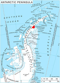
Nusser Island is an island 1.5 nautical miles (2.8 km) north of Laktionov Island, off the east side of Renaud Island in the Biscoe Islands. The island was first accurately shown on an Argentine government chart of 1957. It was named by the United Kingdom Antarctic Place-Names Committee (UK-APC) in 1959 for Franz Nusser, an Austrian meteorologist who specialized in sea ice studies.
Frost Cliff is a steep, partly ice-covered cliff 2 nautical miles (4 km) east of Mount Steinfeld, on the south side of the divide between the upper reaches of Hull Glacier and Kirkpatrick Glacier, in Marie Byrd Land, Antarctica. It was mapped by the United States Geological Survey from surveys and U.S. Navy air photos, 1959–65, and was named by the Advisory Committee on Antarctic Names for Commander William L. Frost, U.S. Navy, Officer-in-Charge of Antarctic Support Activities at McMurdo Station, 1970.

Drummond Glacier is a glacier 10 nautical miles (18 km) long and 2 nautical miles (4 km) wide, on the west coast of Graham Land, situated south of Hopkins Glacier and flowing west-northwest between Voit Peak and Sherba Ridge into Darbel Bay east of Sokol Point.
Gaviotín Rock is a rock lying in Larsen Channel, about 0.25 nautical miles (0.5 km) north of the coastal ice cliffs of Joinville Island, Antarctica, and 2 nautical miles (4 km) north of Saxum Nunatak. The name Gaviotín (gull) appears on an Argentine government chart of 1957.

Long Glacier is a glacier about 8 nautical miles long in the southeastern part of Thurston Island, Antarctica. It flows south to the Abbot Ice Shelf, 14 nautical miles (26 km) west of Harrison Nunatak. The glacier was mapped by the United States Geological Survey from surveys and U.S. Navy air photos, 1960–66, and was named by the Advisory Committee on Antarctic Names (US-ACAN) for Fred A. Long, Jr., an aviation machinist of U.S. Navy Squadron VX-6, who wintered at Little America V in 1957 and was in Antarctica in the 1960–61 and 1962–63 seasons.
Kitticarrara Glacier is a short, steep glacier 1 nautical mile (2 km) south of Howard Glacier in the Kukri Hills, flowing east-southeast into Ferrar Glacier, in Victoria Land, Antarctica. It was named by the Western Journey Party, led by Thomas Griffith Taylor, of the British Antarctic Expedition, 1910–13. The name was suggested by Frank Debenham after Kitticarrara, a sheep station in New South Wales.

McCance Glacier is the 30-km long and 5 km wide glacier draining the Hutchison Hill area on the west slopes of Avery Plateau on Loubet Coast in Graham Land, Antarctica. It flows north-northwestwards along the west side of Osikovo Ridge, Kladnitsa Peak and Rubner Peak and enters Darbel Bay.
MacAyeal Peak is a peak about 1,100 metres (3,600 ft) high located 2 nautical miles (4 km) west-northwest of the Brandwein Nunataks in the north-central part of the Nebraska Peaks of Antarctica. It was named by the Advisory Committee on Antarctic Names after Douglas R. MacAyeal of the Institute of Quaternary Studies, University of Maine, Orono, a member of the United States Antarctic Research Program glaciological party during the Ross Ice Shelf Project in the 1976–77 austral summer; he was later affiliated with the University of Chicago.
Screen Islands is a group of islands extending northwest from Aguda Point for 1.5 nautical miles (2.8 km) across the entrance to Hidden Bay, off the west coast of Graham Land. First charted by the Belgian Antarctic Expedition under Gerlache, 1897-99. So named by the United Kingdom Antarctic Place-Names Committee (UK-APC) in 1958 because they form a screen across the entrance to Hidden Bay.

Renaud Glacier is a heavily crevassed glacier on the east side of Hemimont Plateau flowing southeast to enter Seligman Inlet between Lewis Glacier and Choyce Point, on the east coast of Graham Land. The glacier was first photographed by the United States Antarctic Service (USAS), 1939-41. Named by United Kingdom Antarctic Place-Names Committee (UK-APC) for Andre Renaud, Swiss glaciologist and chairman of the Swiss Glacier Commission, 1955-74.

Valiente Peak is a peak on Kiev Peninsula on the west coast of Graham Land, standing close north of the mouth of Lever Glacier where the latter enters Beascochea Bay. It was discovered by the French Antarctic Expedition, 1908–10, under Charcot and named by him "Sommet Saens Valiente," probably for Captain J.P. Saenz Valiente of Argentina. It was remapped by the British Graham Land Expedition (BGLE) under Rymill during surveys in Beascochea Bay in August 1935 and a journey to Trooz Glacier in January 1936. The name was shortened by the United Kingdom Antarctic Place-Names Committee (UK-APC) in 1959.
Rotz Glacier is a tributary glacier 9 nautical miles (17 km) long and 2 nautical miles (3.7 km) wide. It flows west from Wakefield Highland, central Antarctic Peninsula, into Airy Glacier at a point due south of Mount Timosthenes. Photographed by Ronne Antarctic Research Expedition (RARE) on November 27, 1947. Surveyed by Falkland Islands Dependencies Survey (FIDS) in December 1958 and November 1960. Named by United Kingdom Antarctic Place-Names Committee (UK-APC) after Jean Rotz, 16th century French chartmaker and writer on the principles of navigation, who designed an elaborate magnetic compass and became hydrographer to King Henry VIII in 1542.


