Piravanthur

Last updated
Piravanthoor
പിറവന്തൂ൪
village
Country India
State Kerala
District Kollam
Government
  Type Local
  Body Panchayat
Population (2001)
  Total 23,336
Languages
  Official Malayalam, English
Time zone IST (UTC+5:30)
Vehicle registration KL-

Piravanthoor is a village in Kollam district in the state of Kerala, India. [1]

Kollam district District in Kerala, India

Kollam district is one of 14 districts of the state of Kerala, India. The district has a cross-section of Kerala's natural attributes; it is endowed with a long coastline, a major Laccadive Sea seaport and an inland lake. The district has many waterbodies. Kallada river is one among them, and the east side land of river is EastKallada and the west side land is WestKallada. Kallada Boat race is one among the famous festival events of district. Even though it is a competition between two land sides of the river, many boat clubs from various place,s even beyond the district participate in the event. Kollam is the capital of Kerala's cashew industry. Plains, mountains, lakes, lagoons and backwaters, forests, farmland and rivers make up the topography of the district. The area had trading relationships with Phoenicia and Ancient Rome.

Kerala State in southern India

Kerala is a state on the southwestern, Malabar Coast of India. It was formed on 1 November 1956, following passage of the States Reorganisation Act, by combining Malayalam-speaking regions. Spread over 38,863 km2 (15,005 sq mi), Kerala is the twenty-second largest Indian state by area. It is bordered by Karnataka to the north and northeast, Tamil Nadu to the east and south, and the Lakshadweep Sea to the west. With 33,387,677 inhabitants as per the 2011 Census, Kerala is the thirteenth-largest Indian state by population. It is divided into 14 districts with the capital being Thiruvananthapuram. Malayalam is the most widely spoken language and is also the official language of the state.

Contents

Demographics

Last updated

As of 2001 India census, Piravanthoor had a population of 23336 with 11222 males and 12114 females. [1]

Census Acquiring and recording information about the members of a given population

A census is the procedure of systematically acquiring and recording information about the members of a given population. The term is used mostly in connection with national population and housing censuses; other common censuses include agriculture, business, and traffic censuses. The United Nations defines the essential features of population and housing censuses as "individual enumeration, universality within a defined territory, simultaneity and defined periodicity", and recommends that population censuses be taken at least every 10 years. United Nations recommendations also cover census topics to be collected, official definitions, classifications and other useful information to co-ordinate international practice.

Schools in Piravanthoor [2]

Offices and Places of Piravanthoor [3]

  1. Piravanthoor Krishi Bhavan
  2. Piravanthoor Co-operative Bank
  3. Indian Pentecoastal Church
  4. St.Mary Orthdox Church

Related Research Articles

Pathanamthitta district District in Kerala, India

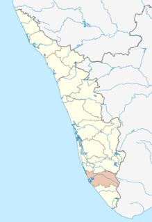
Pathanamthitta District is a district in the southern part of Kerala, India. The district headquarters is in the town of Pathanamthitta. There are four municipalities in Pathanamthitta: Tiruvalla, Adoor, Pathanamthitta and Pandalam.

Paravur, Kollam Municipal Town in Kerala, India

Paravur (Paravūr), is a town and a municipality in the Kollam district of the Indian state of Kerala.

Thalavoor village in Kerala, India

Thalavoor is a village located in the district of Kollam in the Kerala state of India. It is 77 km to the north of the State Capital, Thiruvananthapuram, and 28 km to the east of District Capital, Kollam. Thalavoor village is bordered by Pattazhy village to the north, Pidavoor village to the north-east, Vilakkudy village to the south-east, Melila village to the south and Mylom village to the west. Thalavoor is a part of Pathanapuram Block Panchayat

Pathanapuram Town and Taluk in Kerala, India

Pathanapuram is a town in Punalur Revenue Division Of Kollam district, Kerala, India. It is situated in Pathanapuram taluka, of which it is also the headquarters. Pathanapuram is a part of Grama Panchayat and Block panchayat of same name and part of Kollam District Panchayat.

Kamukumchery village in Kerala, India

Kamukumchery is a village located in Pathanapuram in Kollam district of Kerala, India. .It belongs to Piravanthoor and Thalavor panchayats. The Kallada River passes through the village. Main temple in Kamukumchery is Kamukumchery Thiruvilangonappan Temple.. There are three schools which helped Kamukumchery to achieve 100% literacy. Government LPS Kamukumchery, Government New LPS Kamukumchery and UPS Kamukumchery

Aryankavu Village in Kerala, India

Aryankavu is a village in Punalur, Kollam district, Kerala. It lies on National Highway 744 near Thenmala. It is a mountain pass in Western Ghats. The Punalur-Shenkottai broad gauge railway line also passes through Aryankavu. Aryankavu is 78 km away from Kollam and 36 km away from Punalur.

Ezhupunna village in Kerala, India

Ezhupunna is a village in the taluk of Cherthala in Alappuzha district in the Indian state of Kerala. It lies between Alappuzha and Kochi, near National Highway 47. It is at a distance of 23 km from Kochi. There is also a railway station, where only passenger trains halt. This is a panchayat which come under the Aroor Assembly constituency and the Alappuzha Parliamentary constituency. The village have borders with Kumbalangy and Chellanam, suburbs of the city of Kochi.

Karumalloor Village in Kerala, India

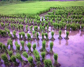
Karumallur is a village in Paravur Taluk, Ernakulam district in the Indian state of Kerala. Karumalloor is a panchayat in Ernakulam District. The village consists of large tracts of paddy fields. Karumallur is bounded by distributaries of the river Periyar. The panchayat is mainly a rice-based agrarian economy.

Chithara village in Kerala, India

Chithara is a village in Kollam district in the state of Kerala, India.

Mulavana village in Kerala, India

Mulavana is a village in Kollam district in the state of Kerala, India. The place is filled with almost all types of shops,which includes stationary,fancy,textile etc.The Mulavana Fish market is regarded as the best market while comparing with the surrounding places.

Mynagappally village in Kerala, India

Mynagappally is a village in Kollam district in the Indian state of Kerala.

Pattazhy Vadakkekara is a village in Kollam district in the state of Kerala, India. It is separated from Pattazhi by the Kallada River. Pattazhi Vadakkekkara is a part of Pathanapuram Block Panchayat and Kollam district Panchayat.

Pavithreswaram village in Kerala, India

Pavithreswaram is a village in Kottarakkara taluk of Kollam district in the state of Kerala, India.

Thevalakkara village in Kerala, India

Thevalakkara is a village in the Karunagappally taluk, Kollam district of the state of Kerala, India. Formerly known as Quilon, it is one of the 14 districts of Kerala.Thevalakkara is the land which contain a famous Devi temple and along with newly constructed mosque and church in the same area.Thevalakkara is home to great people like Thevalakkara Kunjanpilla and also his son and famous dramatist Babykuttan Thoolika and famous director Thevalakkara Chellapan.*Thoolika* drama troops main office was located in this place.This place is a land of unity.

Ummannoor village in Kerala, India

Ummannoor is a village in Kollam district in the state of Kerala, India.

Vilakkudy village in Kerala, India

Vilakkudy is a village in Kollam district in the state of Kerala, India. Vilakkudy is a part of Pathanapuram Block Panchayat and Kollam district Panchayat.

Melukavu village in Kerala, India

Melukavu (Melukavumattom) is a village in the eastern part of Meenachil Taluk in Kottayam District of Kerala state, India.

Vallicode-Kottayam village in Kerala, India

Vallicode-Kottayam is a village in Pathanamthitta district in the state of Kerala, India.

Karimpuzha is a gram panchayat in the Palakkad district, state of Kerala, India. It is a local government organisation that serves the villages of Karimpuzha-I and Karimpuzha-II.

Umayanalloor Village in Kerala, India

Umayanalloor is a village near Mayyanad in Kollam District, Kerala state, India.

References

  1. 1 2 Registrar General & Census Commissioner, India. "Census of India : Villages with population 5000 & above". Archived from the original on December 8, 2008. Retrieved 2008-12-10.
  2. "Schools in Piravanthoor - Kollam district of Kerala". study4sure.com. Retrieved 2018-05-10.
  3. "Google Maps". Google Maps. Retrieved 2018-05-10.

Coordinates: 9°03′N76°55′E / 9.050°N 76.917°E / 9.050; 76.917

Geographic coordinate system Coordinate system

A geographic coordinate system is a coordinate system that enables every location on Earth to be specified by a set of numbers, letters or symbols. The coordinates are often chosen such that one of the numbers represents a vertical position and two or three of the numbers represent a horizontal position; alternatively, a geographic position may be expressed in a combined three-dimensional Cartesian vector. A common choice of coordinates is latitude, longitude and elevation. To specify a location on a plane requires a map projection.