Last updated The Pittsburgh Wayfinder map symbol, which is present on nearly all signs in the system, is a stylized neighborhood map of the city of Pittsburgh.
The Pittsburgh Wayfinder System is a series of directional and destination signs installed throughout the City of Pittsburgh, Pennsylvania meant to guide travelers to popular destinations and services. The system is designed for easy mapping of neighborhood-to-neighborhood routes with the intent of creating a coherent pattern of travel in the city.
In 1993, city leaders asked Informing Design, a Pittsburgh-based design firm, to create a sign system for Pittsburgh's notoriously confusing network of streets.[1] The signs were designed by graphic designer Martine Bruel in collaboration with Bob Firth, the founding principal of the firm.[1] Since its implementation in 1995 and 1996,[2] the system has been actively maintained and expanded to reflect additions and changes in Pittsburgh's road system.[1]
Composition
The Pittsburgh Wayfinder System is composed of more than 1,500 traffic signs, and nearly all of the city's eighty neighborhoods are covered by the system.[1]
The system divides the city into five regions and assigns each a color:[2]
The dark blue stripes on the Wayfarer map symbol indicate the Ohio, Monongahela, and Allegheny Rivers, which form the main navigational landmarks for the city.[2] The signs are maintained by the City of Pittsburgh Department of Engineering and Construction.
Signage
The system is made up of two types of sign: "Exit-Finder" signs, which provide directional assistance, and "Site-Finder" signs, which denote particular destinations. The system also includes a "Purple Belt" for easy navigation in the downtown area, as well as directional signs to hospitals and parking facilities.[2]
Exit-Finder signs
The dark blue background of Exit-Finder signs serve to differentiate them from the majority of Pennsylvania guide signs, which typically have a green background.[2]
When an Exit-Finder sign is located in the same zone as the destination, the background of the sign matches the color for that zone, and an arrow in the dark blue band at the bottom of the sign points the way to the destination. If destination in question is in a different zone than the one in which the sign is located, a color-coded stripe on an Exit-Finder sign denotes this fact.[2] A variation on the sign occurs when the directional sign gives information on highways or roads, without pointing to a specific destination. These signs have the dark blue background, but do not include the Wayfinder symbol.[2] The diagram to the right demonstrates an Exit-Finder sign, with the Wayfinder map symbol and a color-coded stripe.[note 1]
Site-Finder signs
Site-Finder signs are found directly in front of their locations. The background of the sign matches the color of the region, and a star indicates that the destination has been reached.[2]
The Purple Belt is the innermost colored belt in the Allegheny County belt system, running through downtown Pittsburgh. Unlike the other belts, however, it was established in 1995 along with the Wayfinder System. The Purple Belt sign has the blue background of other Exit-Finder signs, and the purple dot matches the color of the downtown region.[2]
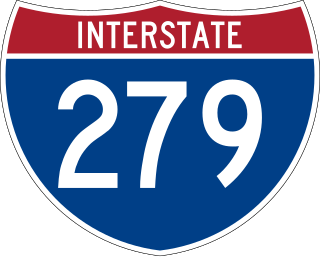
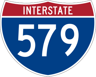
The belt travels in a loop on four two-way streets—Stanwix Street, Fort Duquesne Boulevard / 11th Street, Grant Street and Boulevard of the Allies. (In the counter-clockwise direction, it follows Smithfield Street and 4th Avenue to bypass the left turn from Boulevard of the Allies onto Grant Street, which is prohibited at certain times.) This lies inside the area bounded by the Allegheny River, Interstate 579, Interstate 376 and Interstate 279.
Parking and hospital signs
The Wayfarer system also features signs that point to parking or hospitals. Parking signs have a "P" for parking, while hospital signs have an "H". The background colors of these signs match the color code for the region.[2]
↑ This example of an Exit-Finder gives information on the location of Bigelow Boulevard, while also pointing the way to neighborhoods in the East End. The actual sign on which this image is based is located at the intersection of Fifth Avenue and Washington Place, near Duquesne University. See the Google Maps streetview.
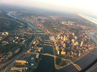
Downtown Pittsburgh, colloquially referred to as the Golden Triangle, and officially the Central Business District, is the urban downtown center of Pittsburgh, Pennsylvania, United States. It is located at the confluence of the Allegheny River and the Monongahela River whose joining forms the Ohio River. The triangle is bounded by the two rivers.
Interstate 279 (I-279), locally referred to as Parkway North, is a north–south auxiliary Interstate Highway that lies entirely within Allegheny County, Pennsylvania. Its southern end is at I-376 at the Fort Pitt Bridge in Pittsburgh, and the north end is in Franklin Park at I-79. It primarily serves at the main access route between Pittsburgh and its northern suburbs.
Interstate 579 (I-579) is a north–south Interstate Highway entirely within Pittsburgh, Pennsylvania. The highway is 2.73 miles (4.39 km) long. I-579 is also known as the Crosstown Boulevard since it crosses the backside of Downtown Pittsburgh.
Interstate 395 (I-395) is an auxiliary Interstate Highway in the US state of Maryland. Known as Cal Ripken Way, the highway runs 1.98 miles (3.19 km) from I-95 north to Howard Street and Camden Street in Downtown Baltimore, where it provides access to the Inner Harbor and the Baltimore Convention Center. The Interstate also serves the Camden Yards Sports Complex, which contains M&T Bank Stadium and Oriole Park at Camden Yards, homes of the Baltimore Ravens and Baltimore Orioles, respectively. I-395 also serves as the southern terminus of Martin Luther King Jr. Boulevard, an urban arterial that provides a western bypass of Downtown Baltimore and connects I-95 with U.S. Route 40 (US 40), US 1, and I-83. The Interstate is maintained by the Maryland Transportation Authority (MDTA) and, like all Interstates, is a part of the National Highway System.
Interstate 170 (I-170) was the designation for a 2.3-mile (3.7 km) freeway in Baltimore, Maryland, that currently carries U.S. Route 40 (US 40). The freeway was originally planned to be the eastern terminus of I-70 and, later, a link between I-70 and the west side of Downtown Baltimore. However, after the Baltimore portion of I-70 was canceled due to community opposition, the freeway was left disconnected from the Interstate system and its Interstate designation rescinded. Local citizens and environmental groups have given the freeway nicknames of "The Highway to Nowhere" and "The Ditch", the latter owing to its mostly below-grade construction; other names include the "Westside Freeway" and the "Franklin–Mulberry Expressway", both referring to its location in the city. Growing support for the freeway's removal has occurred over the last several years.
The Allegheny County Belt System color codes various county roads to form a unique system of routes in Allegheny County, Pennsylvania, and around the city of Pittsburgh.
North Shore is a neighborhood in Pittsburgh's North Side. Its zip code is 15212.
Greater Pittsburgh is the metropolitan area surrounding the city of Pittsburgh in Western Pennsylvania, United States. The region includes Allegheny County, Pittsburgh's urban core county and economic hub, and seven adjacent Pennsylvania counties: Armstrong, Beaver, Butler, Fayette, Lawrence, Washington, and Westmoreland in Western Pennsylvania, which constitutes the Pittsburgh, PA Metropolitan Statistical Area MSA as defined by the U.S. Census Bureau.
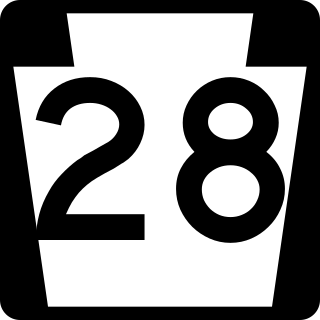
Pennsylvania Route 28 is a major state highway, which runs for 98 miles (158 km) from Anderson Street in Pittsburgh to U.S. Route 219 (US 219) in Brockway in Pennsylvania in the United States.
Pennsylvania Route 60 (PA 60) is a state highway located in the western suburbs of Pittsburgh, Pennsylvania. Although the route follows a mostly east–west alignment, it is signed as a north–south highway. The southern terminus of the route is at a partial interchange with U.S. Route 19 (US 19) and PA 51 in Pittsburgh's West End while the northern terminus is at an interchange with Interstate 376 (I-376), US 22, and US 30 in Robinson Township. The portion of PA 60 outside of Pittsburgh is known as the Steubenville Pike; within the city, PA 60 follows several different streets.
A large metropolitan area that is surrounded by rivers and hills, Pittsburgh has an infrastructure system that has been built out over the years to include roads, tunnels, bridges, railroads, inclines, bike paths, and stairways; however, the hills and rivers still form many barriers to transportation within the city.
The Pittsburgh Cultural Trust (PCT) is an American, nonprofit, arts organization that was formed in 1984 to promote economic and cultural development in Downtown Pittsburgh, Pennsylvania. The "Trust" has focused its work on a fourteen-square block section known as the Cultural District, which encompasses numerous entertainment and cultural venues, restaurants, and residential buildings.
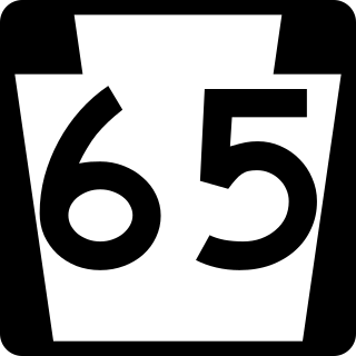
Pennsylvania Route 65 is a major 51-mile-long (82 km) state highway located in western Pennsylvania, United States. The route, traveling north–south from the Interstate 279/U.S. Route 19 Truck concurrency in Pittsburgh north to the PA 108/PA 168 concurrency in New Castle, connects downtown Pittsburgh to the northwestern portion of the Pittsburgh Metropolitan Area. PA 65 is similar in its purpose to PA 18 and PA 51, both of which run parallel to PA 65 at one point or another; however, the three routes pass through different cities for most of their respective alignments.
The Boulevard of the Allies is a mostly four-lane road in the U.S. state of Pennsylvania, connecting Downtown Pittsburgh with the Oakland neighborhood of the city. Because of its lengthy name, locals sometimes refer to it as simply "The Boulevard".
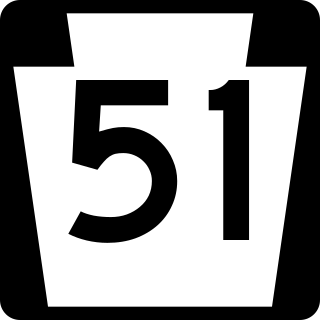
Pennsylvania Route 51 is a major state highway that is located in Western Pennsylvania in the United States. It runs for 89 miles (143 km) from Uniontown to the Ohio state line near Darlington, where it connects with Ohio State Route 14.
Pennsylvania Route 380, also known as J.F. Bonetto Memorial Highway and within the city of Pittsburgh Bigelow Boulevard, Baum Boulevard and Frankstown Road, is a 32.80 mi (52.8 km) long state highway in western portions of the U.S. state of Pennsylvania. The western terminus of the route is at Interstate 579 in downtown Pittsburgh near PPG Paints Arena. The eastern terminus is at Pennsylvania Route 286 in Bell Township, near the hamlet of Wakena.
Pennsylvania Route 885 is a 14.1 mi (22.69 km) long north–south state highway in the U.S. state of Pennsylvania. It runs from Pennsylvania Route 837 in Clairton north to Interstate 579 in Pittsburgh. The route is entirely within Allegheny County and serves as a connector between the city of Pittsburgh and its southern suburbs.
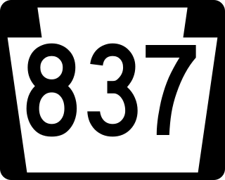
Pennsylvania Route 837 is a state route located in western Pennsylvania. The southern terminus of the route is at Pennsylvania Route 88 in the Carroll Township hamlet of Wickerham Manor. The northern terminus is at U.S. Route 19 and PA 51 near downtown Pittsburgh at the junction of the Ohio, Allegheny and Monongahela rivers. The highway parallels the Monongahela River for all of its route with the exceptions of its extreme north and south ends. Popular amusement park Kennywood is located along this route.
Pennsylvania Route 130 (PA 130) is a 49-mile-long (79 km) state highway located in Allegheny and Westmoreland counties in Pennsylvania. The western terminus is at PA 8 in Pittsburgh, and the eastern terminus is at PA 381 near Kregar.
This page is based on this Wikipedia article Text is available under the CC BY-SA 4.0 license; additional terms may apply. Images, videos and audio are available under their respective licenses.