The Tödi, is a mountain massif and with the mountain peak Piz Russein the highest mountain in the Glarus Alps and the highest summit in the canton of Glarus, Switzerland. It is located on the border between the cantons of Graubünden, to the south, and Glarus, to the north, close to the point where those two cantons meet the canton of Uri, to the west. Although not the culminating point of Graubünden, it is its highest peak outside the Bernina range.

Aconcagua, with a summit elevation of 6,960.8 metres (22,837 ft), is the highest mountain in both the Southern and Western Hemispheres. It is located in the Andes mountain range, in the Mendoza Province, Argentina, and lies 112 km (70 mi) northwest of its capital, the city of Mendoza, about five km (3.1 mi) from San Juan Province and 15 km (9.3 mi) from the international border with Chile. The mountain itself lies entirely within Argentina, immediately east of Argentina's border with Chile. The nearest higher peak is Tirich Mir in the Hindu Kush, 16,520 kilometres (10,270 mi) away. It is one of the Seven Summits.

The Diablerets are a huge ice-covered mountain massif of the Alps, culminating at the Sommet des Diablerets at 3,210 metres (10,530 ft) above sea level and straddling the border between the Swiss cantons of Vaud (VD) and Valais (VS). The northeastern part of the massif stretches also into the canton of Bern (BE).
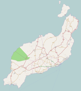
Puerto del Carmen is the main tourist town on the island of Lanzarote, Canary Islands, Spain. It is part of the municipality of Tías. Most of Lanzarote's over 1 million visitors per year choose this town as their destination. As a result, almost all of the town's economy revolves around tourism.

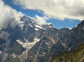
Monte Rosa is a mountain massif located in the eastern part of the Pennine Alps. It is located between Italy and Switzerland (Valais). Monte Rosa is the second highest mountain in the Alps and western Europe, after Mont Blanc.
The Jägerhorn is a mountain of the Pennine Alps, located on the border between Switzerland and Italy. It lies just north of Monte Rosa, at a height of 3,970 metres above sea level, and overlooks the village of Macugnaga on its east side, 2,600 metres below. On its west side it overlooks the Gorner Glacier.

Lai da Sontga Maria is a lake, located north of the Lukmanier Pass in Switzerland. It lies almost entirely in the municipality of Medel, a tiny fraction of the south-west part of the lake belonging to the municipalities of Quinto and Blenio. The reservoir has a surface area is 1.77 km2 (0.68 sq mi). The arch dam Santa Maria was completed in 1968. The main road of the Lukmanier Pass runs along the eastern shore of the lake.

The Vanil Noir is a mountain of the Fribourg Prealps, located on the border between the cantons of Fribourg and Vaud in western Switzerland. Reaching a height of 2,389 metres above sea level, the Vanil Noir is the highest summit of the canton of Fribourg and of the Alpine foothills lying north of the Saane and Simme. It is also the northernmost point in the canton of Vaud above 2,300 metres and the most prominent summit of both cantons.

The Ringelspitz is a mountain of the Glarus Alps, located on the border between the Swiss cantons of St. Gallen and Graubünden. Reaching a height of 3,248 metres above sea level, it is the highest summit in the canton of St. Gallen. It is split between three municipalities: Pfäfers, Trin and Tamins (Graubünden).

The Helsenhorn is a mountain of the Lepontine Alps, overlooking Binn in the Swiss canton of Valais. With a height of 3,272 metres above sea level, it is the highest summit of the Binntal. The border with Italy runs approximately 200 metres south-east of the summit and culminates at 3,247 metres.

The Chüebodenhorn is a 3,070 metres high mountain in the Lepontine Alps, located on the border between the cantons of Valais and Ticino. It is situated south of Passo di Rotondo, where a glacier named Ghiacciaio del Pizzo Rotondo lies at the foot of its north face. The south side (Ticino) overlooks the valley of Bedretto.

The Fleckistock is a 3,417 metres high mountain in the Urner Alps, overlooking Wassen in the canton of Uri. It is the highest summit of the group lying east of the pass of Sustenjoch. This range, starting at the Stucklistock and ending at the Salbitschijen, separates the valleys of Voralp, above Göschenen and Meiental, above Wassen.

Pizzo di Claro is a 2,727 metres high mountain of the Lepontine Alps, located on the border between the Swiss cantons of Ticino and Graubünden. It overlooks Claro on its western side, although Cresciano is closer. On its eastern side it overlooks the valley of Calanca near Arvigo (Graubünden). A small lake lies west of the summit at 2,198 metres, Lago Canee.

The Surettahorn is a mountain in the Oberhalbstein Range of the Alps located on the border between Italy and Switzerland. It overlooks the Splügen Pass on its west side.

Piz la Stretta is a mountain of the Livigno Alps, located on the border between Italy and Switzerland. Its 3,104-metre (10,184 ft) high summit overlooks the pass of La Stretta

The Madrisa is a mountain in the Rätikon mountain range, overlooking Klosters in the Swiss canton of Graubünden. Its summit is located near the Austrian border.

Theodul Pass, elevation 3,295 metres (10,810 ft), is a high mountain pass across the eastern Pennine Alps, connecting Zermatt in the Swiss canton of Valais and Breuil-Cervinia in the Italian region of Aosta Valley. Theodul Pass is the second lowest pass and the easiest pass between the valleys of Zermatt and Valtournanche.

Zimmerberg is a mountain and a region located in the district of Horgen in the canton of Zurich, Switzerland. Its name bases on the Old High German word zimbar in the meaning of lumber.

Tambohorn or Pizzo Tambo[ˈpittso ˈtambo] or Pizzo Tambò[ˈpittso tamˈbɔ] is a mountain located at the eastern extremity of the Lepontine Alps on the Swiss-Italian border. The mountain lies on the German-Italian language border, west of the Splügen Pass which divides the Western Alps from the Eastern Alps.

Bric del Dente is a 1107 metres high mountain of the Apennines located in the Italian region of Liguria.