Related Research Articles

Monroe County is a county in the state of Florida. As of the 2010 census, the population was 73,090. Its county seat is Key West. Monroe County includes the islands of the Florida Keys and comprises the Key West Micropolitan Statistical Area.
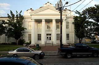
Lafourche Parish is a parish located in the south of the U.S. state of Louisiana. As of the 2010 census, the population was 96,318. The parish seat is Thibodaux. The parish was formed in 1807. It was originally the northern part of Lafourche Interior Parish, which consisted of the present parishes of Lafourche and Terrebonne. Lafourche Parish was named after the Bayou Lafourche. The city buildings have also been featured in television and movies, such as in Fletch Lives, due to its architecture and rich history.

Islamorada is an incorporated village in Monroe County, Florida, United States. It is located directly in the middle of Miami and Key West on five islands—Tea Table Key, Lower Matecumbe Key, Upper Matecumbe Key, Windley Key and Plantation Key—in the Florida Keys.

Tavernier is a census-designated place (CDP) and unincorporated community in Monroe County, Florida, United States on Key Largo, the largest island in the upper Florida Keys. Tavernier's population was 2,173 at the 2000 census.

West Point is an incorporated town in King William County, Virginia, United States. The population was 3,306 at the 2010 census.

Exmore is the largest town in Northampton County on the Eastern Shore of the U.S. state of Virginia. The population was 1,460 at the 2010 census. A popular story is that Exmore received its name because it is the tenth railroad station south of the Delaware state line, so there were "X more" stations to go. The same website also states another theory behind the town's name—that it was named for Exmoor, Devon, in South West England. This theory is more plausible because many towns and counties in Virginia were named for places in England. Northampton County itself was named for Northamptonshire.
The Florida Keys are a coral cay archipelago located off the southern coast of Florida, forming the southernmost part of the continental United States. They begin at the southeastern coast of the Florida peninsula, about 15 miles (24 km) south of Miami, and extend in a gentle arc south-southwest and then westward to Key West, the westernmost of the inhabited islands, and on to the uninhabited Dry Tortugas. The islands lie along the Florida Straits, dividing the Atlantic Ocean to the east from the Gulf of Mexico to the northwest, and defining one edge of Florida Bay. At the nearest point, the southern part of Key West is just 90 miles (140 km) from Cuba. The Florida Keys are between about 24.3 and 25.5 degrees North latitude.

The Great Labor Day Hurricane of 1935 was the most intense Atlantic hurricane to make landfall on record in terms of pressure, and tied with Hurricane Dorian in 2019 for the strongest landfalling Atlantic hurricane by maximum sustained winds, with winds of 185 mph (295 km/h). It was also the most intense Atlantic hurricane on record until Hurricane Gilbert in 1988. The fourth tropical cyclone, third tropical storm, second hurricane, and second major hurricane of the 1935 Atlantic hurricane season, the Labor Day hurricane was one of four Category 5 hurricanes on record to strike the contiguous United States, along with Hurricane Andrew in 1992, Hurricane Camille in 1969, and Hurricane Michael in 2018. In addition, it was the third most intense Atlantic hurricane on record in terms of barometric pressure, behind Hurricane Gilbert in 1988 and Hurricane Wilma in 2005.

The River Swale in Yorkshire England is a major tributary of the River Ure, which becomes the River Ouse, that empties into the North Sea via the Humber Estuary. The river gives its name to the valley through which it flows, Swaledale.

Plantation Key is an island in Monroe County, Florida, United States. It is located in the upper Florida Keys on U.S. 1, between Key Largo and Windley Key.
Plantation Key, Florida is a former census-designated place on Plantation Key in the Florida Keys, in Monroe County, Florida, United States. It is located just South of the Tavernier bridge and North of the Snake Creek bridge and was reported to have a population of 4,405 in 1990. It became part of the Village of Islamorada when the latter incorporated in 1997.

Bheramara is an Upazila of Kushtia District in the Division of Khulna, Bangladesh. The upazila is beside the mighty Padma River, and the important Hardinge Bridge crosses the river between Bheramara Upazila and Ishurdi Upazila of Pabna District.

A seagull intersection or continuous green T-intersection is a type of three-way road intersection, usually used on high traffic volume roads and dual carriageways. This form of intersection is popular in Australia and New Zealand, and sometimes used in the United States and other countries.

Monroe County School District is a public school district serving the residents of Monroe County, Florida. The district's administrative offices are headquartered in Key West, Florida, United States, with school sites located throughout the Florida Keys from Key West to Key Largo. The district provides educational services for students enrolled in Pre-Kindergarten through 12th grade and educational opportunities for adult learners enrolled through adult education programs.
Deem City is a ghost town in Palm Beach County, Florida, United States, located approximately 15 miles (24 km) northwest of Weston on U.S. Route 27, near the Palm Beach/Broward county line.
Sunset Point is an unincorporated community in Monroe County, Florida, United States, located in the upper Florida Keys on Key Largo on US 1 northeast of Tavernier and Thompson, and southwest of Rock Harbor.
Lower Matecumbe Beach is a neighborhood within the village of Islamorada in Monroe County, Florida, United States. It is located in the upper Florida Keys on the southwestern half of Lower Matecumbe Key.
Matecumbe is a neighborhood within the village of Islamorada in Monroe County, Florida, United States. It is located in the upper Florida Keys on the island of Upper Matecumbe Key.

Anne's Beach is located at Lower Matecumbe Key, Florida. The Islamorada Beach is dedicated to local environmentalist Anne Eaton. There are 2 parking lots approximately 1/4 mile apart on US-1 at MM 73. Anne's Beach features a shallow swimming area, covered picnic tables, boardwalk and bathroom facilities.
Coral Shores High School is a senior high school in Islamorada, Florida, near Tavernier. It is within the Monroe County School District.
References
Coordinates: 24°59′49″N80°32′28″W / 24.997°N 80.541°W
| This Monroe County, Florida location article is a stub. You can help Wikipedia by expanding it. |