
Cuenca is a city and municipality of Spain located in the autonomous community of Castilla–La Mancha. It is the capital of the province of Cuenca.

Arcos de la Frontera is a town and municipality in the Sierra de Cádiz comarca, province of Cádiz, in Andalusia, Spain. It is located on the northern, western and southern banks of the Guadalete river, which flows around three sides of the city under towering vertical cliffs, to Jerez and on to the Bay of Cádiz. The town commands a fine vista atop a sandstone ridge, from which the peak of San Cristóbal and the Guadalete Valley can be seen. The town gained its name by being the frontier of Spain's 13th-century battle with the Moors.

Labastida in Spanish or Bastida in Basque is a town and municipality of the Rioja Alavesa, in the province of Álava in the Basque Country, northern Spain. It is located between the River Ebro and the Sierra de Toloño mountain range, 4 km east of the city of Haro and 30 km south of the Basque capital Vitoria-Gasteiz.

The Catedral de la Asunción de la Virgen, popularly known as New Cathedral is, together with the Old Cathedral, one of the two cathedrals of Salamanca, Castile and León, Spain. It is the seat of the diocese of Salamanca. It was constructed between 1533 and 1733 mixing late Gothic, Plateresque and Baroque styles. It was commissioned by Ferdinand V of Castile. It is one of the largest cathedrals in Spain in size and its bell tower, at 92 meters high, is also one of the tallest.

Churrigueresque, also but less commonly "Ultra Baroque", refers to a Spanish Baroque style of elaborate sculptural architectural ornament which emerged as a manner of stucco decoration in Spain in the late 17th century and was used until about 1750, marked by extreme, expressive and florid decorative detailing, normally found above the entrance on the main façade of a building.

The plaza de toros de la Real Maestranza de Caballería de Sevilla is a 12,000-capacity bullring in Seville, Spain. During the annual Seville Fair in Seville, it is the site of one of the most well-known bullfighting festivals in the world. It is a part of the Real Maestranza de Caballería de Sevilla, a noble guild established for traditional cavalry training.

Spanish Baroque is a strand of Baroque architecture that evolved in Spain, its provinces, and former colonies.

El Madrid de los Austrias is a name used for the old centre of Madrid, built during the reign of the Habsburg Dynasty (1516–1700), known in Spain as Casa de Austria. The area is located south of the Calle Mayor, in between the Metro stations Sol and Ópera.

Ventura Rodríguez Tizón was a Spanish architect and artist. Born at Ciempozuelos, Rodríguez was the son of a bricklayer. In 1727, he collaborated with his father in the work at the Royal Palace of Aranjuez.

The Plaza Mayor is a central plaza in the city of Valladolid, Spain. It is located only a few blocks away from another famous plaza, the Plaza Zorrilla.

The Ponce City Hall is a historic city hall in Ponce, Puerto Rico. It is located it the center of the city, on Calle Degetau, across from Plaza Degetau in the Ponce Historic Zone. The building serves as the seat of the executive branch of government of the Autonomous Municipality of Ponce, including the office of the Mayor of Ponce. Built in 1840, it is the oldest colonial building in the city. The building was listed on the U.S. National Register of Historic Places in 1986 as Casa Alcaldía de Ponce-City Hall.

Salamanca is a municipality and city in Spain, capital of the province of the same name, located in the autonomous community of Castile and León. It is located in the Campo Charro comarca, in the Meseta Norte, in the northwestern quadrant of the Iberian Peninsula. It has a population of 144,436 registered inhabitants. Its stable functional area reaches 203,999 citizens, which makes it the second most populated in the autonomous community, after Valladolid. Salamanca is known for its large number of remarkable Plateresque-style buildings.

The Convento de San Esteban is a Dominican monastery of Plateresque style, situated in the Plaza del Concilio de Trento in Salamanca, Castile and León, Spain.
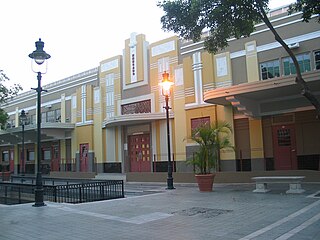
Plaza del Mercado de Ponce or, formally, Plaza del Mercado Isabel Segunda, is a historic marketplace building in Ponce, Puerto Rico. It was inaugurated in 1863 by Ponce Mayor Don Luis de Quixano. Designed by famed engineer Timoteo Luberza, it occupies a city block in the Ponce Historic Zone at the grid formed by Calle Atocha, Estrella, Leon, and Castillo streets. It has room for 65 kiosks. It was originally called Plaza del Capá.

The Museo de la Arquitectura Ponceña is an architecture museum housed at the Casa Wiechers-Villaronga, in Ponce, Puerto Rico. It is preserves the history of the architectural styles of Ponce and Puerto Rico. The Casa Wiechers-Villaronga was acquired and restored by the Institute of Puerto Rican Culture. The museum is located in the Ponce Historic Zone. The historic house was designed and built in 1912 by Alfredo B. Wiechers. The house that is home to this architecture museum is itself an example of the architectural history of the city. The museum is housed at the historic Casa Wiechers-Villaronga.

Holy Week in Salamanca is the most important religious event of Salamanca, Spain. It is celebrated in the week leading up to Easter.

The defunct Convento de Santo Tomás was a set of buildings belonging to the Dominicans, under the patronage of St. Thomas Aquinas, in Madrid.

Old Town of Cáceres is a historic walled city in Cáceres, Spain.

The Plaza de Teucro is a square of medieval origin located in the heart of the old town of Pontevedra (Spain). It is the most harmoniously proportioned medieval square in the city.

Ephemeral architecture had a special relevance in the Spanish Baroque, as it fulfilled diverse aesthetic, political, religious and social functions. On the one hand, it was an indispensable component of support for architectural achievements, carried out in a perishable and transitory way, which allowed a cheapening of materials and a way to capture new designs and more daring and original solutions of the new Baroque style, which could not be done in conventional constructions. On the other hand, its volubility made possible the creation of a wide range of productions designed according to their diverse functionality: triumphal arches for the reception of kings and aristocratic personages, catafalques for religious ceremonies, burial mounds for funerary ceremonies and diverse scenarios for social or religious events, such as the feast of Corpus Christi or Holy Week.

![Plaque in the center of the plaza, which says Twentieth anniversary [of] Salamanca patrimony of humanity 1988-2008. Center of the plaza mayor salamanca.JPG](http://upload.wikimedia.org/wikipedia/commons/thumb/8/8b/Center_of_the_plaza_mayor_salamanca.JPG/220px-Center_of_the_plaza_mayor_salamanca.JPG)
