Related Research Articles

Schoharie Creek is a river in New York that flows north 93 miles (150 km) from the foot of Indian Head Mountain in the Catskills through the Schoharie Valley to the Mohawk River. It is twice impounded north of Prattsville to create New York City's Schoharie Reservoir and the Blenheim-Gilboa Power Project.

The Sacandaga River is a 64-mile-long (103 km) river in the northern part of New York in the United States. Its name comes from the Native American Sa-chen-da'-ga, meaning "overflowed lands".

Pleasant Valley Township is a township in Scott County, Iowa, United States.
Fishing Creek is a 29.98-mile (48.25 km) long tributary of the Susquehanna River in Columbia County, Pennsylvania, in the United States. It joins the Susquehanna River near the census-designated place of Rupert and the town of Bloomsburg. The watershed has an area of 385 square miles (1,000 km2).
The Fisher River is a tributary of the Kootenay River in the U.S. state of Montana. The Fisher River properly begins at the confluence of its two main tributaries, the Pleasant Valley Fisher River and the Silver Butte Fisher River. Of the two tributaries, the Pleasant Valley Fisher River is the larger and is sometimes considered part of the Fisher River proper. A variant name of the Fisher River is Pleasant Valley River, and a variant name of the Pleasant Valley Fisher River is Fisher River.

Pleasant Valley Township is one of sixteen townships in Cerro Gordo County, Iowa, USA. As of the 2000 census, its population was 494.

Spring Valley Township is a township in Cherokee County, Kansas, USA. As of the 2000 census, its population was 1,007.

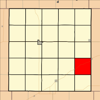
Pleasant Valley Township is a township in Cowley County, Kansas, USA. As of the 2000 census, its population was 838.
Pleasant Valley Township is a township in Decatur County, Kansas, USA. As of the 2000 census, its population was 46.

Pleasant Valley Township is a township in Finney County, Kansas, USA. As of the 2000 census, its population was 139.

The 1915 Pleasant Valley earthquake occurred at 22:53:21 on October 2 in north-central Nevada. With a moment magnitude of 6.8, a surface wave magnitude of 7.7, and a maximum Mercalli intensity of X (Extreme), it was the strongest earthquake ever recorded in the state.
The Tobin Range is a mountain range in eastern Pershing County, Nevada. The linear range is typical of the basin and range structure with an approximate length and width of 32.5 miles (52.3 km) by 6 miles (9.7 km) with a NNE orientation. The Tobin Range includes Mount Tobin, a 9,754 feet (2,973 m) summit that dominates the surrounding area. Mount Tobin has a latitude of 40°22′37″N and a longitude of 117°31′33″W.
The East Branch Mattawamkeag River is a tributary of the Mattawamkeag River in Aroostook County, Maine. From its source in Dudley, the river runs 36 miles (58 km) south and southeast to its confluence with the West Branch Mattawamkeag River in Haynesville, about 10 miles (16 km) west of the Canada–United States border.

The Pleasant River is a 13.1-mile-long (21.1 km) tributary of the Presumpscot River in the U.S. state of Maine.
The West Branch Pleasant River is a tributary of the Pleasant River in Washington County, Maine. From the confluence of Branch Brook and Bells Brook in southeast Columbia, the river meanders 2.3 miles (3.7 km) south to the estuary of the Pleasant River at Addison.
Pleasant Valley is an unincorporated community in Dover Township, Pope County, Arkansas, United States.

The Pocantico River is a nine-mile-long (14 km) tributary of the Hudson River in western central Westchester County, New York, United States. It rises from Echo Lake, in the town of New Castle south of the hamlet of Millwood, and flows generally southwest past Briarcliff Manor to its outlet at Sleepy Hollow. Portions of the towns of Mount Pleasant and Ossining are within its 16-square-mile (41 km2) watershed.
Pleasant Valley Wildlife Sanctuary is a 1,405 acres (569 ha) wildlife sanctuary located in Lenox, Massachusetts owned by the Massachusetts Audubon Society. There are 7 miles of trails and a large pond on Yokun Brook. One trail hikes to the summit of Lenox Mountain.
Pleasant Brook is a hamlet located south of Cherry Valley, at the corner of NY 165 and Middlefield Road in the Town of Roseboom in Otsego County, New York, United States. Pleasant Brook runs west through the hamlet.
References
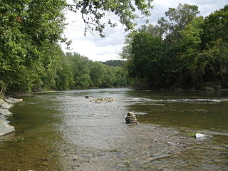
- ↑ "Pleasant valley brook". usgs.gov. usgs. 1998. Retrieved 17 May 2017.
data