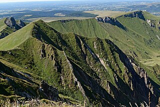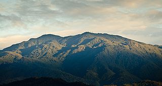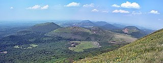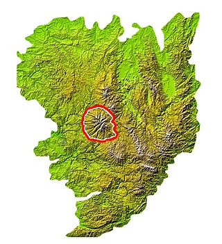
Cantal is a rural department in the Auvergne-Rhône-Alpes region of France, with its prefecture in Aurillac. Its other principal towns are Saint-Flour and Mauriac; its residents are known as Cantalians. Cantal borders the departments of Puy-de-Dôme, Haute-Loire, Aveyron, Lot, Lozère and Corrèze, in the Massif Central natural region.

Nevado del Ruiz, also known as La Mesa de Herveo is a volcano on the border of the departments of Caldas and Tolima in Colombia, being the highest point of both. It is located about 130 km (81 mi) west of the capital city Bogotá. It is a stratovolcano composed of many layers of lava alternating with hardened volcanic ash and other pyroclastic rocks. Volcanic activity at Nevado del Ruiz began about two million years ago, during the Early Pleistocene or Late Pliocene, with three major eruptive periods. The current volcanic cone formed during the present eruptive period, which began 150,000 years ago.

The Massif Central is a highland region in south-central France consisting of mountains and plateaus. It covers about 15% of mainland France.

Acatenango is a stratovolcano in Guatemala, close to the city of Antigua. It is part of the mountain range of the Sierra Madre. The volcano has two peaks, Pico Mayor and Yepocapa which is also known as Tres Hermanas. Acatenango is joined with Volcán de Fuego and collectively the volcano complex is known as La Horqueta.
Aubrac is a small village in the southern Massif Central of France. The name is also applied to the surrounding countryside, which is properly called L'Aubrac in French. The Aubrac region has been a member of the Natura 2000 network since August 2006. It straddles three départements and three régions.

Salers is a French semi-hard cheese originating from Salers, in the volcanic region of the Cantal mountains of the Massif Central, Auvergne, central France. It is a pressed, uncooked cheese, sometimes made from Salers cow's milk, between 15 April and 15 November. It is circular in shape, formed in rounds weighing around 40 kilograms (88 lb). The cheese is aged in caves at temperatures ranging from 6–12 °C (43–54 °F) for a minimum of 3 months, and up to 45 months.

The Cordillera Central is a volcanic mountain range in central Costa Rica which continues from the Continental Divide to east of Cordillera de Tilarán. It extends 80 km from Tapezco Pass to the Turrialba Volcano and ends on the Pacuare River. It is separated from Cordillera de Tilarán by Balsa River and Platanar and Zarcero hills. The Cordillera Central is part of the American Cordillera, a chain of mountain ranges (cordillera) that consists of an almost continuous sequence of mountain ranges that form the western "backbone" of North America, Central America, South America and Antarctica.

The Mount Meager massif is a group of volcanic peaks in the Pacific Ranges of the Coast Mountains in southwestern British Columbia, Canada. Part of the Cascade Volcanic Arc of western North America, it is located 150 km (93 mi) north of Vancouver at the northern end of the Pemberton Valley and reaches a maximum elevation of 2,680 m (8,790 ft). The massif is capped by several eroded volcanic edifices, including lava domes, volcanic plugs and overlapping piles of lava flows; these form at least six major summits including Mount Meager which is the second highest of the massif.

Cerro de la Muerte is a mountain peak of a massif in Costa Rica, it is located within the Tapantí — Cerro de la Muerte Massif National Park, and is the highest point on the Pan-American Highway.

Ampato is a dormant 6,288-metre (20,630 ft) stratovolcano in the Andes of southern Peru. It lies about 70–75 kilometres (43–47 mi) northwest of Arequipa and is part of a north-south chain that includes the volcanoes Hualca Hualca and Sabancaya, the last of which has been historically active.

The Chaîne des Puys is a north-south oriented chain of cinder cones, lava domes, and maars in the Massif Central of France. The chain is about 40 km (25 mi) long, and the identified volcanic features, which constitute a volcanic field, include 48 cinder cones, eight lava domes, and 15 maars and explosion craters. Its highest point is the lava dome of Puy de Dôme, located near the middle of the chain, which is 1,465 m (4,806 ft) high. The name of the range comes from a French term, puy, which refers to a volcanic mountain with a rounded profile. A date of 4040 BC is usually given for the last eruption of a Chaîne des Puys volcano.

La Tour-d'Auvergne is a commune in the Puy-de-Dôme department in Auvergne in central France.
The Massif Central is one of the two large basement massifs in France, the other being the Armorican Massif. The Massif Central's geological evolution started in the late Neoproterozoic and continues to this day. It has been shaped mainly by the Caledonian orogeny and the Variscan orogeny. The Alpine orogeny has also left its imprints, probably causing the important Cenozoic volcanism. The Massif Central has a very long geological history, underlined by zircon ages dating back into the Archaean 3 billion years ago. Structurally it consists mainly of stacked metamorphic basement nappes.

The Monts Dore are the remnant peaks of a volcanic massif situated near the center of the Massif Central, in the Auvergne region of France. They form a picturesque mountainous region, dotted with lakes, thermal springs and romanesque churches. The massif is an integral part of the Parc des Volcans d'Auvergne, and is known for its alpine ski areas and hiking trails.

The Mounts of Cantal are a mountainous massif in the mid-west of the Massif Central, France, made up of the remnants of the largest stratovolcano of Europe, which was formed from 13 million years ago and last erupted approximately 2 million years ago, reaching estimated heights between 3,500 and 4,000 meters. However, the main part of the volcanic activity was concentrated between 8.5 and 7 million years. Thereafter, the original volcano was largely eroded, massive landslides occurred, and it was further eroded by glaciers and water.

The Puy Mary is a summit in the mounts of Cantal in Massif Central in France. It is classified as a "Grand National Site" in France. Nearly 500,000 visitors come to this site every year.
The GR 400 is a long-distance walking route within the Grande Randonnée network in France. It is not a linear route, but a series of five circuits, all within the Monts de Cantal area of the Massif Central. The circuits interconnect with, and sometimes follow the same route as, the GR 4, one of the spine paths of the network, and also with a subsidiary section of the Via Podiensis St James's Way route. The walking is described as "within the range of any good hiker accustomed to walking in mountain country and to carrying a rucksack"

The Cézallier massif, which can also be written Cézalier, is a volcanic plateau in the Massif Central, between the Monts Dore and Monts du Cantal, making up a natural region of France. It is mainly divided between two départements: Puy-de-Dôme and Cantal, but also includes a small part of Haute-Loire. It is also one of the five natural regions making up the Parc naturel régional des volcans d'Auvergne.

The Puy de Peyre-Arse is a peak in the volcanic massif of Cantal, separating the valleys of the Jordanne, Impradine, and Santoire. It reaches an altitude of 1,806 meters.

The Devès is a vast basalt plateau in the Velay mountains of the Massif Central, located in Haute-Loire, forming a natural region of France. It reaches its highest point at Mont Devès at an altitude of 1,421 meters.


