The Wolf River is a 40.3-mile-long (64.9 km) river in the U.S. states of Tennessee and Kentucky that rises at the base of the Cumberland Plateau in Fentress County, Tennessee and flows westward for several miles before emptying into the Obey River at the Dale Hollow Reservoir. The river is part of the Cumberland River drainage basin, and flows primarily in Middle Tennessee and southern Kentucky. Via the Cumberland and Ohio rivers, it is part of the Mississippi River watershed. It is not to be confused with the Wolf River of West Tennessee which flows into the Mississippi at Memphis.
The Piney River is a 23.7-mile-long (38.1 km) tributary of the Duck River in Middle Tennessee in the United States. Via the Duck River, the Tennessee River, and the Ohio River, it is part of the Mississippi River watershed. The headwater tributaries of the Piney River rise in Dickson County, Tennessee, near the city of Dickson. Dickson is located on the "Tennessee Valley Divide", which corresponds for some distance with the downtown's Main Street. The western part of the town, the part in the Tennessee Valley, is drained by the East Piney River, a tributary to the Piney.

The Little Pigeon River is a river located entirely within Sevier County, Tennessee. It rises from a series of streams which flow together on the dividing ridge between the states of Tennessee and North Carolina inside the boundary of the Great Smoky Mountains National Park. The river is subdivided with three separate tributaries: East, Middle, and West.

The Collins River is a 67-mile-long (108 km) stream in the east-central portion of Middle Tennessee in the United States. It is a tributary of the Caney Fork, and is part of the Cumberland, Ohio and Mississippi watersheds. The river drains the scenic Savage Gulf area, located just below the river's source, and empties into Great Falls Lake at Rock Island State Park.
The New River is a 58.7-mile-long (94.5 km) tributary of the Big South Fork of the Cumberland River in the U.S. state of Tennessee. Via the Big South Fork and the Cumberland and Ohio rivers, it is part of the Mississippi River watershed.

The Clear Fork is a 27.2-mile-long (43.8 km) stream draining part of the Cumberland Plateau of Tennessee, United States. It is a tributary of the Big South Fork of the Cumberland River. By that river, the Cumberland River, and the Ohio River, it is part of the Mississippi River watershed.

The Caney Fork River is a river that flows through central Tennessee in the United States, draining a substantial portion of the southwestern Cumberland Plateau and southeastern Highland Rim regions. It is a major tributary of the Cumberland River, and is part of the Cumberland, Ohio and Mississippi basins. The river is 143 miles (230 km) long, and its watershed covers 1,771 square miles (4,590 km2) in eleven counties. Monterey, Baxter, Sparta, Smithville, McMinnville, Altamont, Spencer and Gordonsville are among the towns that are at least partially drained by the river.
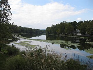
The Obey River is a 47.8-mile-long (76.9 km) tributary of the Cumberland River in the U.S. state of Tennessee. It joins the Cumberland River near the town of Celina, which is generally considered to be the Cumberland's head of navigation. Via the Cumberland and Ohio rivers, the Obey River is part of the Mississippi River watershed.

Obed River is a stream draining a part of the Cumberland Plateau in Tennessee. It, and particularly its tributaries, are important streams for whitewater enthusiasts.

The Piney River is a stream that drains a portion of Tennessee's Cumberland Plateau generally known as Walden Ridge. The Piney River rises near the Rhea County – Bledsoe County line and is referred to as Piney Creek in its upper reaches roughly until its confluence with Duskin Creek. Its major tributary, Little Piney Creek, flows over two spectacular waterfalls which are located in Piney Falls State Natural Area near the community of Grandview. A tributary of Little Piney Creek is Soak Creek, Tennessee's newest State Scenic River. The confluence of the two streams occurs below the falls of the smaller stream in an area referred to as "Shut-in Gap". The stream flows out of the gap and is bridged by State Route 68 just before that road begins its steep climb up the Cumberland Escarpment onto Waldens Ridge. The stream flows north of Spring City, Tennessee and becomes slack just east of the town at a headland of Watts Bar Lake, an impoundment of the Tennessee River formed by the Tennessee Valley Authority's Watts Bar Dam project. The mouth of the Piney is one of the larger bays of Watts Bar Lake and contains several small islands.

The Paint Rock River is a 58.7-mile-long (94.5 km) tributary of the Tennessee River in northern Alabama in the United States. Its tributaries also drain a portion of south-central Tennessee.

Yellow Breeches Creek, also known as Callapatscink Creek, Callapatschink Creek or Shawnee Creek is a 56.1-mile-long (90.3 km) tributary of the Susquehanna River in central Pennsylvania, USA. There is no agreed upon explanation for the name Yellow Breeches Creek, which it is found in land warrants as early as 1736.
Conodoguinet Creek is a 104-mile-long (167 km) tributary of the Susquehanna River in South central Pennsylvania in the United States. The name is Native American, and means "A Long Way with Many Bends".

Plunketts Creek is an approximately 6.2-mile-long (10 km) tributary of Loyalsock Creek in Lycoming and Sullivan counties in the U.S. state of Pennsylvania. Two unincorporated villages and a hamlet are on the creek, and its watershed drains 23.6 square miles (61 km2) in parts of five townships. The creek is a part of the Chesapeake Bay drainage basin via Loyalsock Creek and the West Branch Susquehanna and Susquehanna Rivers.

The Jemez River is a tributary of the Rio Grande in the U.S. state of New Mexico. The river is formed by the confluence of the East Fork Jemez River and San Antonio Creek, which drain a number of tributaries in the area of the Jemez Mountains and Santa Fe National Forest. The Jemez River is about 50 miles (80 km) long, or about 80 miles (130 km) long if its longest headwater tributary, San Antonio Creek, is included. The East Fork Jemez River is about 22 miles (35 km) long. Both San Antonio Creek and the East Fork Jemez River flow through intricate meanders along their courses. The East Fork Jemez is a National Wild and Scenic River.
The Clear Fork is a 42.8-mile-long (68.9 km) tributary of the Cumberland River in Kentucky and Tennessee. By the Cumberland and Ohio rivers, it is part of the Mississippi River watershed.
Coal Creek is a tributary of the Clinch River in Tennessee, approximately 10.3 miles (16.6 km) long.

Difficult is an unincorporated community in Smith County, Tennessee, in the United States. It lies just north of State Route 85, about halfway between Defeated to the south and Kempville to the east. Defeated Creek, a tributary of the Cumberland River, passes through the community.