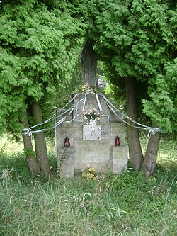
Bąków is a village in the administrative district of Gmina Długołęka, within Wrocław County, Lower Silesian Voivodeship, in south-western Poland. Prior to 1945 it was in Germany.

Mierczyn is a settlement in the administrative district of Gmina Góra Świętej Małgorzaty, within Łęczyca County, Łódź Voivodeship, in central Poland. It lies approximately 7 kilometres (4 mi) east of Łęczyca and 31 km (19 mi) north-west of the regional capital Łódź.

Quzeyxırman is a village in the Khojavend Rayon of Azerbaijan.
Moczydła is a village in the administrative district of Gmina Nowa Brzeźnica, within Pajęczno County, Łódź Voivodeship, in central Poland.

Smroków is a village in the administrative district of Gmina Słomniki, within Kraków County, Lesser Poland Voivodeship, in southern Poland. It lies approximately 6 kilometres (4 mi) north-west of Słomniki and 26 km (16 mi) north of the regional capital Kraków.

Wólka Bałtowska is a village in the administrative district of Gmina Bałtów, within Ostrowiec County, Świętokrzyskie Voivodeship, in south-central Poland. It lies approximately 3 kilometres (2 mi) north-west of Bałtów, 15 km (9 mi) north-east of Ostrowiec Świętokrzyski, and 67 km (42 mi) east of the regional capital Kielce.

Doły Opacie is a village in the administrative district of Gmina Kunów, within Ostrowiec County, Świętokrzyskie Voivodeship, in south-central Poland. It lies approximately 5 kilometres (3 mi) west of Kunów, 14 km (9 mi) west of Ostrowiec Świętokrzyski, and 43 km (27 mi) east of the regional capital Kielce.
Lipa is a village in the administrative district of Gmina Jednorożec, within Przasnysz County, Masovian Voivodeship, in east-central Poland.
Opole Świerczyna is a village in the administrative district of Gmina Siedlce, within Siedlce County, Masovian Voivodeship, in east-central Poland.
Chojeczno-Cesarze is a village in the administrative district of Gmina Grębków, within Węgrów County, Masovian Voivodeship, in east-central Poland.

Dybów-Górki is a village in the administrative district of Gmina Radzymin, within Wołomin County, Masovian Voivodeship, in east-central Poland. It lies approximately 3 kilometres (2 mi) north-east of Radzymin, 10 km (6 mi) north of Wołomin, and 29 km (18 mi) north-east of Warsaw.

Wojciechów is a village in the administrative district of Gmina Jastrzębia, within Radom County, Masovian Voivodeship, in east-central Poland. It lies approximately 11 kilometres (7 mi) north of Radom and 83 km (52 mi) south of Warsaw.

Dobieszczyzna is a village in the administrative district of Gmina Żerków, within Jarocin County, Greater Poland Voivodeship, in west-central Poland. It lies approximately 9 kilometres (6 mi) south-east of Żerków, 14 km (9 mi) north-east of Jarocin, and 66 km (41 mi) south-east of the regional capital Poznań.
Dębniałki is a village in the administrative district of Gmina Blizanów, within Kalisz County, Greater Poland Voivodeship, in west-central Poland.

Nowa Wieś is a settlement in the administrative district of Gmina Trzcinica, within Kępno County, Greater Poland Voivodeship, in west-central Poland. It lies approximately 6 kilometres (4 mi) north of Trzcinica, 9 km (6 mi) south-east of Kępno, and 153 km (95 mi) south-east of the regional capital Poznań.
Modła-Kolonia is a village in the administrative district of Gmina Stare Miasto, within Konin County, Greater Poland Voivodeship, in west-central Poland.
Jankowo is a settlement in the administrative district of Gmina Wągrowiec, within Wągrowiec County, Greater Poland Voivodeship, in west-central Poland.

Lubartów is a village in the administrative district of Gmina Wymiarki, within Żagań County, Lubusz Voivodeship, in western Poland. It lies approximately 4 kilometres (2 mi) west of Wymiarki, 24 km (15 mi) south-west of Żagań, and 59 km (37 mi) south-west of Zielona Góra.

Parwark is a village in the administrative district of Gmina Stare Pole, within Malbork County, Pomeranian Voivodeship, in northern Poland. It lies approximately 3 kilometres (2 mi) south of Stare Pole, 11 km (7 mi) east of Malbork, and 52 km (32 mi) south-east of the regional capital Gdańsk.
Gandabar is a village in Bala Velayat Rural District, in the Central District of Kashmar County, Razavi Khorasan Province, Iran. At the 2006 census, its population was 172, in 43 families.


