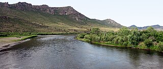
The Onon is a river in Mongolia and Russia. It is 818 km long and drains an area of 94,010 km2. It originates at the eastern slope of the Khentii Mountains. For 298 km it flows within Mongolia. It joins with Ingoda River to produce the Shilka River.
Lavans Stadion is a multi-use stadium in Helmond, Netherlands. It is currently used mostly for football matches and is the home stadium of Helmond Sport. The stadium is able to hold 4,100 people and was built in 1967.

Czarnogoździce is a village in the administrative district of Gmina Krośnice, within Milicz County, Lower Silesian Voivodeship, in south-western Poland. It lies approximately 6 kilometres (4 mi) south of Milicz, and 45 kilometres (28 mi) north-east of the regional capital Wrocław.
Troska is a village in the administrative district of Gmina Twardogóra, within Oleśnica County, Lower Silesian Voivodeship, in south-western Poland. Prior to 1945 it was in Germany.
Sobkowice is a village in the administrative district of Gmina Kostomłoty, within Środa Śląska County, Lower Silesian Voivodeship, in south-western Poland. Prior to 1945 it was in Germany.
Lipniczki is a village in the administrative district of Gmina Łysomice, within Toruń County, Kuyavian-Pomeranian Voivodeship, in north-central Poland.
Kolonie Jasionowo is a village in the administrative district of Gmina Sztabin, within Augustów County, Podlaskie Voivodeship, in north-eastern Poland.
Korzeń is a village in the administrative district of Gmina Widawa, within Łask County, Łódź Voivodeship, in central Poland.

Maralyansarov is a village in the Tartar Rayon of Azerbaijan.
Nowy Kłopoczyn is a village in the administrative district of Gmina Sadkowice, within Rawa County, Łódź Voivodeship, in central Poland. It lies approximately 8 kilometres (5 mi) east of Sadkowice, 27 km (17 mi) east of Rawa Mazowiecka, and 80 km (50 mi) east of the regional capital Łódź.

Mniów is a village in Kielce County, Świętokrzyskie Voivodeship, in south-central Poland. It is the seat of the gmina called Gmina Mniów. It lies approximately 17 km (11 mi) north-west of the regional capital Kielce.
Sokół is a village in the administrative district of Gmina Sobolew, within Garwolin County, Masovian Voivodeship, in east-central Poland. It lies approximately 4 kilometres (2 mi) north-east of Sobolew, 17 km (11 mi) south of Garwolin, and 71 km (44 mi) south-east of Warsaw.

Kaleń-Towarzystwo is a village in the administrative district of Gmina Żabia Wola, within Grodzisk Mazowiecki County, Masovian Voivodeship, in east-central Poland.
Lipie is a village in the administrative district of Gmina Błędów, within Grójec County, Masovian Voivodeship, in east-central Poland. It lies approximately 13 kilometres (8 mi) west of Grójec and 48 km (30 mi) south-west of Warsaw.
Majdany is a village in the administrative district of Gmina Dąbie, within Koło County, Greater Poland Voivodeship, in west-central Poland.
Lasotki is a village in the administrative district of Gmina Rydzyna, within Leszno County, Greater Poland Voivodeship, in west-central Poland.
Biernatów is a village in the administrative district of Gmina Szprotawa, within Żagań County, Lubusz Voivodeship, in western Poland. It lies approximately 14 kilometres (9 mi) south-east of Szprotawa, 28 km (17 mi) south-east of Żagań, and 52 km (32 mi) south of Zielona Góra.

Good Spirit Acres is a hamlet in the Canadian province of Saskatchewan.

The Balu River, located in Bangladesh, is a tributary of the Shitalakshya River. It passes through the wetlands of Beel Belai and Dhaka before its confluence with the Shitalakshya at Demra.

The Unity Cup was an international football tournament held in May and June 2004 at The Valley Stadium, London. Nigeria, Jamaica and Ireland were the competing sides. Nigeria won the competition with Ireland finishing second. The competitors were countries with large communities in London.


