Mali's transportation infrastructure is regarded as poor, even by regional standards, and deficiencies have limited economic growth and development. Nevertheless, improvements have been noted in the early 2000s. Most of the transportation in Mali consists of cars, planes, and boats.

Senegal is a coastal West African nation located 14 degrees north of the equator and 14 degrees west of the Prime Meridian. The country's total area is 196 190 km2 of which 192 000 km2 is land and 4 190 km2 is water.
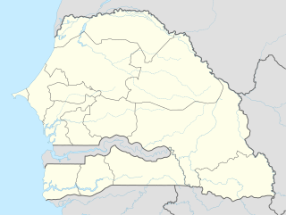
This article describes the system of transport in Senegal, both public and private. This system comprises roads, rail transport, water transport, and air transportation.

Léopold Sédar Senghor International Airport is an international airport serving Dakar, the capital of Senegal. The airport is situated near the town of Yoff, north of Dakar. It was known as Dakar-Yoff International Airport until 9 October 1996, when it was renamed in honor of Léopold Sédar Senghor, the first president of Senegal.

Kayes is a city in western Mali on the Sénégal River, with a population of 127,368 at the 2009 census. Kayes is the capital of the administrative region of the same name. The name "Kayes" comes from the Soninké word "karré", which describes a low humid place that floods in rainy season. The city is located 420 kilometres (260 mi) northwest of the capital Bamako.

Morfil Island is an island lying between the River Senegal and the Doué River in northern Senegal. Morfil is an antiquated French term for raw ivory. It is separate from the mainland for almost 150 km.

The Mauritania–Senegal Border War was a conflict fought between the West African countries of Mauritania and Senegal during 1989–1991. The conflict began around disputes over the two countries' River Senegal border and grazing rights, and resulted in the rupture of diplomatic relations between the two countries for several years, the creation of thousands of refugees from both sides, as well as having a significant impact on domestic Senegalese politics.
Futa Toro, often simply the Futa, is a semidesert region around the middle run of the Senegal River. This region is along the border of Senegal and Mauritania. It is well watered and fertile close to the river, but the interior parts of the region away from the river is porous, dry and infertile. This region is historically significant for the Islamic theocracies, Fulani states, jihad armies and migrants for Fouta Djallon that emerged from here.
Saint-Louis Airport is an airport serving Saint-Louis, the capital of the Saint-Louis Region in Senegal. Saint-Louis is located near the Senegal River, and served as Senegal's capital until independence in 1960. It is 320 km (199 mi) north of Senegal's current capital in Dakar.
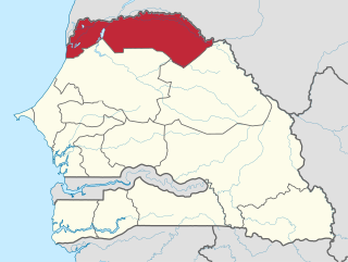
Podor Department is one of the 45 departments of Senegal and one of the three in the Saint-Louis Region in the far north-west of the country.
Ouro Sogui Airport is an airport serving Matam, a city on the Sénégal River and capital of the Matam Region in Senegal. The airport is 10 kilometres (6.2 mi) southwest of Matam, near the town of Ouro Sogui.
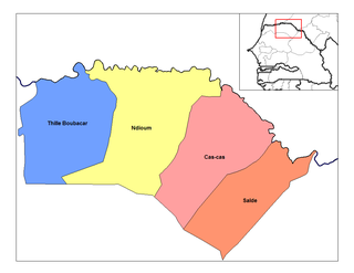
Salde Arrondissement is an arrondissement of the Podor Department in the Saint-Louis Region of Senegal.
Thille Boubacar Arrondissement is an arrondissement of the Podor Department in the Saint-Louis Region of Senegal.

Grains of Selim are the seeds of a shrubby tree, Xylopia aethiopica, found in Africa. The seeds have a musky flavor and are used as a spice in a manner similar to black pepper, and as a flavouring agent that that defines café Touba, the dominant style of coffee in Senegal. It is also known as Kani pepper, Senegal pepper, Ethiopian pepper, and (historically) Moor pepper and Negro pepper. It also has many names in native languages of Africa, the most common of which is djar in the Wolof language. It is sometimes referred to as African pepper or Guinea pepper, but these are ambiguous terms that may refer to Ashanti pepper and grains of paradise, among others.
Doué River is a left branch of the Senegal River in Senegal roughly between the cities of Kaédi and Podor. The Doué is about 68 kilometers long, and it runs parallel to the Senegal River on its southern side. The long land strip between the branches is called Morfil.
Gamadji Saré is an arrondissement of Podor in Saint-Louis Region in Senegal.