Saint-Louis Airport is an airport serving Saint-Louis, the capital of the Saint-Louis Region in Senegal. Saint-Louis is located near the Senegal River, and served as Senegal's capital until independence in 1960. It is 320 km (199 mi) north of Senegal's current capital in Dakar.
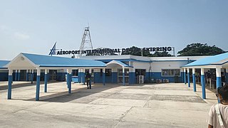
Cap Skirring Airport is an airport serving Cap Skirring, a town in the Ziguinchor region of Senegal.

Tambacounda Airport is an airport serving Tambacounda, the capital of the Tambacounda Region in Senegal.

Ziguinchor Airport is an airport serving Ziguinchor, the capital of the Ziguinchor Region in Senegal.
Houston County Airport is a public airport located three miles (5 km) southeast of the central business district of Crockett, in Houston County, Texas, United States. It is owned by Houston County.
Bear Creek 3 Airport is a public-use airport located three nautical miles west of the central business district of Bear Creek, in the Yukon-Koyukuk Census Area of the U.S. state of Alaska. Bear Creek 3 is 40 nautical miles north of McGrath Airport.
Bakel Airport is an airport serving Bakel, a town in Bakel department, Tambacounda region, Senegal.
Kédougou Airport is an airport serving Kédougou, a town in the Tambacounda Region of Senegal.
Podor Airport is an airport serving Podor, a town in the Saint-Louis Region of Senegal. Podor is located on Morfil Island between the Sénégal River and Doué River.
Richard Toll Airport is an airport serving Richard Toll, a town in the Saint-Louis Region in northern Senegal.
Simenti Airport is an airport serving Simenti in Senegal.
Ouro Sogui Airport is an airport serving Matam, a city on the Sénégal River and capital of the Matam Region in Senegal. The airport is 10 kilometres (6.2 mi) southwest of Matam, near the town of Ouro Sogui.
Bafoulabé Airport is an airstrip serving Bafoulabé, a town and commune in the Bafoulabé Cercle of the Kayes Region of Mali. Bafoulabé is on the Senegal River at its confluence from the Bafing and Bakoy Rivers. The airport is just west of the town.

Guardia Marina Zañartu Airport is an airport serving the town of Puerto Williams on the north shore of Navarino Island in the Magallanes Region of Chile. The island is at the southern tip of Chile, and is across a narrow strait from Argentina called Beagle Channel. It is the world's southernmost airport with regular scheduled flights.
Chañaral Airport Spanish: Aeropuerto de Chañaral, is an airport serving Chañaral, a Pacific coastal city in the Atacama Region of Chile.

