La Pointe du Hoc is a promontory with a 35-metre (110 ft) cliff overlooking the English Channel on the northwestern coast of Normandy in the Calvados department, France.

The Grandes Jorasses is a mountain in the Mont Blanc massif, on the boundary between Haute-Savoie in France and Aosta Valley in Italy.

The Susa Valley is a valley in the Metropolitan City of Turin, Piedmont region of northern Italy, located between the Graian Alps in the north and the Cottian Alps in the south. It is one of the longest valleys of the Italian Alps. It extends over 50 kilometres (31 mi) in an east-west direction from the French border to the outskirts of Turin. The valley takes its name from the city of Susa which lies in the valley. The Dora Riparia river, a tributary of the Po, flows through the valley.

The Dent du Géant is a mountain in the Mont Blanc massif in France and Italy.

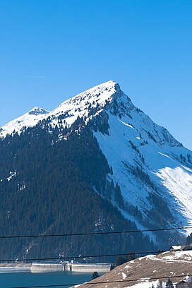
The Vanoise massif is a mountain range of the Graian Alps, located in the Western Alps. After the Mont Blanc Massif and the Massif des Écrins it is the third highest massif in France, reaching a height of 3,885 m at the summit of Grande Casse. It lies between Tarentaise Valley to the north and the Maurienne valley in the south. The range is the site of France's first National Park in 1963, the Vanoise National Park. The ski resorts of Tignes and Val-d'Isère and the 2,770-meter-high Col de l'Iseran are located in the eastern part of the range.

Michel Auguste Croz was a French mountain guide and the first ascentionist of many mountains in the western Alps during the golden age of alpinism. He is chiefly remembered for his death on the first ascent of the Matterhorn and for his climbing partnership with Edward Whymper.
Pornichet is a commune in the Loire-Atlantique department in western France.
The Pointe d'Orny is a mountain of the Mont Blanc massif, located west of Orsières in the canton of Valais. It lies north-east of the Plateau du Trient.
The Pointe de Vouasson is a mountain of the Swiss Pennine Alps, overlooking Lac des Dix in the canton of Valais. It lies between the valleys of Hérémence (west) and Arolla (east), north of the Aiguilles Rouges d'Arolla.
The Pointe du Tsaté is a mountain of the Swiss Pennine Alps, overlooking Les Haudères in the canton of Valais. It lies between the valleys of Hérens and Moiry. On its east side is the lake of Moiry.
The Tsa de l'Ano is a mountain of the Swiss Pennine Alps, located east of Les Haudères in the canton of Valais. It is separated by the Col de Mourti from the Pointes de Mourti to the southeast, on the range between the valley of Hérens and the Moiry Glacier . To the north of the main summit is the secondary peak of Pointe de Moiry, which is separated by the Col de la Couronne from the Couronne de Bréona.

The Pointe de Zinal is a mountain of the Swiss Pennine Alps, located south of Zinal in the canton of Valais. It is situated east of the Dent Blanche, between the valleys of Zinal and Zmutt (Zermatt).
The Pointe Ronde is a mountain of the Mont Blanc massif, overlooking Trient in the canton of Valais. It lies near the northern end of the Arête de la Lys, the ridge descending in a north-westerly direction from the Génépi towards the Col de la Forclaz.
The Pointe des Plines is a minor peak on the east edge of the Mont Blanc massif, close to the Aiguille Dorees, and overlooking the Saleina Glacier in the canton of Valais.
The Grande Pointe des Planereuses is a mountain of the Mont Blanc massif, located west of Praz de Fort in the canton of Valais, Switzerland. It lies on the range south of the Saleina Glacier.
The Bornes Massif is a mountainous massif in the north French Prealps in the département of Haute-Savoie. It has 20 peaks higher than 2000 m and is a popular destination for winter sports. The Massif is the source of the celebrated cheese Reblochon.
The Pointe Nord de Moming is a mountain of the Swiss Pennine Alps, located west of Täsch in the canton of Valais. It lies on the range between the Weisshorn and the Zinalrothorn, north of the Col de Moming.

The Malatraix is a mountain and ridge of the Swiss Prealps, overlooking Lake Geneva in the canton of Vaud. The summit is 1,931 metres (6,335 ft) high, while the rocky part of the southwestern ridge culminates at 1,768 metres (5,801 ft). The Malatraix is part of the range between the Rochers de Naye and the Tour d'Aï, which culminates at the Pointe d'Aveneyre. It belongs to the municipality of Villeneuve.

Praz de Lys - Sommand is a twinned ski resort starting at a high altitude and composed of Sommand resort and Praz de Lys resort both linked by ski trails and chair lifts over and around their dividing mountains. Sommand sits high above its village of Mieussy and Praz de Lys sits above Taninges. The ski resort of Les Gets is also nearby Praz de Lys, about 15 minutes drive. It was opened in approximately 1978.

Les Périades is a sharp and heavily-pinnacled mountain ridge, stretching for over 1,500 metres (0.93 mi) in the Mont Blanc massif in Haute-Savoie, France. It runs in a southerly direction from the Col du Tacul to the Col du Mont Mallet. Its highest point is Pointe Cupelin