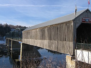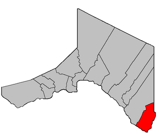
Florenceville-Bristol is a former town in the northwestern part of Carleton County, New Brunswick, Canada along the Saint John River. It held town status prior to 2023 and is now part of the town of Carleton North.

The St. Croix River is a river in northeastern North America, 71 miles (114 km) in length, that forms part of the Canada–United States border between Maine (U.S.) and New Brunswick (Canada). The river rises in the Chiputneticook Lakes and flows south and southeast, between Calais and St. Stephen. It discharges into Passamaquoddy Bay, in the Bay of Fundy.

The Saint John River is a 673-kilometre-long (418 mi) river flowing within the Dawnland region from headwaters in the Notre Dame Mountains near the Maine-Quebec border through western New Brunswick to the northwest shore of the Bay of Fundy. Eastern Canada's longest river, its drainage basin is one of the largest on the east coast at about 55,000 square kilometres (21,000 sq mi). This “River of the Good Wave” and its tributary drainage basin formed the territorial countries of the Wolastoqiyik and Passamaquoddy First Nations prior to European colonization, and it remains a cultural centre of the Wabanaki Confederacy to this day.
Route 2 is a major provincial highway in the Canadian province of New Brunswick, carrying the main route of the Trans-Canada Highway in the province. The highway connects with Autoroute 85 at the border with Quebec and Highway 104 at the border with Nova Scotia, as well as with traffic from Interstate 95 in the U.S. state of Maine via the short Route 95 connector. A core route in the National Highway System, Route 2 is a four-lane freeway in its entirety, and directly serves the cities of Edmundston, Fredericton, and Moncton.
5th Canadian Division Support Base Gagetown, formerly known as and commonly referred to as CFB Gagetown, is a large Canadian Forces Base covering an area over 1,100 km2 (420 sq mi), located in southwestern New Brunswick. It is the biggest facility in Eastern Canada, and Canada's second-largest facility.

The Mactaquac Dam is an embankment dam used to generate hydroelectricity in Mactaquac, New Brunswick. It dams the waters of the Saint John River and is operated by NB Power with a capacity to generate 670 megawatts of electricity from 6 turbines; this represents 20 percent of New Brunswick's power demand.
Route 102 is a 156.96-kilometre-long (97.53 mi) provincial highway in the Canadian province of New Brunswick. The highway runs from an interchange with Route 2 in Pokiok, to an interchange with Route 7 in Grand Bay-Westfield.
The Tobique River is a river in northwestern New Brunswick, Canada. The river rises from Nictau Lake in Mount Carleton Provincial Park and flows for 148 kilometres to its confluence with the Saint John River near Perth-Andover.

Pokiok Falls is a former waterfall in Pokiok, New Brunswick where the Pokiok Stream emptied over a ledge into the Saint John River. The high water level of the Mactaquac Dam reservoir submerged the waterfall and the Pokiok Gorge in 1967.
St. Croix is a rural community in York County, New Brunswick, Canada.

Queensbury is a geographic parish in York County, New Brunswick, Canada.

Dumfries is a geographic parish in York County, New Brunswick, Canada.

Bear Island is a Name Place in Queensbury Parish, New Brunswick, Canada, located on the north shore of the Saint John River.

Saint-André is a geographic parish in Madawaska County, New Brunswick, Canada.

Denmark is a geographic parish in Victoria County, New Brunswick, Canada.

Gordon is a geographic parish in Victoria County, New Brunswick, Canada.

Perth is a geographic parish in Victoria County, New Brunswick, Canada.

Canterbury is a geographic parish in York County, New Brunswick, Canada.

Prince William is a geographic parish in York County, New Brunswick, Canada.
The Grand Bay is a body of water at the confluence of the Wolastoq and Kennebecasis rivers in southern New Brunswick, Canada. The bay is approximately 19.7 km2 and spans across the boundary between Saint John and Kings counties.


