Polički Vrh

Last updated
Polički Vrh
Slovenia location map.svg
Red pog.svg
Polički Vrh
Location in Slovenia
Coordinates: 46°38′56.08″N15°41′43.08″E / 46.6489111°N 15.6953000°E / 46.6489111; 15.6953000 Coordinates: 46°38′56.08″N15°41′43.08″E / 46.6489111°N 15.6953000°E / 46.6489111; 15.6953000
Country Flag of Slovenia.svg Slovenia
Traditional region Styria
Statistical region Drava
Municipality Pesnica
Area
  Total1.88 km2 (0.73 sq mi)
Elevation
298.9 m (980.6 ft)
Population
(2002)
  Total180
[1]

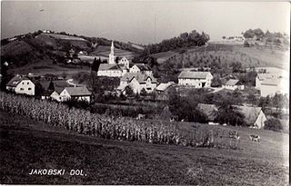
Polički Vrh (pronounced  [pɔˈliːtʃki ˈʋəɾx] ) is a settlement in the Municipality of Pesnica in northeastern Slovenia. It lies in the Slovene Hills (Slovene : Slovenske gorice), part of the traditional region of Styria. The municipality is now included in the Drava Statistical Region. [2]

Municipality An administrative division having corporate status and usually some powers of self-government or jurisdiction

A municipality is usually a single administrative division having corporate status and powers of self-government or jurisdiction as granted by national and regional laws to which it is subordinate. It is to be distinguished (usually) from the county, which may encompass rural territory or numerous small communities such as towns, villages and hamlets.

Municipality of Pesnica Municipality in Slovenia

The Municipality of Pesnica is a municipality in northeastern Slovenia. The center of the municipality is Pesnica pri Mariboru, a suburb near Maribor. It lies at the western end of the Slovene Hills in the Upper Pesnica Valley. The area was part of the traditional region of Styria. It is now included in the Drava Statistical Region as part of the Pesnica Administrative Unit. The main economic activities in the area are tourism, transportation, viticulture, vinemaking, craftsmanship and farming.

Slovenia republic in Central Europe

Slovenia, officially the Republic of Slovenia, is a sovereign state located in southern Central Europe at a crossroads of important European cultural and trade routes. It is bordered by Italy to the west, Austria to the north, Hungary to the northeast, Croatia to the southeast, and the Adriatic Sea to the southwest. It covers 20,273 square kilometers (7,827 sq mi) and has a population of 2.07 million. One of the successor states of the former Yugoslavia, Slovenia is a parliamentary republic and a member of the United Nations, of the European Union, and of NATO. The capital and largest city is Ljubljana.

A large mansion in the south of the settlement known as the Jarenina Mansion (Slovene : Jareninski dvor) dates to the 17th century, but was mentioned in written documents dating to the late 11th century. [3] Jarenina Creek (Slovene : Jareninski potok) flows through the village.

Mansion large dwelling house

A mansion is a large dwelling house. The word itself derives through Old French from the Latin word mansio "dwelling", an abstract noun derived from the verb manere "to dwell". The English word manse originally defined a property large enough for the parish priest to maintain himself, but a mansion is no longer self-sustaining in this way. Manor comes from the same root—territorial holdings granted to a lord who would "remain" there.

Slovene language language spoken in Slovenia

Slovene or Slovenian belongs to the group of South Slavic languages. It is spoken by approximately 2.5 million speakers worldwide, the majority of whom live in Slovenia. It is the first language of about 2.1 million Slovenian people and is one of the 24 official and working languages of the European Union.

Related Research Articles

Trnovska Vas Place in Styria, Slovenia

Trnovska Vas is a settlement in the Municipality of Trnovska Vas in northeastern Slovenia. It is the seat of the municipality. The area was part of the traditional region of Styria. It is now included in the Drava Statistical Region. The settlement lies on the regional road from Ptuj to Lenart v Slovenskih Goricah in the Pesnica Valley.

Jurski Vrh Place in Styria, Slovenia

Jurski Vrh is a settlement in the Municipality of Kungota in the western part of the Slovene Hills in northeastern Slovenia, right on the border with Austria. It includes the hamlet of Jurij ob Pesnici, on the left bank of the Pesnica River, as well as the dispersed houses in the hills north of the village.

Kozjak nad Pesnico Place in Styria, Slovenia

Kozjak nad Pesnico is a dispersed settlement in the Municipality of Kungota in the western part of the Slovenian Hills in northeastern Slovenia.

Vrh pri Površju Place in Lower Carniola, Slovenia

Vrh pri Površju is a settlement west of Raka in the Municipality of Krško in eastern Slovenia. The area was traditionally part of Lower Carniola. It is now included with the rest of the municipality in the Lower Sava Statistical Region.

Hlaponci Place in Styria, Slovenia

Hlaponci is a settlement in the Municipality of Juršinci in northeastern Slovenia. It lies in the valley of a minor left tributary of the Pesnica River in the Slovene Hills. The area is part of the traditional region of Styria. It is now included with the rest of the municipality in the Drava Statistical Region.

Mostje, Juršinci Place in Styria, Slovenia

Mostje is a small settlement in the Municipality of Juršinci in northeastern Slovenia. It lies on the left bank of the Pesnica River north of Dornava on the edge of the Slovene Hills. The area is part of the traditional region of Styria. It is now included with the rest of the municipality in the Drava Statistical Region.

Kočki Vrh in Styria, Slovenia

Kočki Vrh is a small settlement in the Municipality of Sveti Jurij ob Ščavnici in northeastern Slovenia. Traditionally the area was part of Styria and is now included in the Mura Statistical Region.

Trnovski Vrh Place in Styria, Slovenia

Trnovski Vrh is a settlement in the Slovene Hills in the Municipality of Trnovska Vas in northeastern Slovenia. The area was part of the traditional region of Styria. It is now included in the Drava Statistical Region.

Gačnik Place in Styria, Slovenia

Gačnik is a settlement in the Municipality of Pesnica in northeastern Slovenia. It lies in the western part of the Slovene Hills in the valley of Gačnik Creek, a minor tributary of the Pesnica River. The area was part of the traditional region of Styria. It is now included in the Drava Statistical Region.

Jareninski Dol Place in Styria, Slovenia

Jareninski Dol is a village in the Municipality of Pesnica in northeastern Slovenia. It lies in the western part of the Slovene Hills. The area was part of the traditional region of Styria. It is now included in the Drava Statistical Region. Jarenina Creek flows through the settlement.

Jareninski Vrh Place in Styria, Slovenia

Jareninski Vrh is a dispersed settlement in the Municipality of Pesnica in northeastern Slovenia. It lies along the ridge above Jareninski Dol in the western part of the Slovene Hills. The area was part of the traditional region of Styria and is now included in the Drava Statistical Region. Jarenina Creek flows along the western edge of the settlement.

Kušernik Place in Styria, Slovenia

Kušernik is a small settlement in the Municipality of Pesnica in northeastern Slovenia. It lies in the Slovene Hills, part of the traditional region of Styria. The municipality is now included in the Drava Statistical Region.

Pesniški Dvor Place in Styria, Slovenia

Pesniški Dvor is a settlement in the Municipality of Pesnica in northeastern Slovenia. It lies in the Pesnica Valley in the traditional region of Styria. The entire municipality is now included in the Drava Statistical Region.

Spodnji Jakobski Dol Place in Styria, Slovenia

Spodnji Jakobski Dol is a settlement in the Municipality of Pesnica in northeastern Slovenia. It lies in the Slovene Hills, part of the traditional region of Styria. The municipality is now included in the Drava Statistical Region.

Vajgen Place in Styria, Slovenia

Vajgen is a dispersed settlement in the Municipality of Pesnica in northeastern Slovenia. It lies in the Slovene Hills, north of Jareninski Dol. Traditionally the area was part of the Styria region. The municipality is now included in the Drava Statistical Region.

Vosek, Pesnica Place in Styria, Slovenia

Vosek is a settlement in the Municipality of Pesnica in northeastern Slovenia. It lies on the left bank of the Pesnica River. The area was traditionally part of Styria. The municipality is now included in the Drava Statistical Region. Jarenina Creek empties into Lake Pernica in the northeastern part of the settlement.

Vukovje Place in Styria, Slovenia

Vukovje is a settlement in the Municipality of Pesnica in northeastern Slovenia. It lies north and east of the Pernica Reservoir in the Slovene Hills. The area was traditionally part of Styria. The municipality is now included in the Drava Statistical Region.

Vukovski Vrh Place in Styria, Slovenia

Vukovski Vrh is a dispersed settlement in the Municipality of Pesnica in northeastern Slovenia. It lies along a ridge east of Jareninski Dol in the Slovene Hills. Traditionally the area was part of Styria and is now included in the Drava Statistical Region.

Trebanjski Vrh Place in Lower Carniola, Slovenia

Trebanjski Vrh is a settlement in the Municipality of Trebnje in eastern Slovenia. The area is part of the historical region of Lower Carniola. The municipality is now included in the Southeast Slovenia Statistical Region.

Bukovje, Dravograd Place in Styria, Slovenia

Bukovje is a village along the road linking the town of Dravograd and the settlement of Trbonje, northeast of Dravograd, along the southern bank of the Drava River, in northeastern Slovenia. The village is part of the traditional region of Styria and is, as part of the Municipality of Dravograd, included in the Carinthia Statistical Region. It was established in 2004, when it ceded from the settlement of Otiški Vrh.

References