
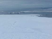

Pomorie Point (Nos Pomorie \'nos po-'mo-ri-e\) is a point on the coast of McFarlane Strait forming the north side of the entrance to Lister Cove, Varna Peninsula, Livingston Island in the South Shetland Islands, Antarctica.
Pomorie Point (Nos Pomorie \'nos po-'mo-ri-e\) is a point on the coast of McFarlane Strait forming the north side of the entrance to Lister Cove, Varna Peninsula, Livingston Island in the South Shetland Islands, Antarctica.
The point is located at 62°29′05.3″S60°03′56″W / 62.484806°S 60.06556°W , which is 5.17 km southeast of Williams Point, 7.61 km northeast of Miziya Peak in Vidin Heights, 5.49 km northwest of Inott Point, 4.36 km south-southwest of Duff Point, Greenwich Island, and 2.5 km south-southeast of Channel Rock (British mapping in 1968, Bulgarian mapping in 2005 and 2009).

Amadok Point is a point on the south coast of Livingston Island, Antarctica which projects 400 m into the Bransfield Strait. The point was named after the Thracian King Amadokos, 415-384 BC. It is snow-free in the summer.

Magura Glacier on the southeast side of Tangra Mountains on Livingston Island in the South Shetland Islands, Antarctica is located to the north of M'Kean Point, northeast of Srebarna Glacier, south of Iskar Glacier and southwest of Dobrudzha Glacier. It is bounded by Great Needle Peak to the west, Vitosha Saddle, Vihren Peak and Helmet Peak to the northwest, Plovdiv Peak and Shishman Peak to the north, and Devin Saddle and Kuber Peak to the northeast. The glacier extends 3.5 km in southwest-northeast direction and 1.9 km in northwest-southeast direction, and flows southeastward into Bransfield Strait.
Melta Point is a rocky point on the coast of Hero Bay, Livingston Island, formed by an offshoot of Teres Ridge. Adjacent ice-free area 116 hectares. The point is named after the ancient Melta, ancestor of the present town of Lovech in Northern Bulgaria. This is one of the Bulgarian names bestowed on hitherto nameless geographical features by the Tangra 2004/05 Expedition.

Ogosta Point is located in the central part of Zagore Beach on the east coast of False Bay, Livingston Island in the South Shetland Islands, Antarctica. Situated on Rozhen Peninsula 5.35 km north of Barnard Point, 4.4 km west of St. Methodius Peak and 3.45 km east of Castro Peak. The point is named after the Ogosta River in Bulgaria.

Rila Point is a low, ice-free point on the south coast of Moon Bay, projecting 330 m west-northwestwards from Burgas Peninsula on Livingston Island in the South Shetland Islands, Antarctica, and forming the east side of the entrance to Bruix Cove. The point is named after Rila Mountain, Bulgaria.

Rose Valley Glacier is a glacier on Varna Peninsula, eastern Livingston Island in the South Shetland Islands, Antarctica situated northeast of Saedinenie Snowfield, northwest of Debelt Glacier and north of Panega Glacier. It extends 5.2 km in southeast-northwest direction and 3.7 km in southwest-northeast direction, and drains the northeast slopes of Vidin Heights to flow into Lister Cove and McFarlane Strait between Pomorie Point and Inott Point.

Spanish Point is located on Bulgarian Beach on Hurd Peninsula, eastern Livingston Island in the South Shetland Islands, Antarctica formed by an offshoot of Spanish Knoll.
Struma Glacier is a glacier in eastern Livingston Island in the South Shetland Islands, Antarctica situated south of lower Kaliakra Glacier and north of Huron Glacier. Bounded by Melnik Ridge to the north, Yankov Gap to the west and Bowles Ridge to the south, it is 4.8 km long and 1.5 km wide, and flows eastwards into Moon Bay south of Sindel Point.
Aytos Point is a point on the coast of Bransfield Strait, Livingston Island, Antarctica formed by an offshoot of Christoff Cliff. The point was named after the Bulgarian town of Aytos.

Desolation Island is one of the minor islands in the South Shetlands archipelago, Antarctica situated at the entrance to Hero Bay, Livingston Island. The island is V-shaped with its northern coast indented by Kozma Cove. Surface area is 3.12 square kilometres (1.20 sq mi).

Ficheto Point is an ice-free point on the northeast coast of Varna Peninsula, Livingston Island, Antarctica forming the southeast side of the entrance to Dragon Cove. Channel Rock is lying in the adjacent northwestern part of McFarlane Strait, 1.3 km (0.81 mi) northeast of Ficheto Point and 920 m (1,010 yd) south-southwest of Meade Islands. The area was visited by 19th century sealers.
Kuklen Point is a point forming the east side of the entrance to Skravena Cove on the coast of Hero Bay, Livingston Island, South Shetland Islands. It is situated 2.13 km southeast of Avitohol Point, 5.6 km west of Lukovit Point and 2.4 km west of Atanasova Point. Bulgarian early mapping in 2009. Named after the town of Kuklen in southern Bulgaria.

Ugain Point is the point on the west coast of Rugged Island in the South Shetland Islands, Antarctica separating Smyadovo Cove to the north and Bogomil Cove to the south. Situated 1.76 km north-northwest of Benson Point, 970 m north of Kokalyane Point and 1.55 km south of Cape Sheffield.

Sevar Point is a point on the south coast of Byers Peninsula on Livingston Island in the South Shetland Islands, Antarctica situated 1.9 km east-southeast of Devils Point, 2.71 km west of Nikopol Point, and 2.97 km northeast of Long Rock in Morton Strait. It is surmounted by Wasp Hill on the north-northeast, Sealer Hill on the east-northeast, and forms the east side of the entrance to Raskuporis Cove.
Yana Point is the point forming the west side of the entrance to Bruix Cove in eastern Livingston Island in the South Shetland Islands, Antarctica. The point separates the glacier termini of Huron Glacier to the northwest and Iskar Glacier to the southeast. The feature is named after the settlement of Yana in western Bulgaria.
Lister Cove is a 2.1 km wide cove indenting for 1.55 km the northeast coast of Varna Peninsula, Livingston Island in the South Shetland Islands, Antarctica south of Pomorie Point and north of Karavelova Point. The cove is fed by Rose Valley Glacier.
Sayer Nunatak is a rocky peak rising to 210 m south of Williams Point on Varna Peninsula, at the north edge of the ice cap of Livingston Island in the South Shetland Islands, Antarctica. The nunatak is forming the north extremity of Vidin Heights and surmounting Dragon Cove to the northeast, Griffin Cove to the north-northwest and Charybdis Cove to the southwest.
Window Island is a small ice-free island off the north coast of Ray Promontory in the northwest of Byers Peninsula, Livingston Island in the South Shetland Islands, Antarctica. The island has a surface area of 23 hectares and rises to 72 m (236 ft). It was known to the early 19th century sealers operating on Byers Peninsula.
The Meade Islands are a group of two large islands, Zverino Island and Cave Island, the minor Pisanitsa Island, and several rocks lying in the north entrance to McFarlane Strait, off Archar Peninsula, Greenwich Island in the South Shetland Islands, Antarctica. The surface areas of the first two islands are 48 hectares and 18 hectares. respectively. The area was visited by early 19th-century sealers.
Yasen Point is the sharp, rocky point on the south coast of Livingston Island in the South Shetland Islands, Antarctica, forming the west side of the entrance to Mateev Cove. Situated on the east side of the small ice-free promontory ending in Hannah Point to the west.
This article includes information from the Antarctic Place-names Commission of Bulgaria which is used with permission.
| | This Livingston Island location article is a stub. You can help Wikipedia by expanding it. |