
Breydon Water is a 514.4-hectare (1,271-acre) biological Site of Special Scientific Interest at Great Yarmouth, Norfolk. It is a Local Nature Reserve, a Ramsar site and a Special Protection Area. It is part of the Berney Marshes and Breydon Water nature reserve, which is managed by the Royal Society for the Protection of Birds (RSPB).
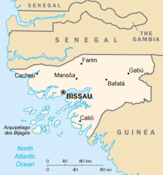
The Bissagos Islands, also spelled Bijagós, are a group of about 88 islands and islets located in the Atlantic Ocean off the coast of Guinea-Bissau.
Baga, or Barka, is a dialect cluster spoken by the Baga people of coastal Guinea. The name derives from the phrase bae raka Slaves trading place and understood by the local as 'people of the seaside' outcast people. Most Baga are bilingual in the Mande language Susu, the official regional language. Two ethnically Baga communities, Sobané and Kaloum, are known to have abandoned their (unattested) language altogether in favour of Susu.
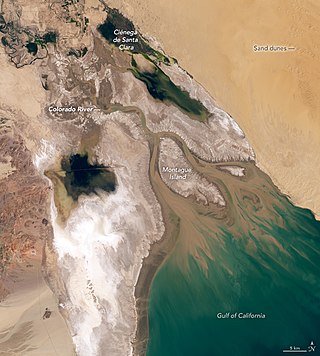
The Colorado River Delta is the region where the Colorado River once flowed into the Gulf of California in eastern Mexicali Municipality in the north of the state of Baja California, in northwestern Mexico. The delta is part of a larger geologic region called the Salton Trough. Historically, the interaction of the river's flow and the ocean's tide created a dynamic environment, supporting freshwater, brackish, and saltwater species. Within the delta region, the river split into multiple braided channels and formed a complex estuary and terrestrial ecosystems. The use of water upstream and the accompanying reduction of freshwater flow has resulted in the loss of most of the wetlands of the area, as well as drastic changes to the aquatic ecosystems - an ecosystem collapse.

The Baga are a West African ethnic group who live in the southern swampy lands of Guinea Atlantic coastline. Traditionally animist through the pre-colonial times, they converted to Islam during the mid-eighteenth century under the influence of Muslim Mandé missionaries. Some continue to practice their traditional rituals.
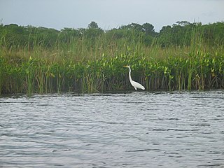
The Black River is one of the longest rivers in Jamaica. At a length of 53.4 km (33.2 mi), it was believed to be the longest until it was discovered that the Rio Minho was 92.8 km long. Its name refers to the darkness of the riverbed caused by thick layers of decomposing vegetation.

The Central African mangroves ecoregion consists of the largest area of mangrove swamp in Africa, located on the coasts of West Africa, mainly in Nigeria.
Verlorevlei River is a river in the Western Cape province of South Africa. Lying on the Sandveld of the West Coast, the river runs past Eendekuil, Het Kruis, and Redelinghuys. The river mouth is located at Elands Bay. Its tributaries include the Hol River, Kruismans River and the Krom Antonies River. It falls within the Drainage system G and the Management Area.
The Port Phillip Bay and Bellarine Peninsula Ramsar Site is one of the Australian sites listed under the Ramsar Convention as a wetland of international importance. It was designated on 15 December 1982, and is listed as Ramsar Site No.266. Much of the site is also part of either the Swan Bay and Port Phillip Bay Islands Important Bird Area or the Werribee and Avalon Important Bird Area, identified as such by BirdLife International because of their importance for wetland and waterbirds as well as for orange-bellied parrots. It comprises some six disjunct, largely coastal, areas of land, totalling 229 km2, along the western shore of Port Phillip and on the Bellarine Peninsula, in the state of Victoria. Wetland types protected include shallow marine waters, estuaries, freshwater lakes, seasonal swamps, intertidal mudflats and seagrass beds.
Guinean Americans are an ethnic group of Americans of Guinean descent. According to estimates by 2000 US Census, there were 3,016 people who identified Guinean as one of their two top ancestry identities. However, in November 2010 the New York Times estimated that as many 10,000 Guineans and Guinean Americans reside in New York City alone.

Nunez River or Rio Nuñez (Kakandé) is a river in Guinea with its source in the Futa Jallon highlands. It is also known as the Tinguilinta River, after a village along its upper course.
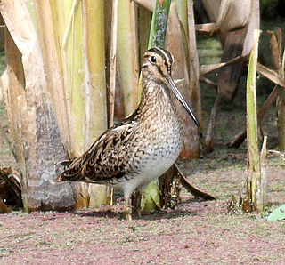
The Hunter Estuary Wetlands comprise a group of associated wetlands at and near the mouth of the Hunter River in the city of Newcastle, New South Wales, Australia. The wetlands are part of Hunter Wetlands National Park. 30 km2 of the wetlands have been recognised as being of international importance by designation under the Ramsar Convention. It was listed on 21 February 1984 as Ramsar site 287. A larger area of the wetlands has been identified by BirdLife International as an Important Bird Area (IBA). The wetlands are recognised as the most important area in New South Wales for waders, or shorebirds.
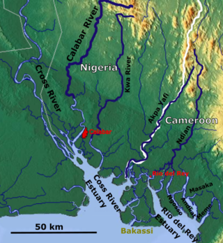
The Rio del Rey is an estuary of a drainage basin in West Africa in Cameroon. It is located in the eastern area of the Niger River system. The Cameroon volcanic line separates Rio Del Rey from the Douala basin. Rio del Rey has been described as an estuary in which "the two rivers N'dian and Massake flow out". The mouth is close to the border with Nigeria and has connections to the Cross River estuary from which it is separated by the Bakassi peninsula. The Rio del Rey estuary has been designated as a Ramsar site since 2010.
Farenya is a settlement in Boffa Prefecture, Boké Region, Guinea. It is situated 69 miles north of Conakry. It is located on the Pongo River.
Niara Bely, also known as Elizabeth Bailey Gomez, was a Luso-African queen who became a prominent businesswoman in nineteenth century Guinea. She was active in the slave trade in Farenya, Guinea.
John Holman was an English slave trader from London who settled in the Pongo River area in the 1760s before eventually moving on to South Carolina in 1790.
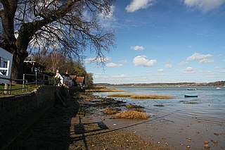
Orwell Estuary is a 1,335.7 hectare biological Site of Special Scientific Interest which stretches along the River Orwell and its banks between Felixstowe and Ipswich in Suffolk. It is part of the Stour and Orwell Estuaries Ramsar site internationally important wetland site and Special Protection Area under the European Union Directive on the Conservation of Wild Birds. It is also in the Suffolk Coast and Heaths Area of Outstanding Natural Beauty.
Mary Faber, also called Mary Faber de Sanger, was an African slave-trader. From the 1830s until 1852, she was a dominant figure of the Atlantic slave trade from Guinea, and known for her conflict with the British Royal Navy Anti-Slave Squadron.

Théodore Canot (1804–1860) was a slave trader and writer of Franco-Florentine origin.

Bolama is the closest of the Bissagos Islands to the mainland of Guinea-Bissau. The island has a population of 6,024. It shares its name with its largest settlement, the town Bolama, which is the capital of the island and the Bolama Region. A causeway links the island to the Ilha das Cobras. Attractions on the island include sandy beaches and the abandoned ruins of the town of Bolama. It is known for its cashew nuts.


