
Kankan is the largest city in Guinea in land area, and the third largest in population, with a population of 198,013 people as of 2020. The city is located in eastern Guinea about 555 kilometres east of the national capital Conakry.
Nzérékoré is the second-largest city in Guinea by population after the capital, Conakry, and the largest city in the Guinée forestière region of southeastern Guinea. The city is the capital of Nzérékoré Prefecture. Nzérékoré is a commercial and economic center and lies approximately 354 mi (570 km) southeast of Conakry.
Faranah is a town and sub-prefecture in central Guinea, lying by the River Niger. As of 2014 it had a population of 78,108 people. The town is mainly inhabited by the Malinke people.

Bouar is a market town in the western Central African Republic, lying on the main road from Bangui (437 km) to the frontier with Cameroon (210 km). The city is the capital of Nana-Mambéré prefecture, has a population of 40,353, while the whole sous-préfecture has a population of 96,595. Bouar lies on a plateau almost 1000m above sea level and is known as the site of Camp Leclerc, a French military base.

Boffa is a prefecture located in the Boké Region of Guinea. The capital is Boffa. The prefecture covers an area of 5,050 km2 (1,950 sq mi) and has a population of 212,583.
Gómez Farías Municipality is situated in the Mexican state of Tamaulipas. The town of Gómez Farías serves as the municipal seat of government. Covering an area of 433 square kilometres, Gómez Farías Municipality had a population of 8,786 as of 2010. The town of Gómez Farías, specifically, had a population of 883 in the same year. Additionally, within the municipal area, a portion of 23,124 hectares is encompassed by the El Cielo Biosphere Reserve.

Chtouka Aït Baha is a province in the Moroccan economic region of Souss-Massa. Its population in 2004 was 297,245.
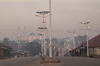
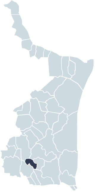
Douprou is a town and sub-prefecture in the Boffa Prefecture in the Boké Region of western Guinea. As of 2014 it had a population of 21,045 people.
Koba-Tatema is a town and sub-prefecture in the Boffa Prefecture in the Boké Region of western Guinea. As of 2014 it had a population of 50,644 people.
Lisso is a town and sub-prefecture in the Boffa Prefecture in the Boké Region of western Guinea. As of 2014 it had a population of 11,861 people.
Tamita is a town and sub-prefecture in the Boffa Prefecture in the Boké Region of western Guinea. As of 2014 it had a population of 14,443 people.
Tougnifili is a town and sub-prefecture in the Boffa Prefecture in the Boké Region of western Guinea.
Bardou is a town and sub-prefecture in the Kissidougou Prefecture in the Faranah Region of Guinea. As of 2014 it had a population of 9,767 people.
Kondiadou or Koundiatou is a town and sub-prefecture in the Kissidougou Prefecture in the Faranah Region of Guinea. As of 2014 it had a population of 14,897 people.
Kounsankoro is a town and sub-prefecture in the Kérouané Prefecture in the Kankan Region of south-eastern Guinea. As of 2014, it had a population of 7,053 people.
Sibiribaro is a town and sub-prefecture in the Kérouané Prefecture in the Kankan Region of south-eastern Guinea. As of 2014 it had a population of 16,485 people.
Kentzou is a town and commune in Cameroon.
Kékem is a town and commune in Cameroon.
Melloulèche is a town and commune in the Mahdia Governorate, Tunisia. In 2004, it had a population of 6,411.
Lakhnafif is a small town and rural commune located in Taroudant Province of the Souss-Massa-Drâa region of Morocco. At the time of the 2004 census, the commune had a total population of 8881 people living in 1513 households.


