Les Collines-de-l'Outaouais is a regional county municipality in the Outaouais region of western Quebec, Canada. The region nearly encircles the City of Gatineau, which is to the south. Its administrative seat is in Chelsea, Quebec.
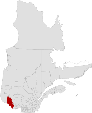
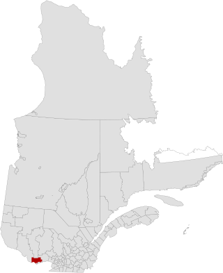
Pontiac is a regional county municipality in the Outaouais region of Quebec, Canada. Campbell's Bay is the county seat. It should not be confused with the municipality of Pontiac, which is located in the neighbouring Les Collines-de-l'Outaouais Regional County Municipality. For the electoral district see Pontiac.
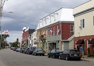
Shawville is a town located in the Pontiac Regional County Municipality in the administrative region of Outaouais in western Quebec, Canada.

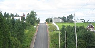
Bryson is a village and municipality in the Pontiac Regional County Municipality in the Outaouais region of Quebec, Canada. It is located on the northern bank of the Ottawa River.

L'Ange-Gardien is a municipality in the Outaouais region of Quebec, Canada. It constitutes the easternmost part of Les Collines-de-l'Outaouais Regional County Municipality, north of the Buckingham Sector of the City of Gatineau.

Waltham, also known as Waltham Station is a village and municipality in the Outaouais region, Quebec, Canada, part of the Pontiac Regional County Municipality. It is located at the mouth of the Noire River, along the north shore of the Ottawa River at Allumette Island.

Sheenboro is a village and municipality in the Outaouais region, part of the Pontiac Regional County Municipality, Quebec, Canada. It was formerly known as Sheen-Esher-Aberdeen-et-Malakoff. Its territory stretches along the north shore of the Ottawa River from Chichester to Rapides-des-Joachims.

L'Isle-aux-Allumettes is a municipality in the Outaouais region, part of the Pontiac Regional County Municipality, Quebec, Canada. The municipality consists primarily of Allumette Island, and also includes Morrison Island, Marcotte Island, and some minor islets, all in the Ottawa River north of Pembroke.

Lochaber-Partie-Ouest is a township municipality in the Canadian province of Quebec, located within the Papineau Regional County Municipality. The township had a population of 926 in the 2021 Canadian Census.

L'Île-du-Grand-Calumet is a municipality in the Outaouais region, part of the Pontiac Regional County Municipality, Quebec, Canada. The municipality consists primarily of Calumet Island, but also includes Lafontaine Island, French Island, Green Island, and numerous minor surrounding islets, all in the Ottawa River, approximately two kilometres from Campbell's Bay, two kilometres from Bryson.

Litchfield is a municipality in the Outaouais region, part of the Pontiac Regional County Municipality, Quebec, Canada. It is located on the shores of the eastern channel of the Ottawa River at Calumet Island.

Clarendon is a municipality in the Outaouais region, part of the Pontiac Regional County Municipality, Quebec, Canada. It is located on the north shore of the Ottawa River across from Horton Township in Ontario.

Bristol is a municipality in the Ottawa Valley, on the Quebec side in the Outaouais region, part of the Pontiac Regional County Municipality, Quebec, Canada. It is located on the north shore of Lac des Chats across from Arnprior, Ontario.

Thorne is a municipality in the Pontiac Regional County Municipality, Quebec, Canada, about 63 kilometres (39 mi) northwest of Downtown Gatineau, part of the Outaouais region.

Otter Lake is a municipality in the Outaouais region, northwest of Gatineau, part of the Pontiac Regional County Municipality, Quebec, Canada.

Alleyn-et-Cawood is a municipality in the Outaouais region, northwest of Gatineau, part of the Pontiac Regional County Municipality, Quebec, Canada. Its main population centre is Danford Lake, located along Route 301.

Lac-Simon is a town and municipality in the Outaouais region of Quebec, Canada, part of the Papineau Regional County Municipality.

Namur is a town and municipality in the Outaouais region of Quebec, Canada, part of the Papineau Regional County Municipality. It is nicknamed "la Nouvelle Belgique".

Saint-Émile-de-Suffolk is a municipality in the Outaouais region of Quebec, Canada, part of the Papineau Regional County Municipality. Until 1994 it was known as United Township Municipality of Suffolk-et-Addington.
Saint-André-de-Restigouche is a municipality in Quebec, Canada.


