Papineau Regional County Municipality

Last updated
Papineau
Quebec MRC Papineau location map.svg
Coordinates: 45°53′N75°03′W / 45.883°N 75.050°W / 45.883; -75.050 Coordinates: 45°53′N75°03′W / 45.883°N 75.050°W / 45.883; -75.050 [1]
CountryFlag of Canada (Pantone).svg  Canada
Province Flag of Quebec.svg  Quebec
Region Outaouais
EffectiveJanuary 1, 1983
County seat Papineauville
Government
[2]
  Type Prefecture
  PrefectM. Benoit Lauzon
Area
  Total3,205.90 km2 (1,237.80 sq mi)
  Land3,016.78 km2 (1,164.79 sq mi)
Population
 (2021) [3]
  Total25,149
  Density8.3/km2 (21/sq mi)
  Change
2016-2021
Increase2.svg 6.5%
  Dwellings
16,537
Time zone UTC−5 (EST)
  Summer (DST) UTC−4 (EDT)
Area code 819
Website www.mrcpapineau.com OOjs UI icon edit-ltr-progressive.svg

Papineau is a regional county municipality in the Outaouais region of Quebec, Canada. The seat is Papineauville.

Contents

Subdivisions

There are 25 subdivisions within the RCM: [2]

NameTypePopulation
(2016)
Area
(km2)
Density
(inhab./km2)
Boileau Municipality335136.332.5
Bowman Municipality658129.305.1
Chénéville Municipality76466.7611.4
Duhamel Municipality430434.571.0
Fassett Municipality43112.4934.5
Lac-des-Plages Municipality431152.942.8
Lac-Simon Municipality94497.489.7
Lochaber Township41560.706.8
Lochaber-Partie-Ouest Township85657.4514.9
Mayo Municipality60173.258.2
Montebello Municipality9838.62114.0
Montpellier Municipality985249.144.0
Mulgrave-et-Derry Municipality369293.751.3
Namur Municipality57256.7610.1
Notre-Dame-de-Bonsecours Municipality301264.971.1
Notre-Dame-de-la-Paix Municipality648106.626.1
Notre-Dame-de-la-Salette Municipality727117.106.3
Papineauville Municipality2,10161.3334.3
Plaisance Municipality1,08836.1530.1
Ripon Municipality1,542131.4711.7
Saint-André-Avellin Municipality3,749137.9927.2
Saint-Émile-de-Suffolk Municipality47756.688.4
Saint-Sixte Municipality46985.335.5
Thurso City2,8186.28449.0
Val-des-Bois Municipality865225.423.8
Total22,8322,941.797.8

Demographics

In the 2021 Census of Population conducted by Statistics Canada, the RCM of Papineau had a population of 24,308 living in 11,504 of its 16,059 total private dwellings, a change of 6.5% from its 2016 population of 22,832. With a land area of 2,903.45 km2 (1,121.03 sq mi), it had a population density of

In 2021, the median age was 54.0, as opposed to 41.6 for all of Canada. French was the mother tongue of 91.2% of residents in 2021. The next most common mother tongues are English at 5.5% total, followed by Spanish and German at 0.2% each and by Portugese at 0.1%. 1.9% reported both English and French as their first language. Additionally there were 0.1% who reported both French and a non-official language as their mother tongue and another 0.1% who reported both French, English and a non-official language as their mother tongue.

As of 2021, Indigenous peoples comprised 4.4% of the population, and visible minorities contributed 1.1%. The largest visible minority groups in the RCM of Papineau are Black (0.4%), Chinese (0.1%), and Arab (0.1%).

In 2021, 65.2% of the population identified as Catholic, while 26.1% said they had no religious affiliation. Baptists were the largest religious minority, making up 0.6% of the population. Buddhists were the largest non-Christian religious minority, making up just over 0.1% of the population.

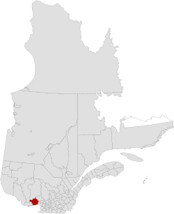
Canada census – Papineau community profile
2021 2016 2011
Population24,308 (+6.5% from 2016)22,832 (1.3% from 2011)22,541 (3.1% from 2006)
Land area2,903.45 km2 (1,121.03 sq mi)2,941.79 km2 (1,135.83 sq mi)2,941.82 km2 (1,135.84 sq mi)
Population density8.4/km2 (22/sq mi)7.8/km2 (20/sq mi)7.7/km2 (20/sq mi)
Median age54 (M: 54.4, F: 53.6)52.1 (M: 52.2, F: 52.0)49.9 (M: 49.8, F: 50.1)
Total private dwellings11,50515,89314,569
Median household income$51,196$44,308
References: 2021 [5] 2016 [6] 2011 [7] earlier [8] [9]
Historical census populations
YearPop.±%
1986 18,790    
1991 19,526+3.9%
1996 20,308+4.0%
2001 20,367+0.3%
2006 21,863+7.3%
2011 22,541+3.1%
2016 22,832+1.3%

Mother tongue from Canada 2016 Census [3]

LanguagePopulationPct (%)
French only21,01592.6%
English only1,1505.1%
Both English and French2501.1%
Other languages2701.19%

Transportation

Access Routes

Highways and numbered routes that run through the municipality, including external routes that start or finish at the county border: [10]

See also

Related Research Articles

<span class="mw-page-title-main">Acton Regional County Municipality</span> Regional county municipality in Quebec, Canada

Acton Regional County Municipality is a regional county municipality located in the Montérégie region of Quebec. The seat is Acton Vale.

<span class="mw-page-title-main">Arthabaska Regional County Municipality</span> Regional county municipality in Quebec, Canada

Arthabaska Regional County Municipality is a regional county municipality located in the Centre-du-Québec region of Quebec. Its seat is Victoriaville.

<span class="mw-page-title-main">Bécancour Regional County Municipality</span> Regional county municipality in Quebec, Canada

Bécancour is a regional county municipality in the Centre-du-Québec region of Quebec, Canada. Its seat is Bécancour.

<span class="mw-page-title-main">La Haute-Yamaska Regional County Municipality</span> Regional county municipality in Quebec, Canada

La Haute-Yamaska is a regional county municipality in the Estrie region of Quebec, Canada. Its seat is Granby.

<span class="mw-page-title-main">La Vallée-de-la-Gatineau Regional County Municipality</span> Regional county municipality in Quebec, Canada

La Vallée-de-la-Gatineau is a regional county municipality in the Outaouais region of western Quebec, Canada. The seat is in Gracefield. It was incorporated on January 1, 1983 and was named for its location straddling the Gatineau River north of Low.

<span class="mw-page-title-main">Les Collines-de-l'Outaouais Regional County Municipality</span> Regional county municipality in Quebec, Canada

Les Collines-de-l'Outaouais is a regional county municipality in the Outaouais region of western Quebec, Canada. The region nearly encircles the City of Gatineau, which is to the south. Its administrative seat is in Chelsea, Quebec.

<span class="mw-page-title-main">Les Jardins-de-Napierville Regional County Municipality</span> Regional county municipality in Quebec, Canada

Les Jardins-de-Napierville(English: The Gardens of Napierville) is a regional county municipality (French: Municipalité régionale de comté ) in southwestern Quebec, Canada in the Montérégie region. Founded on January 1, 1982. Its seat is Napierville.

<span class="mw-page-title-main">L'Île-d'Orléans Regional County Municipality</span> Regional county municipality in Quebec, Canada

L'Île-d'Orléans is a regional county municipality in central Quebec, Canada, in the Capitale-Nationale region. Its seat is Sainte-Famille-de-l'Île-d'Orléans. The population in the 2016 census was 7,082 people.

<span class="mw-page-title-main">Lotbinière Regional County Municipality</span> Regional county municipality in Quebec, Canada

Lotbinière is a regional county municipality in the Chaudière-Appalaches region of Quebec. It is an almost exclusively rural RCM, with no village with a population above 4,000. As of the 2016 Canadian Census, the RCM had a population of 31,741. Its seat is in Sainte-Croix.

<span class="mw-page-title-main">Maria-Chapdelaine Regional County Municipality</span> Regional county municipality in Quebec, Canada

Maria-Chapdelaine is a regional county municipality in the Saguenay–Lac-Saint-Jean region of Quebec, Canada. Its seat is in Dolbeau-Mistassini.

<span class="mw-page-title-main">Papineauville, Quebec</span> Municipality in Quebec, Canada

Papineauville is a town and municipality in the Outaouais region of Quebec, Canada. It is the seat of the Papineau Regional County Municipality. In 2001 its population was 2247.

<span class="mw-page-title-main">Lochaber, Quebec</span> Township municipality in Quebec, Canada

Lochaber is a township municipality in the Canadian province of Quebec, located within the Papineau Regional County Municipality. The township had a population of 415 in the 2016 Canadian Census.

<span class="mw-page-title-main">Lochaber-Partie-Ouest, Quebec</span> Township municipality in Quebec, Canada

Lochaber-Partie-Ouest is a township municipality in the Canadian province of Quebec, located within the Papineau Regional County Municipality. The township had a population of 926 in the 2021 Canadian Census.

<span class="mw-page-title-main">Val-des-Bois, Quebec</span> Municipality in Quebec, Canada

Val-des-Bois is a town and municipality in the Papineau Regional County Municipality in the Outaouais region of Quebec, Canada. The town is located on the eastern shores of the Du Lièvre River, 47 kilometers (29 mi) north of Buckingham.

<span class="mw-page-title-main">Montpellier, Quebec</span> Municipality in Quebec, Canada

Montpellier is a town and municipality in the Papineau Regional County Municipality in the Outaouais region of Quebec, Canada. The town is located 30 kilometres (19 mi) northwest of Papineauville.

<span class="mw-page-title-main">Duhamel, Quebec</span> Municipality in Quebec, Canada

Duhamel is a town and municipality in the Outaouais region of Quebec, Canada. It is the largest municipality in surface area in the Papineau Regional County Municipality.

<span class="mw-page-title-main">Chénéville, Quebec</span> Municipality in Quebec, Canada

Chénéville is a town and municipality in the Outaouais region of Quebec, Canada, part of the Papineau Regional County Municipality.

<span class="mw-page-title-main">Namur, Quebec</span> Municipality in Quebec, Canada

Namur is a town and municipality in the Outaouais region of Quebec, Canada, part of the Papineau Regional County Municipality. It is nicknamed "la Nouvelle Belgique".

<span class="mw-page-title-main">Lac-des-Plages, Quebec</span> Municipality in Quebec, Canada

Lac-des-Plages is a town and municipality in the Outaouais region of Quebec, Canada, part of the Papineau Regional County Municipality. It is named after Lac des Plages which attracts many vacationers with the beauty of its beaches.

<span class="mw-page-title-main">Notre-Dame-du-Laus</span> Municipality in Quebec, Canada

Notre-Dame-du-Laus is a municipality in the Laurentides region of Quebec, Canada, part of the Antoine-Labelle Regional County Municipality.

References

  1. "Reference number 141047 in Banque de noms de lieux du Québec". toponymie.gouv.qc.ca (in French). Commission de toponymie du Québec.
  2. 1 2 3 "Geographic code 800 in the official Répertoire des municipalités". www.mamh.gouv.qc.ca (in French). Ministère des Affaires municipales et de l'Habitation.
  3. 1 2 3 "Census Profile, 2021 Census: Papineau, Municipalité régionale de comté [Census division], Quebec + Notre-Dame-de-la-Salette, Municipalité [Census subdivision], Quebec". Statistics Canada. Retrieved May 16, 2023.
  4. "Population and dwelling counts: Canada, provinces and territories, and census subdivisions (municipalities), Quebec". Statistics Canada. February 9, 2022. Retrieved May 16, 2023.
  5. "2021 Community Profiles". 2021 Canadian Census . Statistics Canada. February 4, 2022. Retrieved 2022-04-27.
  6. "2016 Community Profiles". 2016 Canadian Census . Statistics Canada. August 12, 2021. Retrieved 2019-12-20.
  7. "2011 Community Profiles". 2011 Canadian Census . Statistics Canada. March 21, 2019. Retrieved 2019-12-20.
  8. "2006 Community Profiles". 2006 Canadian Census . Statistics Canada. August 20, 2019.
  9. "2001 Community Profiles". 2001 Canadian Census . Statistics Canada. July 18, 2021.
  10. "Official Transport Quebec Road Map". Archived from the original on 2011-02-24. Retrieved 2009-05-30.