Duhamel, Quebec

Last updated

Duhamel
Lac Gagnon.JPG
Lake Gagnon
Duhamel Quebec location diagram.png
Location within Papineau RCM
Canada Western Quebec location map.png
Red pog.svg
Duhamel
Location in western Quebec
Coordinates: 46°01′N75°05′W / 46.017°N 75.083°W / 46.017; -75.083 [1]
CountryFlag of Canada (Pantone).svg  Canada
Province Flag of Quebec.svg  Quebec
Region Outaouais
RCM Papineau
ConstitutedAugust 15, 1936
Government
[2]
  MayorDavid Pharand
   Federal riding Argenteuil—Papineau—Mirabel
   Prov. riding Papineau
Area
  Total481.90 km2 (186.06 sq mi)
  Land427.32 km2 (164.99 sq mi)
Population
 (2021) [3]
  Total569
  Density1.3/km2 (3/sq mi)
  Pop 2016-2021
Increase2.svg 32.3%
  Dwellings
972
Time zone UTC−5 (EST)
  Summer (DST) UTC−4 (EDT)
Postal code(s)
Area code 819
HighwaysQc321.svg R-321
Website municipalite.duhamel.qc.ca OOjs UI icon edit-ltr-progressive.svg

Duhamel is a town and municipality in the Outaouais region of Quebec, Canada. It is the largest municipality in surface area in the Papineau Regional County Municipality.

Contents

Its western portion consists mostly of undeveloped Laurentian Hills, part of the Papineau-Labelle Wildlife Reserve. The town itself is located along the Petite-Nation River between Lake Simon and Lake Gagnon.

History

In the mid 19th century, the area's forests were being exploited. Duhamel, which used to be called Preston, formed shortly after when its first settlers were assigned land, while logging continued to be the dominant factor for its colonization. [4] By 1880, a post office existed bearing the name Duhamel, named in honour of Joseph-Thomas Duhamel (1841–1909), second bishop of Ottawa from 1874 to 1909. In 1888, the Mission of Notre-Dame-du-Mont-Carmel opened. [5] In 1892, the Township of Preston was formed (named after Frederick Stanley, 16th Earl of Derby, Baron of Preston, and governor general of Canada from 1888 to 1893). [6]

Starting in 1925, the Singer Company, best known for its sewing machines, built a railway through Duhamel linking Thurso to Lake Montjoie (in Lac-Ernest unorganized territory). The railroad was used until 1980 when it was dismantled and converted to a tourism corridor. [4]

On August 15, 1936, the Municipality of Duhamel was formed when it separated from the United Township Municipality of Hartwell-et-Preston. [5]

On December 21, 1985, Duhamel annexed a portion of the unorganized territories of Lac-du-Sourd and Lac-des-Écorces, and again on October 10, 1998, it annexed the northern portion of Lac-des-Écorces.

Demographics

Canada census – Duhamel community profile
2021 2016 2011
Population569 (+32.3% from 2016)430 (4.4% from 2011)412 (-14.7% from 2006)
Land area427.32 km2 (164.99 sq mi)434.57 km2 (167.79 sq mi)434.19 km2 (167.64 sq mi)
Population density1.3/km2 (3.4/sq mi)1.0/km2 (2.6/sq mi)0.9/km2 (2.3/sq mi)
Median age63.6 (M: 64.5, F: 62.0)59.0 (M: 59.7, F: 58.4)58.1 (M: 58.0, F: 58.1)
Private dwellings972 (total)  345 (occupied)1,001 (total) 884 (total) 
Median household income$63,200$49,451
References: 2021 [7] 2016 [8] 2011 [9] earlier [10] [11]
Historical census populations – Duhamel, Quebec
YearPop.±%
1986 337    
1991 394+16.9%
1996 321−18.5%
2001 361+12.5%
2006 483+33.8%
2011 412−14.7%
2016 430+4.4%
2021 569+32.3%
Population amounts are not adjusted for boundary changes.
Source: Statistics Canada

Mother tongue: [3]

Local government

Duhamel federal election results [12]
Year Liberal Conservative Bloc Québécois New Democratic Green
2021 36%10511%3247%1384%110%0
2019 35%8615%3646%1143%71%3
Duhamel provincial election results [13]
Year CAQ Liberal QC solidaire Parti Québécois
2018 47%12623%633%824%64
2014 24%6337%975%1334%91

Duhamel forms part of the federal electoral district of Argenteuil—La Petite-Nation and has been represented by Stéphane Lauzon of the Liberal Party since 2015. Provincially, Duhamel is part of the Papineau electoral district and is represented by Mathieu Lacombe of the Coalition Avenir Québec since 2018.

List of former mayors:

Related Research Articles

<span class="mw-page-title-main">La Vallée-de-la-Gatineau Regional County Municipality</span> Regional county municipality in Quebec, Canada

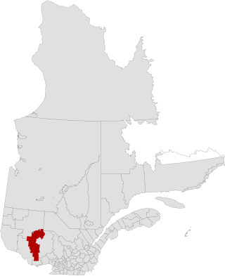
La Vallée-de-la-Gatineau is a regional county municipality in the Outaouais region of western Quebec, Canada. The seat is in Gracefield. It was incorporated on January 1, 1983 and was named for its location straddling the Gatineau River north of Low.

<span class="mw-page-title-main">Fassett, Quebec</span> Municipality in Quebec, Canada

Fassett is a municipality and village in the Papineau Regional County Municipality in Quebec, Canada, located on the north shore of the Ottawa River east of Montebello.

<span class="mw-page-title-main">Montebello, Quebec</span> Municipality in Quebec, Canada

Montebello is a municipality located in the Papineau Regional County Municipality of Western Quebec, Canada. At the 2001 census, there were 1,039 permanent residents. The village has a total area of 7.95 square kilometres (3.07 sq mi), and is located at the eastern edge of Quebec's Outaouais region. It is located on the border with Ontario.

<span class="mw-page-title-main">Papineauville, Quebec</span> Municipality in Quebec, Canada

Papineauville is a town and municipality in the Outaouais region of Quebec, Canada. It is the seat of the Papineau Regional County Municipality. In 2001 its population was 2247.

<span class="mw-page-title-main">Nominingue</span> Municipality in Quebec, Canada

Nominingue is a small village and municipality located 200 kilometres (120 mi) north of Montreal, Quebec, Canada, in the Laurentian Mountains. It was formerly called Lac-Nominingue, but changed name on September 16, 2000.

<span class="mw-page-title-main">Saint-Zotique, Quebec</span> City in Quebec, Canada

Saint-Zotique is a city located within the Vaudreuil-Soulanges Regional County Municipality in the Montérégie region located about 45 minutes west of Montreal, Quebec, Canada. It is named for Saint Zoticus of Comana.

<span class="mw-page-title-main">Rivière-Héva</span> Municipality in Quebec, Canada

Rivière-Héva is a municipality in northwestern Quebec, Canada in the La Vallée-de-l'Or Regional County Municipality. It is named after the Héva River that flows through the municipality.

<span class="mw-page-title-main">Wentworth, Quebec</span> Township municipality in Quebec, Canada

Wentworth is a township municipality in the Laurentides region of Quebec, Canada, part of the Argenteuil Regional County Municipality, north-west of Lachute.

<span class="mw-page-title-main">Montpellier, Quebec</span> Municipality in Quebec, Canada

Montpellier is a town and municipality in the Papineau Regional County Municipality in the Outaouais region of Quebec, Canada. The town is located 30 kilometres (19 mi) northwest of Papineauville.

<span class="mw-page-title-main">Lac-Simon, Outaouais</span> Municipality in Quebec, Canada

Lac-Simon is a town and municipality in the Outaouais region of Quebec, Canada, part of the Papineau Regional County Municipality.

<span class="mw-page-title-main">Chénéville, Quebec</span> Municipality in Quebec, Canada

Chénéville is a town and municipality in the Outaouais region of Quebec, Canada, part of the Papineau Regional County Municipality.

<span class="mw-page-title-main">Namur, Quebec</span> Municipality in Quebec, Canada

Namur is a town and municipality in the Outaouais region of Quebec, Canada, part of the Papineau Regional County Municipality. It is nicknamed "la Nouvelle Belgique".

<span class="mw-page-title-main">Saint-Émile-de-Suffolk, Quebec</span> Municipality in Quebec, Canada

Saint-Émile-de-Suffolk is a municipality in the Outaouais region of Quebec, Canada, part of the Papineau Regional County Municipality. Until 1994 it was known as United Township Municipality of Suffolk-et-Addington.

<span class="mw-page-title-main">Lac-des-Plages, Quebec</span> Municipality in Quebec, Canada

Lac-des-Plages is a town and municipality in the Outaouais region of Quebec, Canada, part of the Papineau Regional County Municipality. It is named after Lac des Plages which attracts many vacationers with the beauty of its beaches.

<span class="mw-page-title-main">La Minerve, Quebec</span> Municipality in Quebec, Canada

La Minerve is a village and municipality in the Laurentides region of Quebec, Canada, part of the Les Laurentides Regional County Municipality.

<span class="mw-page-title-main">Lac-Ernest, Quebec</span> Unorganized territory in Quebec, Canada

Lac-Ernest is an unorganized territory in the Laurentides region of Quebec, Canada. It is almost entirely within the Papineau-Labelle Wildlife Reserve.

<span class="mw-page-title-main">Lac-des-Écorces, Quebec</span> Municipality in Quebec, Canada

Lac-des-Écorces is a municipality and village in the Laurentides region of Quebec, Canada, part of the Antoine-Labelle Regional County Municipality.

<span class="mw-page-title-main">Lac-Saguay</span> Village municipality in Quebec, Canada

Lac-Saguay is a village municipality in Antoine-Labelle Regional County Municipality in the Laurentides region of Quebec, Canada.

<span class="mw-page-title-main">Lac-Ashuapmushuan, Quebec</span> Unorganized territory in Quebec, Canada

Lac-Ashuapmushuan is an unorganized territory in the Canadian province of Quebec, Canada, located in the regional county municipality of Le Domaine-du-Roy. The region had a population of 140 as of the Canada 2021 Census, and covered a land area of 14,684.28 km2. It is home to the Ashuapmushuan Wildlife Reserve.

<span class="mw-page-title-main">Lac-Achouakan, Quebec</span> Unorganized territory in Quebec, Canada

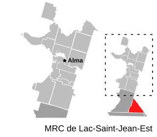
Lac-Achouakan is an unorganized territory in the Canadian province of Quebec, located in the regional county municipality of Lac-Saint-Jean-Est. It had a population of zero in the Canada 2006 Census, and covered a land area of 227.35 km2, entirely within the Laurentides Wildlife Reserve. The western boundary of the territory is Bark River, while Quebec Route 169 forms the eastern boundary.

References

  1. "Reference number 19631 in Banque de noms de lieux du Québec". toponymie.gouv.qc.ca (in French). Commission de toponymie du Québec.
  2. 1 2 "Geographic code 80135 in the official Répertoire des municipalités". www.mamh.gouv.qc.ca (in French). Ministère des Affaires municipales et de l'Habitation.
  3. 1 2 3 "Profile table, Census Profile, 2021 Census of Population - Duhamel, Municipalité (MÉ) [Census subdivision], Quebec". 9 February 2022.
  4. 1 2 "Découvrir Duhamel – Histoire" (in French). Municipalité de Duhamel. Archived from the original on 2008-01-01. Retrieved 2008-11-11.
  5. 1 2 "Duhamel (Municipalité)" (in French). Commission de toponymie du Québec. Archived from the original on 2016-03-03. Retrieved 2008-11-11.
  6. "Preston (Canton)" (in French). Commission de toponymie du Québec. Archived from the original on 2016-03-03. Retrieved 2008-12-02.
  7. "2021 Community Profiles". 2021 Canadian Census . Statistics Canada. February 4, 2022. Retrieved 2023-10-19.
  8. "2016 Community Profiles". 2016 Canadian Census . Statistics Canada. August 12, 2021. Retrieved 2020-01-22.
  9. "2011 Community Profiles". 2011 Canadian Census . Statistics Canada. March 21, 2019. Retrieved 2020-01-22.
  10. "2006 Community Profiles". 2006 Canadian Census . Statistics Canada. August 20, 2019.
  11. "2001 Community Profiles". 2001 Canadian Census . Statistics Canada. July 18, 2021.
  12. "Official Voting Results Raw Data (poll by poll results in block 1630)". Elections Canada. Retrieved March 4, 2023.
  13. "Official Voting Results by polling station (poll by poll results in block 1630)". Elections Québec. Retrieved March 4, 2023.