Argenteuil Regional County Municipality

Last updated

Argenteuil
Quebec MRC Argenteuil location map.svg
Location in province of Quebec.
Coordinates: 45°41′N74°25′W / 45.683°N 74.417°W / 45.683; -74.417 [1]
CountryFlag of Canada (Pantone).svg  Canada
Province Flag of Quebec.svg  Quebec
Region Laurentides
EffectiveJanuary 1, 1983
County seat Lachute
Government
[2]
  Type Prefecture
  PrefectScott Pearce
Area
  Total1,306.60 km2 (504.48 sq mi)
  Land1,252.97 km2 (483.77 sq mi)
Population
 (2016) [3]
  Total32,389
  Density25.8/km2 (67/sq mi)
  Change
2011-2016
Increase2.svg 0.8%
  Dwellings
19,081
Time zone UTC−5 (EST)
  Summer (DST) UTC−4 (EDT)
Area codes 450 and 579
Website www.argenteuil.qc.ca

Argenteuil is a regional county municipality located in the Laurentides region of Quebec, Canada. Its seat is Lachute. [2]

Contents

History

In 1682, Charles-Joseph d'Ailleboust was granted by Louis de Buade de Frontenac, Governor General of New France, a domain of 186 square kilometres (72 sq mi) of land. This fiefdom was bounded by the Ottawa River to the south, a line through the center of the hamlet of Carillon in the west and Clear Lake (Lac Clair) to the north. Since Ailleboust already owned a house in Argenteuil near Paris, he called his domain Argenteuil Seigneury. In 1697, the Lord of Ailleboust and his wife Catherine Le Gardeur sold their seigneury to their son Pierre d'Ailleboust d'Argenteuil. Subsequently over the years, the fiefdom was held by Pierre-Louis Panet, and then by Major Murray. [4]

After the conquest of New France by the British in 1759 during the Seven Years' War, the British implemented their laws, but maintained certain French seigneurial rights. In 1796, Jedediah Lane, from Jericho, Vermont, bought from Major Murray several thousand acres of land on both sides of the North River ( Rivière du Nord ), where Lachute is today. In 1809, Thomas Barron bought the land of the territory that would become the center of the town of Lachute. Five years later, Sir John Johnson, a Loyalist from New York who had resettled in Canada after the American Revolution, bought the rest of the Argenteuil Seigneury. He built a sawmill and gave land for churches, helping to attract new settlers to Argenteuil. [4]

In 1854, the Parliament of the Province of Canada abolished the seigneurial system, and the County of Argenteuil was created the following year. [4] In January 1983, the Argenteuil Regional County Municipality succeeded the County of Argenteuil. [5]

Subdivisions

There are 9 subdivisions within the RCM: [2]

Demographics

Population

Canada census – Argenteuil community profile
2021 2016 2011
Population34,752 (+7.3% from 2016)32,389 (+0.8% from 2011)32,117 (+7.1% from 2006)
Land area1,234.69 km2 (476.72 sq mi)1,252.97 km2 (483.77 sq mi)1,251.64 km2 (483.26 sq mi)
Population density28.1/km2 (73/sq mi)25.8/km2 (67/sq mi)25.7/km2 (67/sq mi)
Median age51.2 (M: 50.8, F: 52.0)49.6 (M: 49.0, F: 50.1)46.9 (M: 46.4, F: 47.4)
Private dwellings19,600 (total)  16,223 (occupied)19,081 (total) 18,352 (total) 
Median household income$62,800$50,415$44,453
References: 2021 [6] 2016 [7] 2011 [8] earlier [9] [10]
Historical Census Data - Argenteuil Regional County Municipality, Quebec
YearPop.±%
1991 27,232    
1996 28,505+4.7%
1996A 28,568+0.2%
2001 28,931+1.3%
YearPop.±%
2006 29,922+3.4%
2011 32,117+7.3%
2016 32,389+0.8%
[11] [12] [3]
(A) adjusted to reflect boundary changes.

Language

Canada Census Mother Tongue - Argenteuil Regional County Municipality, Quebec [11] [12] [3]
CensusTotal
French
English
French & English
Other
YearResponsesCountTrendPop %CountTrendPop %CountTrendPop %CountTrendPop %
2016
31,905
26,010Increase2.svg 1.4%81.5%4,820Decrease2.svg 4.1%15.1%425Increase2.svg 1.1%1.3%650Increase2.svg 16.1%2.0%
2011
31,655
25,650Increase2.svg 9.7%81.03%5,025Decrease2.svg 2.0%15.87%420Increase2.svg 27.3%1.33%560Decrease2.svg 10.4%1.77%
2006
29,460
23,375Increase2.svg 5.6%79.35%5,130Decrease2.svg 2.4%17.41%330Decrease2.svg 10.8%1.12%625Increase2.svg 31.6%2.12%
2001
28,230
22,130Increase2.svg 2.8%78.39%5,255Decrease2.svg 10.8%18.62%370Increase2.svg 42.3%1.31%475Increase2.svg 3.3%1.68%
1996
28,135
21,525n/a76.51%5,890n/a20.93%260n/a0.92%460n/a1.64%

Transportation

Access Routes

Highways and numbered routes that run through the municipality, including external routes that start or finish at the county border: [13]

Attractions

See also

Related Research Articles

<span class="mw-page-title-main">Pointe-Fortune, Quebec</span> Municipality in Quebec, Canada

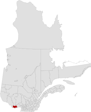
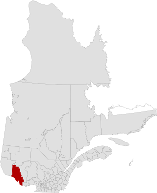
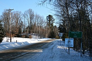
Pointe-Fortune is a municipality in southwestern Quebec, Canada, on the Ottawa River in Vaudreuil-Soulanges Regional County Municipality, northwest of Montreal. The population at the 2021 Census was 582.

<span class="mw-page-title-main">Deux-Montagnes Regional County Municipality</span> Regional county municipality in Quebec, Canada

Deux-Montagnes is a regional county municipality in the Laurentides region of Quebec, Canada. It is located immediately north of Laval on the north shore of the Rivière des Mille-Îles and on the north shore of the Lake of Two Mountains. Its seat and largest city is Saint-Eustache.

<span class="mw-page-title-main">Kamouraska Regional County Municipality</span> Regional county municipality in Quebec, Canada

Kamouraska is a regional county municipality in eastern Quebec, Canada. The regional county municipality seat is Saint-Pascal, but the largest town is La Pocatière.

<span class="mw-page-title-main">Pierre-De Saurel Regional County Municipality</span> Regional county municipality in Quebec, Canada

Pierre-De Saurel is a regional county municipality in the Montérégie region in southwestern Quebec, Canada. Originally named Le Bas-Richelieu Regional County Municipality, the name change to Pierre-De Saurel took effect on January 1, 2009. Its seat is in Sorel-Tracy. It is located on the Richelieu River, downstream from La Vallée-du-Richelieu Regional County Municipality at the confluence of the Richelieu and Saint Lawrence River.

<span class="mw-page-title-main">Les Collines-de-l'Outaouais Regional County Municipality</span> Regional county municipality in Quebec, Canada

Les Collines-de-l'Outaouais is a regional county municipality in the Outaouais region of western Quebec, Canada. The region nearly encircles the City of Gatineau, which is to the south. Its administrative seat is in Chelsea, Quebec.

<span class="mw-page-title-main">Les Jardins-de-Napierville Regional County Municipality</span> Regional county municipality in Quebec, Canada

Les Jardins-de-Napierville(English: The Gardens of Napierville) is a regional county municipality (French: Municipalité régionale de comté ) in southwestern Quebec, Canada in the Montérégie region. Founded on January 1, 1982. Its seat is Napierville.

<span class="mw-page-title-main">Matawinie Regional County Municipality</span> Regional county municipality in Quebec, Canada

Matawinie is a regional county municipality in the region of Lanaudière in southwestern Quebec, Canada. Its seat is Rawdon. The population according to the 2021 Canadian Census was 55,500.

<span class="mw-page-title-main">Pontiac Regional County Municipality</span> Regional county municipality in Quebec, Canada

Pontiac is a regional county municipality in the Outaouais region of Quebec, Canada. Campbell's Bay is the county seat. It should not be confused with the municipality of Pontiac, which is located in the neighbouring Les Collines-de-l'Outaouais Regional County Municipality. For the electoral district see Pontiac.

<span class="mw-page-title-main">Témiscouata Regional County Municipality</span> Regional county municipality in Quebec, Canada

Témiscouata is a regional county municipality in the Bas-Saint-Laurent region of Quebec, Canada. It is located southeast of Rivière-du-Loup, bordering New Brunswick, and is centred on Lake Témiscouata. Its seat is Témiscouata-sur-le-Lac.

<span class="mw-page-title-main">Lachute</span> City in Quebec, Canada

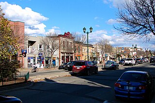
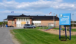
Lachute is a town in southwest Quebec, Canada, 62 km (39 mi) northwest of Montreal, on the Rivière du Nord, a tributary of the Ottawa River, and west of Mirabel International Airport. It is located on Autoroute 50, at the junctions of Quebec Provincial Highways Route 148, Route 158, and Secondary Highways 327 and 329.

<span class="mw-page-title-main">Saint-Apollinaire, Quebec</span> Municipality in Quebec, Canada

Saint-Apollinaire is a municipality in the Municipalité régionale de comté de Lotbinière in Quebec, Canada. It is part of the Chaudière-Appalaches region and the population is 7,968 as of 2021. It is named after Saint Apollinaris.

<span class="mw-page-title-main">Grenville, Quebec</span> Village municipality in Quebec, Canada

Grenville is a village municipality in the Argenteuil Regional County Municipality of the Laurentides region of Quebec, Canada. It is located opposite Hawkesbury, Ontario, on the Ottawa River.

<span class="mw-page-title-main">Gore, Quebec</span> Township municipality in Quebec, Canada

Gore is a township municipality in the Canadian province of Quebec, located within the Argenteuil Regional County Municipality. Its main community is Lakefield.

<span class="mw-page-title-main">Harrington, Quebec</span> Township municipality in Quebec, Canada

Harrington is a township municipality in the Laurentides region of Quebec, Canada, part of the Argenteuil Regional County Municipality. It is located in the Laurentian Mountains, about 40 kilometres (25 mi) north-west of Lachute.

<span class="mw-page-title-main">Wentworth, Quebec</span> Township municipality in Quebec, Canada

Wentworth is a township municipality in the Laurentides region of Quebec, Canada, part of the Argenteuil Regional County Municipality, north-west of Lachute.

<span class="mw-page-title-main">Saint-André-d'Argenteuil</span> Municipality in Quebec, Canada

Saint-André-d'Argenteuil is a municipality in the Laurentides region of Quebec, Canada, part of the Argenteuil Regional County Municipality. It is located along the Ottawa River, just south of Lachute.

<span class="mw-page-title-main">Mille-Isles</span> Municipality in Quebec, Canada

Mille-Isles is a municipality in the Laurentides region of Quebec, Canada, part of the Argenteuil Regional County Municipality, west of Saint-Jérôme.

<span class="mw-page-title-main">Wentworth-Nord</span> Municipality in Quebec, Canada

Wentworth-Nord is a municipality in the Laurentides region of Quebec, Canada, part of the Les Pays-d'en-Haut Regional County Municipality.

<span class="mw-page-title-main">Sainte-Mélanie, Quebec</span> Municipality in Quebec, Canada

Sainte-Mélanie is a municipality in the Lanaudière region of Quebec, Canada, part of the Joliette Regional County Municipality. It is located along the western shores of the L'Assomption River.

<span class="mw-page-title-main">Sainte-Béatrix, Quebec</span> Municipality in Quebec, Canada

Sainte-Béatrix is a municipality in the Lanaudière region of Quebec, Canada, part of the Matawinie Regional County Municipality.

References

  1. "Reference number 141122 in Banque de noms de lieux du Québec". toponymie.gouv.qc.ca (in French). Commission de toponymie du Québec.
  2. 1 2 3 4 "Geographic code 760 in the official Répertoire des municipalités". www.mamh.gouv.qc.ca (in French). Ministère des Affaires municipales et de l'Habitation.
  3. 1 2 3 4 "Census Profile, 2016 Census: Argenteuil, Municipalité régionale de comté [Census division], Quebec". Statistics Canada. Retrieved November 27, 2019.
  4. 1 2 3 "Lachute, d'hier à aujourd'hui" (in French). La ville de Lachute. Archived from the original on 2009-01-08. Retrieved 2009-02-17.
  5. "Argenteuil (Municipalité régionale de comté)" (in French). Commission de toponymie du Québec. Archived from the original on 2016-03-03. Retrieved 2009-02-20.
  6. "2021 Community Profiles". 2021 Canadian Census . Statistics Canada. February 4, 2022. Retrieved 2023-10-19.
  7. "2016 Community Profiles". 2016 Canadian Census . Statistics Canada. August 12, 2021. Retrieved 2019-11-27.
  8. "2011 Community Profiles". 2011 Canadian Census . Statistics Canada. March 21, 2019. Retrieved 2014-03-02.
  9. "2006 Community Profiles". 2006 Canadian Census . Statistics Canada. August 20, 2019.
  10. "2001 Community Profiles". 2001 Canadian Census . Statistics Canada. July 18, 2021.
  11. 1 2 Statistics Canada: 1996, 2001, 2006, 2011 census
  12. 1 2 "Argenteuil Regional County Municipality (Code 2476) Census Profile". 2011 census . Government of Canada - Statistics Canada.
  13. Official Transport Quebec Road Map
  14. "Carillon Barracks (Casernes de Carillon)". Directory of Federal Heritage Designations. Parks Canada. Retrieved November 27, 2019.