Wentworth, Quebec

Last updated

Wentworth
Wentworth QC.JPG
Town entrance
Wentworth Quebec location diagram.png
Location within Argenteuil RCM
Canada Central Quebec location map.png
Red pog.svg
Wentworth
Location in central Quebec
Coordinates: 45°48′N74°22′W / 45.8°N 74.37°W / 45.8; -74.37 [1]
Country Canada
Province Quebec
Region Laurentides
RCM Argenteuil
Settled1830s
ConstitutedJuly 1, 1855
Government
[2]
  MayorJason Morrison
   Federal riding Argenteuil—Papineau—Mirabel
   Prov. riding Argenteuil
Area
  Total95.26 km2 (36.78 sq mi)
  Land85.03 km2 (32.83 sq mi)
Population
 (2021) [3]
  Total682
  Density8.0/km2 (21/sq mi)
  Pop (2016-21)
Increase2.svg 28.0%
  Dwellings
802
Time zone UTC−5 (EST)
  Summer (DST) UTC−4 (EDT)
Postal code(s)
Area code(s) 450 and 579
HighwaysNo major routes
Website www.wentworth.ca OOjs UI icon edit-ltr-progressive.svg

Wentworth is a township municipality in the Laurentides region of Quebec, Canada, part of the Argenteuil Regional County Municipality, north-west of Lachute.

Contents

Its population centres are Louisa and Dunany.

Geography

Louisa Wentworth Louisa QC.JPG
Louisa

The township is in the foothills of the Laurentian Mountains, not exceeding 487 metres (1,598 ft) above sea level, with a rocky, sandy, gravelly soil that is not conducive to agriculture. However, much of the land was cleared by early Irish settlers for farming and there remains small pockets of pastures along the Dalesville River, especially in the Glen and around the town centre. It is dotted with many lakes, such as Curran, Black, McDougall, Rainbow, and most notably Lake Louisa - the largest lake in the Regional County. These lakes attract many cottage vacationers and fishing enthusiasts. [4] [5]

The headwater of the Dalesville River, the largest river in Wentworth, begins at the outlet of Barrows Lake on the western edge of the municipality and meanders for approximately 12 km through the municipality.

History

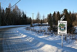
The Gale and Duberger map of 1795 already shows the Wentworth Township, but it was not officially established until 1809. [4] It is unclear if it is named after a village in York County, England, or that it is a tribute to Sir John Wentworth (1737-1820), Lieutenant Governor of Nova Scotia from 1792 to 1808. [5]

Around 1830, a group of settlers composed of Irish and French Canadians, began clearing the rough land with difficulty. In 1845, the Gore Municipality was established, which included the Gore and Wentworth Townships, but it was abolished two years later. In 1855, the Wentworth Township Municipality was formed. [5]

In 1914, a small portion of the Wentworth and Montcalm Townships separated and formed the Municipality of Lac-des-Seize-Îles, [6] and in 1958, Wentworth lost a large chunk of its territory when the Municipality of Wentworth-Nord separated. [7]

Demographics

In the 2021 Census of Population conducted by Statistics Canada, Wentworth had a population of 682 living in 378 of its 802 total private dwellings, a change of 28% from its 2016 population of 533. With a land area of 85.03 km2 (32.83 sq mi), it had a population density of 8.0/km2 (20.8/sq mi) in 2021. [3]

Canada census – Wentworth, Quebec community profile
2021 2016 2011
Population682 (+28.0% from 2016)533 (6.2% from 2011)502 (3.9% from 2006)
Land area85.03 km2 (32.83 sq mi)87.69 km2 (33.86 sq mi)87.16 km2 (33.65 sq mi)
Population density8.0/km2 (21/sq mi)6.1/km2 (16/sq mi)5.8/km2 (15/sq mi)
Median age59.6 (M: 60.4, F: 59.2)56.9 (M: 57.4, F: 56.2)53.5 (M: 53.9, F: 53.2)
Private dwellings802 (total)  378 (occupied)788 (total)  266 (occupied)754 (total) 
Median household income$73,500$66,816$n/a
References: 2021 [8] 2016 [9] 2011 [10] earlier [11] [12]
Historical census populations – Wentworth, Quebec
YearPop.±%
1921 953    
1931 986+3.5%
1941 469−52.4%
1951 727+55.0%
1956 432−40.6%
1961 72−83.3%
YearPop.±%
1966 102+41.7%
1971 146+43.1%
1976 204+39.7%
1981 225+10.3%
1986 273+21.3%
1991 329+20.5%
YearPop.±%
1996 379+15.2%
2001 434+14.5%
2006 483+11.3%
2011 502+3.9%
2016 533+6.2%
2021 682+28.0%
Source: Statistics Canada

Mother tongue (2021): [3]

Local government

Wentworth forms part of the federal electoral district of Argenteuil—La Petite-Nation and has been represented by Stéphane Lauzon of the Liberal Party since 2015. Provincially, Wentworth is part of the Argenteuil electoral district and is represented by Agnès Grondin of the Coalition Avenir Québec since 2018.

Wentworth federal election results [13]
Year Liberal Conservative Bloc Québécois New Democratic Green
2021 45%21714%6528%1349%440%0
2019 41%17315%6327%1158%357%30
Wentworth provincial election results [14]
Year CAQ Liberal QC solidaire Parti Québécois
2018 23%7647%1565%1713%45
2014 5%1971%2601%521%77

List of former mayors:

Education

The Commission scolaire de la Rivière-du-Nord operates French-language public schools. [15]

The Sir Wilfrid Laurier School Board operates English-language public schools:

See also

Related Research Articles

<span class="mw-page-title-main">Argenteuil Regional County Municipality</span> Regional county municipality in Quebec, Canada

Argenteuil is a regional county municipality located in the Laurentides region of Quebec, Canada. Its seat is Lachute.

<span class="mw-page-title-main">Lachute</span> City in Quebec, Canada

Lachute is a town in southwest Quebec, Canada, 62 km (39 mi) northwest of Montreal, on the Rivière du Nord, a tributary of the Ottawa River, and west of Mirabel International Airport. It is located on Autoroute 50, at the junctions of Quebec Provincial Highways Route 148, Route 158, and Secondary Highways 327 and 329.

<span class="mw-page-title-main">Morin-Heights</span> Municipality in Quebec, Canada

Morin-Heights is a town in the Laurentian Mountains region of Quebec, Canada. It is west of Saint-Sauveur and north of Lachute; municipally, it is within the Regional County Municipality of Les Pays-d'en-Haut.

<span class="mw-page-title-main">Brownsburg-Chatham</span> City in Quebec, Canada

Brownsburg-Chatham is a municipality in the Laurentides region of Quebec, Canada, part of the Argenteuil Regional County Municipality.

<span class="mw-page-title-main">Prévost, Quebec</span> City in Quebec, Canada

Prévost is a town within the La Rivière-du-Nord Regional County Municipality, Quebec, Canada, and the administrative region of Laurentides in the Laurentian Mountains, north of Montreal. It was created in 1973 from the amalgamation of the former villages of Shawbridge and Lesage with old Prévost on the other side of the Rivière du Nord. Shawbridge was named after William Shaw (1805-1894) who settled in the township of Abercromby in 1847 and built the first bridge over the Rivière du Nord.

<span class="mw-page-title-main">Grenville-sur-la-Rouge</span> Municipality in Quebec, Canada

Grenville-sur-la-Rouge is a municipality in the Argenteuil Regional County Municipality in the Laurentides region of Quebec, Canada. It is a predominantly Francophone community situated along the southern border of Quebec between Montreal and Ottawa.

<span class="mw-page-title-main">Grenville, Quebec</span> Village municipality in Quebec, Canada

Grenville is a village municipality in the Argenteuil Regional County Municipality of the Laurentides region of Quebec, Canada. It is located opposite Hawkesbury, Ontario, on the Ottawa River.

<span class="mw-page-title-main">Gore, Quebec</span> Township municipality in Quebec, Canada

Gore is a township municipality in the Canadian province of Quebec, located within the Argenteuil Regional County Municipality. Its main community is Lakefield.

<span class="mw-page-title-main">Harrington, Quebec</span> Township municipality in Quebec, Canada

Harrington is a township municipality in the Laurentides region of Quebec, Canada, part of the Argenteuil Regional County Municipality. It is located in the Laurentian Mountains, about 40 kilometres (25 mi) north-west of Lachute.

<span class="mw-page-title-main">Montcalm, Quebec</span> Municipality in Quebec, Canada

Montcalm is a municipality in the Les Laurentides Regional County Municipality of Quebec southeast of Mont-Tremblant. The main population centre in Montcalm is the village of Weir.

<span class="mw-page-title-main">Chénéville, Quebec</span> Municipality in Quebec, Canada

Chénéville is a town and municipality in the Outaouais region of Quebec, Canada, part of the Papineau Regional County Municipality.

<span class="mw-page-title-main">Notre-Dame-de-la-Paix, Quebec</span> Municipality in Quebec, Canada

Notre-Dame-de-la-Paix is a town and municipality in the Outaouais region of Quebec, Canada, part of the Papineau Regional County Municipality.

<span class="mw-page-title-main">Namur, Quebec</span> Municipality in Quebec, Canada

Namur is a town and municipality in the Outaouais region of Quebec, Canada, part of the Papineau Regional County Municipality. It is nicknamed "la Nouvelle Belgique".

<span class="mw-page-title-main">Saint-Émile-de-Suffolk, Quebec</span> Municipality in Quebec, Canada

Saint-Émile-de-Suffolk is a municipality in the Outaouais region of Quebec, Canada, part of the Papineau Regional County Municipality. Until 1994 it was known as United Township Municipality of Suffolk-et-Addington.

<span class="mw-page-title-main">Boileau, Quebec</span> Municipality in Quebec, Canada

Boileau is a village and municipality in the Outaouais region of Quebec, Canada, part of the Papineau Regional County Municipality. The municipality was known as Ponsonby until 1993.

<span class="mw-page-title-main">Saint-Colomban, Quebec</span> City in Quebec, Canada

Saint-Colomban is a city in the regional county municipality of La Rivière-du-Nord in Québec, Canada. It is situated in the Laurentides region of Québec and was named in honour of Saint Columbanus.

<span class="mw-page-title-main">Saint-André-d'Argenteuil</span> Municipality in Quebec, Canada

Saint-André-d'Argenteuil is a municipality in the Laurentides region of Quebec, Canada, part of the Argenteuil Regional County Municipality. It is located along the Ottawa River, just south of Lachute.

<span class="mw-page-title-main">Mille-Isles</span> Municipality in Quebec, Canada

Mille-Isles is a municipality in the Laurentides region of Quebec, Canada, part of the Argenteuil Regional County Municipality, west of Saint-Jérôme.

<span class="mw-page-title-main">Wentworth-Nord</span> Municipality in Quebec, Canada

Wentworth-Nord is a municipality in the Laurentides region of Quebec, Canada, part of the Les Pays-d'en-Haut Regional County Municipality.

<span class="mw-page-title-main">Lac-des-Seize-Îles</span> Municipality in Quebec, Canada

Lac-des-Seize-Îles is a village and municipality in the Laurentides region of Quebec, Canada, part of the Les Pays-d'en-Haut Regional County Municipality. The municipality surrounds and is named after Sixteen Island Lake with the village situated at the northern end of this lake.

References

  1. "Banque de noms de lieux du Québec: Reference number 66892". toponymie.gouv.qc.ca (in French). Commission de toponymie du Québec.
  2. 1 2 "Répertoire des municipalités: Wentworth". www.mamh.gouv.qc.ca (in French). Ministère des Affaires municipales et de l'Habitation. Retrieved 17 May 2022.
  3. 1 2 3 4 "Profile table, Census Profile, 2021 Census of Population - Wentworth, Canton (Municipalité de) (CT) [Census subdivision], Quebec". www12.statcan.gc.ca. Government of Canada - Statistics Canada. 9 February 2022.
  4. 1 2 "Wentworth (canton)" (in French). Commission de toponymie du Québec. Retrieved 2009-03-09.
  5. 1 2 3 "Wentworth (Municipalité de canton)" (in French). Commission de toponymie du Québec. Retrieved 2009-03-09.
  6. "Lac-des-Seize-Îles (Municipalité)" (in French). Commission de toponymie du Québec. Retrieved 2009-03-13.
  7. "Wentworth-Nord (Municipalité)" (in French). Commission de toponymie du Québec. Retrieved 2009-03-09.
  8. "2021 Community Profiles". 2021 Canadian Census . Statistics Canada. February 4, 2022. Retrieved 2022-08-23.
  9. "2016 Community Profiles". 2016 Canadian Census . Statistics Canada. August 12, 2021. Retrieved 2020-01-15.
  10. "2011 Community Profiles". 2011 Canadian Census . Statistics Canada. March 21, 2019. Retrieved 2020-01-15.
  11. "2006 Community Profiles". 2006 Canadian Census . Statistics Canada. August 20, 2019.
  12. "2001 Community Profiles". 2001 Canadian Census . Statistics Canada. July 18, 2021.
  13. "Official Voting Results Raw Data (poll by poll results in block 4282)". Elections Canada. Retrieved March 6, 2023.
  14. "Official Voting Results by polling station (poll by poll results in block 4282)". Elections Québec. Retrieved March 4, 2023.
  15. "Trouver une école ou un centre." Commission scolaire de la Rivière-du-Nord. Retrieved on September 24, 2017. For attendance boundary information, click "Par bassin d'école"
  16. "LAURENTIAN ELEMENTARY ZONE." Sir Wilfrid Laurier School Board. Retrieved on September 16, 2017.
  17. "LAURENTIAN REGIONAL HS ZONE." Sir Wilfrid Laurier School Board. Retrieved on September 4, 2017.