Brownsburg-Chatham

Last updated

Brownsburg-Chatham
Chatham Twp QC.JPG
Brownsburg-Chatham Quebec location diagram.png
Location within Argenteuil RCM
Canada Central Quebec location map.png
Red pog.svg
Brownsburg-Chatham
Location in central Quebec
Coordinates: 45°41′N74°25′W / 45.683°N 74.417°W / 45.683; -74.417 [1]
Country Canada
Province Quebec
Region Laurentides
RCM Argenteuil
SettledEarly 1800s
ConstitutedOctober 6, 1999
Government
[2]
  MayorKévin Maurice
   Federal riding Argenteuil—La Petite-Nation
   Prov. riding Argenteuil
Area
  Total254.72 km2 (98.35 sq mi)
  Land244.46 km2 (94.39 sq mi)
Population
 (2021) [3]
  Total7,247
  Density29.6/km2 (77/sq mi)
  Pop 2016-2021
Increase2.svg 1.8%
  Dwellings
3,783
Time zone UTC−5 (EST)
  Summer (DST) UTC−4 (EDT)
Postal code(s)
J8G
Area code(s) 450 and 579
Highways
Quebec Autoroute 50.svg A-50

Qc148.svg R-148
Qc327.svg R-327
Qc344.svg R-344
Website www.brownsburgchatham.ca OOjs UI icon edit-ltr-progressive.svg

Brownsburg-Chatham is a municipality in the Laurentides region of Quebec, Canada, part of the Argenteuil Regional County Municipality.

Contents

Economic activities include agriculture, tourism and the manufacture of explosives. It is the hometown of late Montreal Canadiens defenceman Gilles Lupien.

Geography

Brownsburg-Chatham is located along the Ottawa River, just west of Lachute, and includes the communities of Brownsburg, Cushing, Dalesville, Greece's Point, Pine Hill, and Saint-Philippe.

History

Chatham Township was established in 1799, and named after English Statesman William Pitt, 1st Earl of Chatham (1708–1778). Mostly populated by rich American Loyalists, its post office opened in 1829 and the township municipality was formed in 1845. By the mid-19th century, there were a few hamlets including Dalesville, Brownsbury, and Starneville. [1]

In 1818, Major George Brown, born in England, was granted by the government land on the West River (Rivière de l'Ouest). Together with pioneers Daniel Smith and Captain A. L. Howard, he was able to breathe life into the local industry during the 1820s. George Brown built, among other achievements, a sawmill and gristmill which contributed to the economic growth of the region and led to the formation of Brownsburg village which was named after him. In 1854, the Brownsburg Post Office opened. Later in the third quarter of the 19th century, a major arms factory run by the Dominion Cartridge Company was the major local industry. [1]

In 1935, the Village Municipality of Brownsburg was officially established by separating from the Township Municipality of Chatham. [1]

On October 6, 1999, Brownsburg was rejoined with Chatham and the new Municipality of Brownsburg-Chatham was formed. On July 6, 2002, the municipality changed its statutes and became the Town of Brownsburg-Chatham. [1]

Demographics

Historical Census Data - Brownsburg-Chatham, Quebec
YearPop.±%
1976 6,516    
1981 6,406−1.7%
1986 6,266−2.2%
1991 6,062−3.3%
1996 6,683+10.2%
2001 6,770+1.3%
2006 6,664−1.6%
2011 7,209+8.2%
2016 7,122−1.2%
2021 7,247+1.8%
Population amounts prior to 1999 are total of Brownsburg (Village) and Chatham (Township).
Source: Statistics Canada [4]

In the 2021 Census of Population conducted by Statistics Canada, Brownsburg-Chatham had a population of 7,247 living in 3,282 of its 3,783 total private dwellings, a change of 1.8% from its 2016 population of 7,122. With a land area of 244.46 km2 (94.39 sq mi), it had a population density of 29.6/km2 (76.8/sq mi) in 2021. [5]

Canada census – Brownsburg-Chatham community profile
2021 2016 2011
Population7,247 (+1.8% from 2016)7,122 (-1.2% from 2011)7209 (+8.2% from 2006)
Land area244.46 km2 (94.39 sq mi)247.40 km2 (95.52 sq mi)248.38 km2 (95.90 sq mi)
Population density29.6/km2 (77/sq mi)28.8/km2 (75/sq mi)29.0/km2 (75/sq mi)
Median age48.4 (M: 48.4, F: 48.8)46.7 (M: 46.6, F: 46.9)44.1 (M: 44.3, F: 43.9)
Private dwellings3,783 (total)  3,282 (occupied)3,726 (total) 3,651 (total) 
Median household income$66,000$54,955$44,790
References: 2021 [6] 2016 [7] 2011 [8] earlier [9] [10]
Canada Census Mother Tongue - Brownsburg-Chatham, Quebec [4]
CensusTotal
French
English
French & English
Other
YearResponsesCountTrendPop %CountTrendPop %CountTrendPop %CountTrendPop %
2011
7,130
5,735Increase2.svg 7.9%80.43%1,145Increase2.svg 7.9%16.06%105Increase2.svg 47.6%1.47%145Decrease2.svg 40.0%2.03%
2006
6,620
5,280Decrease2.svg 0.8%79.76%1,055Decrease2.svg 4.5%15.94%55Decrease2.svg 59.3%0.83%230Increase2.svg 58.7%3.47%
2001
6,655
5,320Increase2.svg 1.7%79.94%1,105Decrease2.svg 6.8%16.60%135Increase2.svg 29.6%2.03%95Steady2.svg 0.0%1.43%
1996
6,605
5,230n/a79.18%1,185n/a17.94%95n/a1.44%95n/a1.44%

Local government

The city council meetings are available online since February 2, 2016.

List of former mayors:

Education

The Centre de services scolaire de la Rivière-du-Nord operates French-language public schools.

The Sir Wilfrid Laurier School Board operates English-language public schools:

See also

Related Research Articles

<span class="mw-page-title-main">Saint-Eustache, Quebec</span> City in Quebec, Canada

Saint-Eustache is an off-island suburb of Montreal, in western Quebec, Canada, west of Montreal on the north shore of the Rivière des Mille Îles. It is located 35 km (22 mi) northwest of Montreal.

<span class="mw-page-title-main">Mirabel, Quebec</span> City in Quebec, Canada

Mirabel is a suburb of Montreal, located on the North Shore in southern Quebec.

<span class="mw-page-title-main">Sainte-Anne-des-Plaines</span> City in Quebec, Canada

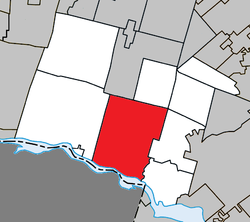
Sainte-Anne-des-Plaines is a city in southwestern Quebec, Canada, 40 km northwest of the city of Montreal in the Thérèse-De Blainville Regional County Municipality, in the region of Laurentides. Its population was 14,990 during the census of 2014.

<span class="mw-page-title-main">Rosemère</span> City in Quebec, Canada

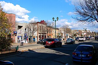
Rosemère is an affluent suburb of Montreal, in southwestern Quebec, Canada on the north shore of the Rivière des Mille Îles in the Thérèse-De Blainville Regional County Municipality. The town is noted for its green look, due to the high density of trees. Some wooded areas in the town have been left intact as the town has grown around them. Homes are mostly upscale, varying from renovated cottages to unique character homes. It is almost entirely residential, with no significant industries. Boulevard Curé-Labelle, the town's main commercial artery, is lined up by suburban shops and shopping malls, the largest of which is Place Rosemère.

<span class="mw-page-title-main">Lachute</span> City in Quebec, Canada

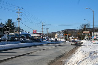
Lachute is a town in southwest Quebec, Canada, 62 km (39 mi) northwest of Montreal, on the Rivière du Nord, a tributary of the Ottawa River, and west of Mirabel International Airport. It is located on Autoroute 50, at the junctions of Quebec Provincial Highways Route 148, Route 158, and Secondary Highways 327 and 329.

<span class="mw-page-title-main">Lorraine, Quebec</span> City in Quebec, Canada

Lorraine is an affluent off-island suburb of Montreal, in southwestern Quebec, Canada on the north shore of the Rivière des Mille-Îles in the Thérèse-De Blainville Regional County Municipality. There are no industries and only a very limited commercial district ; almost all houses are of the detached type. Furthermore, a large portion of the town territory is set aside as wild forest ; some bike/ski trails run through it. The town is divided into two areas, Uptown and Downtown. These two areas are also delimited by Quebec freeway A-640, and are only joined together by the main street overpass.

<span class="mw-page-title-main">Prévost, Quebec</span> City in Quebec, Canada

Prévost is a town within the La Rivière-du-Nord Regional County Municipality, Quebec, Canada, and the administrative region of Laurentides in the Laurentian Mountains, north of Montreal. It was created in 1973 from the amalgamation of the former villages of Shawbridge and Lesage with old Prévost on the other side of the Rivière du Nord. Shawbridge was named after William Shaw (1805-1894) who settled in the township of Abercromby in 1847 and built the first bridge over the Rivière du Nord.

<span class="mw-page-title-main">Saint-Hippolyte, Quebec</span> Municipality in Quebec, Canada

Saint-Hippolyte is a municipality within La Rivière-du-Nord Regional County Municipality in the Laurentides region of Quebec, Canada, in the Laurentian mountains about 45 km north of Montreal. The name comes from Saint Hippolytus.

<span class="mw-page-title-main">Grenville-sur-la-Rouge</span> Municipality in Quebec, Canada

Grenville-sur-la-Rouge is a municipality in the Argenteuil Regional County Municipality in the Laurentides region of Quebec, Canada. It is a predominantly Francophone community situated along the southern border of Quebec between Montreal and Ottawa.

<span class="mw-page-title-main">Lavaltrie</span> City in Quebec, Canada

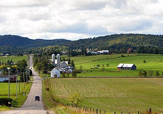
Lavaltrie is a city located within the D'Autray Regional County Municipality in the southern part of the region of Lanaudière, Quebec, Canada, northeast of Montreal outside the suburban sprawl of the North Shore. The population was 13,267 as of the Canada 2011 Census within a land surface area of about 70 square kilometres, with the majority of the territory being used for agricultural activities..

<span class="mw-page-title-main">Grenville, Quebec</span> Village municipality in Quebec, Canada

Grenville is a village municipality in the Argenteuil Regional County Municipality of the Laurentides region of Quebec, Canada. It is located opposite Hawkesbury, Ontario, on the Ottawa River.

<span class="mw-page-title-main">Gore, Quebec</span> Township municipality in Quebec, Canada

Gore is a township municipality in the Canadian province of Quebec, located within the Argenteuil Regional County Municipality. Its main community is Lakefield.

<span class="mw-page-title-main">Harrington, Quebec</span> Township municipality in Quebec, Canada

Harrington is a township municipality in the Laurentides region of Quebec, Canada, part of the Argenteuil Regional County Municipality. It is located in the Laurentian Mountains, about 40 kilometres (25 mi) north-west of Lachute.

<span class="mw-page-title-main">Wentworth, Quebec</span> Township municipality in Quebec, Canada

Wentworth is a township municipality in the Laurentides region of Quebec, Canada, part of the Argenteuil Regional County Municipality, north-west of Lachute.

<span class="mw-page-title-main">Saint-Colomban, Quebec</span> City in Quebec, Canada

Saint-Colomban is a city in the regional county municipality of La Rivière-du-Nord in Québec, Canada. It is situated in the Laurentides region of Québec and was named in honour of Saint Columbanus.

<span class="mw-page-title-main">Saint-André-d'Argenteuil</span> Municipality in Quebec, Canada

Saint-André-d'Argenteuil is a municipality in the Laurentides region of Quebec, Canada, part of the Argenteuil Regional County Municipality. It is located along the Ottawa River, just south of Lachute.

<span class="mw-page-title-main">Mille-Isles</span> Municipality in Quebec, Canada

Mille-Isles is a municipality in the Laurentides region of Quebec, Canada, part of the Argenteuil Regional County Municipality, west of Saint-Jérôme.

<span class="mw-page-title-main">Wentworth-Nord</span> Municipality in Quebec, Canada

Wentworth-Nord is a municipality in the Laurentides region of Quebec, Canada, part of the Les Pays-d'en-Haut Regional County Municipality.

<span class="mw-page-title-main">Sainte-Sophie</span> Municipality in Quebec, Canada

Sainte-Sophie is a municipality in the Laurentides region of Quebec, Canada, part of the La Rivière-du-Nord Regional County Municipality.

The Commission scolaire de la Rivière-du-Nord (CSRDN) was a francophone school district in the Canadian province of Quebec. Its headquarters are in Saint-Jérôme.

References

  1. 1 2 3 4 5 "Brownsburg-Chatham (Ville)" (in French). Commission de toponymie du Québec. Retrieved 2010-06-09.
  2. 1 2 "Geographic code 76043 in the official Répertoire des municipalités". www.mamh.gouv.qc.ca (in French). Ministère des Affaires municipales et de l'Habitation.
  3. 1 2 "Brownsburg-Chatham, Ville (V) Census Profile, 2021 Census of Population". www12.statcan.gc.ca. Government of Canada - Statistics Canada. Retrieved 17 May 2022.
  4. 1 2 1996, 2001, 2006, 2011 census
  5. "Population and dwelling counts: Canada, provinces and territories, and census subdivisions (municipalities), Quebec". Statistics Canada. February 9, 2022. Retrieved August 29, 2022.
  6. "2021 Community Profiles". 2021 Canadian Census . Statistics Canada. February 4, 2022. Retrieved 2023-10-19.
  7. "2016 Community Profiles". 2016 Canadian Census . Statistics Canada. August 12, 2021. Retrieved 2022-01-27.
  8. "2011 Community Profiles". 2011 Canadian Census . Statistics Canada. March 21, 2019. Retrieved 2014-03-03.
  9. "2006 Community Profiles". 2006 Canadian Census . Statistics Canada. August 20, 2019.
  10. "2001 Community Profiles". 2001 Canadian Census . Statistics Canada. July 18, 2021.
  11. "Trouver une école ou un centre." Commission scolaire de la Rivière-du-Nord. Retrieved on September 24, 2017. For attendance boundary information, click "Par bassin d'école"
  12. "LAURENTIAN ELEMENTARY ZONE Archived 2017-09-16 at the Wayback Machine ." Sir Wilfrid Laurier School Board. Retrieved on September 16, 2017.
  13. "About Us." Grenville Elementary School. Retrieved on September 17, 2017.
  14. "LAURENTIAN REGIONAL HS ZONE Archived 2010-12-14 at the Wayback Machine ." Sir Wilfrid Laurier School Board. Retrieved on September 4, 2017.