Grenville-sur-la-Rouge

Last updated

Grenville-sur-la-Rouge
Calumet QC.jpg
Calumet's quiet main street
Blason ville ca Grenville-sur-la-Rouge (Quebec).svg
Motto(s): 
"Fraternitas, Aequalitas, Soliditas."
(Latin for, "Fraternity, Equality, Solidarity")
Grenville-sur-la-Rouge Quebec location diagram.png
Location within Argenteuil RCM
Canada Central Quebec location map.png
Red pog.svg
Grenville-sur-la-Rouge
Location in central Quebec
Coordinates: 45°39′N74°38′W / 45.650°N 74.633°W / 45.650; -74.633 [1]
Country Canada
Province Quebec
Region Laurentides
RCM Argenteuil
ConstitutedApril 24, 2002
Boroughs
List
Government
[2]
  MayorTom Arnold
   Federal riding Argenteuil—La Petite-Nation
   Prov. riding Argenteuil
Area
  Total329.10 km2 (127.07 sq mi)
  Land313.61 km2 (121.09 sq mi)
Population
 (2021) [3]
  Total2,883
  Density9.2/km2 (24/sq mi)
  Pop 2016-2021
Increase2.svg 2.1%
  Dwellings
1,808
Time zone UTC−5 (EST)
  Summer (DST) UTC−4 (EDT)
Postal code(s)
Area code 819
Highways
Quebec Autoroute 50.svg A-50

Qc148.svg R-148
Qc327.svg R-327
Qc344.svg R-344
Website www.grenvillesurlarouge.ca/en/ OOjs UI icon edit-ltr-progressive.svg

Grenville-sur-la-Rouge is a municipality in the Argenteuil Regional County Municipality in the Laurentides region of Quebec, Canada. It is a predominantly Francophone community situated along the southern border of Quebec between Montreal and Ottawa.

Contents

Most of the population of just over 2,800 live in a rural setting; the villages of Calumet and Pointe-au-Chêne comprise under 1,000 residents in total.

Geography

Grenville-sur-la-Rouge covers a rectangular area along the shore of the Ottawa River and extends northward into the foothills of the Laurentian Mountains. The neighbouring village of Grenville is located on the Ottawa River.

The territory of Grenville-sur-la-Rouge includes several smaller neighbourhoods and communities, including Avoca, Bell Falls, Grenville Bay, Kilmar, Marelan, and Pointe-au-Chêne.

History

Although the area has been settled for over 200 years, Grenville-sur-la-Rouge is a relatively new creation. It was formed in 2002 (as an ordinary municipality) by the merger of the village municipality of Calumet with the township municipality of Grenville; [4] the latter is not to be confused with the neighbouring and still-independent village municipality of Grenville. Each of the two components, Calumet and Grenville, acquired the status of boroughs within the new municipality.

The name "Grenville" comes from William Wyndham Grenville, a British statesman who served briefly as British prime minister (1806–1807). While Canada was still under British rule, the Grenville Canal was built by the military to bypass a series of rapids in the Ottawa River. The canal and the settlement that arose in the region were named in Lord Grenville's honour.

The name "Rouge" derives from the municipality's location on the Rouge River, which runs from north to south roughly through the centre of the municipality. In English, Grenville-sur-la-Rouge means "Grenville-on-the-Rouge".

Flooding

In April 2019, record high water levels on the Rouge River made authorities order evacuation of parts of the community as a precaution in case the Bell Falls, or Chute-Bell, hydroelectric dam collapsed. [5] [6]

In 2021 the mayor of Grenville renewed calls for a beaver cull after nearly 200 beaver dams caused extensive flooding. [7]

Demographics

Canada census – Grenville-sur-la-Rouge community profile
2021 2016 2011
Population2,883 (+2.1% from 2016)2,824 (+2.8% from 2011)2,746 (+0.9% from 2006)
Land area313.61 km2 (121.09 sq mi)317.65 km2 (122.65 sq mi)315.85 km2 (121.95 sq mi)
Population density9.2/km2 (24/sq mi)8.9/km2 (23/sq mi)8.7/km2 (23/sq mi)
Median age53.2 (M: 54.0, F: 52.4)52.2 (M: 52.2, F: 52.1)50.4 (M: 50.8, F: 49.8)
Private dwellings1,808 (total)  1,376 (occupied)1,916 (total) 1,899 (total) 
Median household income$61,600$54,016$n/a
References: 2021 [8] 2016 [9] 2011 [10] earlier [11] [12]
Historical census populations – Grenville-sur-la-Rouge
YearPop.±%
1976 2,522    
1981 2,545+0.9%
1986 2,496−1.9%
1991 2,466−1.2%
1996 2,566+4.1%
YearPop.±%
2001 2,663+3.8%
2006 2,721+2.2%
2011 2,746+0.9%
2016 2,824+2.8%
2021 2,883+2.1%
Population amounts prior to 2002 are total of Calumet (Village) and Grenville (Township).
Source: Statistics Canada

The following statistics are derived from the pre-amalgamation data collected by Statistics Canada in its 2001 census. Data reported is the combined data of the Municipality of Grenville and the Village of Calumet. [13]

Economy

Many of the properties along the primary and secondary roads are established farms operated by third and fourth generation families. Forests cover a significant percentage of region and supports a limited amount of logging for regional pulp and paper mills, such as the Fraser Papers mill in Thurso, Quebec.

Tourism is an important part of the local economy, with several whitewater adventure companies being established along the Rouge River. First commercialized in the late 1970s, the Rouge River has become Quebec's most popular whitewater rafting location and is considered one of the best in North America. Local owners have also turned century-old homes into Bed & Breakfasts, which are especially popular in the fall.

The 2001 Statistics Canada census reports that the majority of Grenville-sur-la-Rouge's residents earn income from non-resource based sectors.

Local government

Town hall of Grenville-sur-la-Rouge, in July 2022 Grenville-sur-la-Rouge (QC)-Hotel-de-ville-2022-07-31.jpg
Town hall of Grenville-sur-la-Rouge, in July 2022

Local government comprises a mayor and councillors. The current mayor is Tom Arnold.

List of former mayors:

Transportation

Derelict train station at Calumet Calumet QC 2.jpg
Derelict train station at Calumet

Route 148 and Route 344 are east–west highways that traverse the southern region of the municipality. Autoroute 50, an east–west highway, is also in the southern region with three interchanges in Grenville-sur-la-Rouge. Route 344 briefly passes through the Village of Grenville where one can cross over the Long-Sault Bridge to Hawkesbury, Ontario. The Long-Sault Bridge is the only bridge that crosses the Ottawa River between Ottawa and Montreal. The primary north–south access roads are the Rouge River Road, the Scotch Road, and Avoca Road. These secondary roads provide access to the communities of Avoca, Kilmar and Bell Falls.

A.J. Casson

In the late 1960s, Alfred Joseph Casson (1892–1992) of Group of Seven fame, spent some time in what is now known as Grenville-sur-la-Rouge capturing the beautiful scenery on the lower Ottawa Valley. Paul Duval, in his biography of Casson wrote: [14]

In 1958 Casson retired from Sampson Matthews Limited, which enabled him to devote himself full-time to painting. Although the Ontario countryside had been his main focus, starting in 1966 he turned his attention more seriously to Quebec. Up until this time, his experience there had been limited to a two-week trip to Lac La Pêche in 1950. As Duval writes, "Casson was persuaded at last to paint in Quebec by A.Y. Jackson...Jackson spoke enthusiastically about the painting possibilities around the town of Grenville, a half-French, half-English community where he had stayed as a guest of Munroe Putnam." The Putnams, while in Toronto buying a number of sketches by Casson, invited him to their home to paint with Jackson. Casson made six consecutive summer trips to Grenville, exploring and painting the surrounding countryside, with Jackson showing him the choicest painting places. Duval writes, "Near to Grenville, were Harrington, Avoca and Montebello, all ideal landscape sites offering a rich variety of topography... Altogether he painted at least 150 oil sketches while based at Grenville, more than he had ever done of any one specific place." This fine canvas reflects Casson's deep regard for this beautiful countryside.

Examples of Casson's painting from the region include:

Education

The Commission scolaire de la Rivière-du-Nord operates French-language public schools. [16]

The Sir Wilfrid Laurier School Board operates English-language public schools:

See also

Related Research Articles

<span class="mw-page-title-main">Mirabel, Quebec</span> City in Quebec, Canada

Mirabel is a suburb of Montreal, located on the North Shore in southern Quebec.

<span class="mw-page-title-main">Lachute</span> City in Quebec, Canada

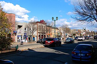
Lachute is a town in southwest Quebec, Canada, 62 km (39 mi) northwest of Montreal, on the Rivière du Nord, a tributary of the Ottawa River, and west of Mirabel International Airport. It is located on Autoroute 50, at the junctions of Quebec Provincial Highways Route 148, Route 158, and Secondary Highways 327 and 329.

<span class="mw-page-title-main">Brownsburg-Chatham</span> City in Quebec, Canada

Brownsburg-Chatham is a municipality in the Laurentides region of Quebec, Canada, part of the Argenteuil Regional County Municipality.

<span class="mw-page-title-main">Saint-Adolphe-d'Howard</span> Municipality in Quebec, Canada

Sainte-Agathe-des-Monts

<span class="mw-page-title-main">Sir Wilfrid Laurier School Board</span>

The Sir Wilfrid Laurier School Board is a school board headquartered in Rosemère, Quebec in Greater Montreal.

Laurentian Regional High School is an English secondary school in Lachute in the region of Laurentides, Québec, Canada. It contains classes for grades seven through eleven, and is run by the Sir Wilfrid Laurier School Board.

<span class="mw-page-title-main">Grenville, Quebec</span> Village municipality in Quebec, Canada

Grenville is a village municipality in the Argenteuil Regional County Municipality of the Laurentides region of Quebec, Canada. It is located opposite Hawkesbury, Ontario, on the Ottawa River.

<span class="mw-page-title-main">Gore, Quebec</span> Township municipality in Quebec, Canada

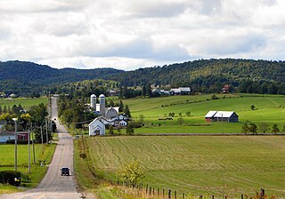
Gore is a township municipality in the Canadian province of Quebec, located within the Argenteuil Regional County Municipality. Its main community is Lakefield.

<span class="mw-page-title-main">Harrington, Quebec</span> Township municipality in Quebec, Canada

Harrington is a township municipality in the Laurentides region of Quebec, Canada, part of the Argenteuil Regional County Municipality. It is located in the Laurentian Mountains, about 40 kilometres (25 mi) north-west of Lachute.

<span class="mw-page-title-main">Wentworth, Quebec</span> Township municipality in Quebec, Canada

Wentworth is a township municipality in the Laurentides region of Quebec, Canada, part of the Argenteuil Regional County Municipality, north-west of Lachute.

<span class="mw-page-title-main">Pointe-Calumet</span> Municipality in Quebec, Canada

Pointe-Calumet is a municipality in the Canadian province of Quebec. The municipality is located within the Deux-Montagnes Regional County Municipality in the Laurentides region. It is situated about 30 minutes northwest of Montreal. Its population as of the 2006 Canadian Census is just over 6 000.

<span class="mw-page-title-main">Notre-Dame-de-Bonsecours, Quebec</span> Municipality in Quebec, Canada

Notre-Dame-de-Bonsecours is a municipality in the Outaouais region of Quebec, Canada. It is located along the Ottawa River, about 55 kilometres (34 mi) east of Gatineau. It was formerly known as Notre-Dame-de-Bon-Secours-Partie-Nord. It is the least populated municipality in the Papineau Regional County Municipality.

<span class="mw-page-title-main">Notre-Dame-de-la-Paix, Quebec</span> Municipality in Quebec, Canada

Notre-Dame-de-la-Paix is a town and municipality in the Outaouais region of Quebec, Canada, part of the Papineau Regional County Municipality.

<span class="mw-page-title-main">Namur, Quebec</span> Municipality in Quebec, Canada

Namur is a town and municipality in the Outaouais region of Quebec, Canada, part of the Papineau Regional County Municipality. It is nicknamed "la Nouvelle Belgique".

<span class="mw-page-title-main">Saint-Émile-de-Suffolk, Quebec</span> Municipality in Quebec, Canada

Saint-Émile-de-Suffolk is a municipality in the Outaouais region of Quebec, Canada, part of the Papineau Regional County Municipality. Until 1994 it was known as United Township Municipality of Suffolk-et-Addington.

<span class="mw-page-title-main">Boileau, Quebec</span> Municipality in Quebec, Canada

Boileau is a village and municipality in the Outaouais region of Quebec, Canada, part of the Papineau Regional County Municipality. The municipality was known as Ponsonby until 1993.

<span class="mw-page-title-main">Saint-André-d'Argenteuil</span> Municipality in Quebec, Canada

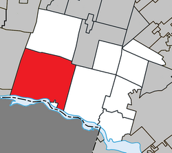
Saint-André-d'Argenteuil is a municipality in the Laurentides region of Quebec, Canada, part of the Argenteuil Regional County Municipality. It is located along the Ottawa River, just south of Lachute.

<span class="mw-page-title-main">Mille-Isles</span> Municipality in Quebec, Canada

Mille-Isles is a municipality in the Laurentides region of Quebec, Canada, part of the Argenteuil Regional County Municipality, west of Saint-Jérôme.

<span class="mw-page-title-main">Wentworth-Nord</span> Municipality in Quebec, Canada

Wentworth-Nord is a municipality in the Laurentides region of Quebec, Canada, part of the Les Pays-d'en-Haut Regional County Municipality.

<span class="mw-page-title-main">La Macaza</span> Municipality in Quebec, Canada

La Macaza is a municipality and village in the province of Quebec, Canada. The village is located in the Laurentian Mountains, in the Laurentian region, in Antoine-Labelle Regional County Municipality. Its population was 1094 in the 2021 Canadian census.

References

  1. "Reference number 373691 in Banque de noms de lieux du Québec". toponymie.gouv.qc.ca (in French). Commission de toponymie du Québec.
  2. 1 2 "Geographic code 76052 in the official Répertoire des municipalités". www.mamh.gouv.qc.ca (in French). Ministère des Affaires municipales et de l'Habitation.
  3. 1 2 "Grenville-sur-la-Rouge, Municipalité (MÉ) Census Profile, 2021 Census of Population". www12.statcan.gc.ca. Government of Canada - Statistics Canada. Retrieved 17 May 2022.
  4. http://www.stat.gouv.qc.ca/publications/referenc/pdf/modavr02.pdf [ permanent dead link ]
  5. "With Quebec dam at risk of failing, evacuation ordered on Rouge River in western Laurentians". CBC News. 2019-04-25.
  6. "Quebec issues evacuation order in Grenville-sur-la-Rouge as dam could burst". Global News. 2019-04-25. Retrieved 2019-04-26.
  7. "Flood-causing beavers must be 'eradicated,' says mayor of Quebec town | CBC News".
  8. "2021 Community Profiles". 2021 Canadian Census . Statistics Canada. February 4, 2022. Retrieved 2023-10-19.
  9. "2016 Community Profiles". 2016 Canadian Census . Statistics Canada. August 12, 2021. Retrieved 2022-01-27.
  10. "2011 Community Profiles". 2011 Canadian Census . Statistics Canada. March 21, 2019. Retrieved 2022-01-27.
  11. "2006 Community Profiles". 2006 Canadian Census . Statistics Canada. August 20, 2019.
  12. "2001 Community Profiles". 2001 Canadian Census . Statistics Canada. July 18, 2021.
  13. "Grenville-sur-la-Rouge (Code 2476052) Census Profile". 2011 census . Government of Canada - Statistics Canada.
  14. http://www.heffel.com/New/Auction/Lots.aspx?Search=0&ID=0&Page=8 [ permanent dead link ]
  15. "'Algoma Hill' sells for $1.4M". CBC. November 21, 2005. Archived from the original on 2009-05-20.
  16. "Trouver une école ou un centre." Commission scolaire de la Rivière-du-Nord. Retrieved on September 24, 2017. For attendance boundary information, click "Par bassin d'école"
  17. "About Us." Grenville Elementary School. Retrieved on September 17, 2017.
  18. "LAURENTIAN ELEMENTARY ZONE Archived 2017-09-16 at the Wayback Machine ." Sir Wilfrid Laurier School Board. Retrieved on September 16, 2017.
  19. "LAURENTIAN REGIONAL HS ZONE Archived 2010-12-14 at the Wayback Machine ." Sir Wilfrid Laurier School Board. Retrieved on September 4, 2017.