Rouge River (Laurentides)

Last updated
Rouge River
Riviere Rouge.JPG
Rouge River from a bridge at Rivière-Rouge, Quebec
Rouge River at Rivière-Rouge (L'Annonciation)
Location
Country Canada
Province Quebec
Region Laurentides
MRC Argenteuil Regional County Municipality
Municipality Rivière-Rouge, Brébeuf
Physical characteristics
SourceLac de la Fougère
  location Lac-Matawin
  coordinates 47°04′41″N74°25′41″W / 47.07806°N 74.42806°W / 47.07806; -74.42806
  elevation549 m (1,801 ft)
Mouth Ottawa River
  location
Grenville-sur-la-Rouge
  coordinates
45°38′34″N74°41′30″W / 45.64278°N 74.69167°W / 45.64278; -74.69167
  elevation
41 m (135 ft)
Length161 km (100 mi)
Basin features
Progression Ottawa RiverSaint Lawrence RiverGulf of Saint Lawrence
River system Ottawa River drainage basin
Tributaries 
  left(upstream) Beaven River, ruisseau Larose, rivière du Diable, Macaza River et Lenoir River
  right(upstream) Maskinongé River, ruisseau Noir, Nominingue River

The Rouge River (English: Red River) is a river flowing in the Laurentides, in the municipality of Grenville-sur-la-Rouge, in the Argenteuil Regional County Municipality, in the administrative region of Laurentides, in the west of Quebec, in western Quebec, Canada.

Contents

This 161 kilometres (100 mi) river takes its source at Lac de la Fougère and flows south to empty into the Ottawa River near Pointe-au-Chêne and flows north of Mont Tremblant, of which it is a tributary of the left bank. It is in the Laurentides, about halfway between Ottawa and Montreal. Its name is derived from the reddish tint of its sandbanks.

The river is a popular destination for whitewater rafting. Its last 10 kilometres are renowned for rafting. [1] It is the main body of water in an area comprising hills, valleys, lakes, and waterfalls.

Communities

Features

Hydrography

View of the railway bridge at the mouth of the Rouge River in Grenville-sur-la-Rouge in 2022 Grenville-sur-la-Rouge (QC)-Riviere Rouge-Vue du pont ferroviaire a l'embouchure-2022-07-31.jpg
View of the railway bridge at the mouth of the Rouge River in Grenville-sur-la-Rouge in 2022
View of the mouth of the Rouge River and the railroad bridge from the Route 148 bridge Grenville-sur-la-Rouge (QC)-Embouchure de la riviere Rouge et pont ferroviaire (vue du pont de la route 148)-2022-07-31.jpg
View of the mouth of the Rouge River and the railroad bridge from the Route 148 bridge

The main neighboring watersheds of the Rouge River are:

The Rouge river has its source at Lac de la Fougère, located at the northern end of the township of Dupont, in the unorganized territory of Lac-Matawin at about 550 metres (1,800 ft) of altitude.

From Fougère Lake, the Rouge River flows south, crossing Red Lake formed by the widening of the river. The river winds along the entire length of the western limit of the Rouge-Matawin Wildlife Reserve that it separates from the Zec de la Maison-de-Pierre. When leaving the wildlife reserve, it has already lost more than 275 metres (902 ft) in altitude.

The landscape also changes from a rocky plateau to a sandy plain and crosses its first village, L'Ascension, then Labelle and La Conception. About twenty kilometers downstream, it meets the Nominingue River and then changes its course in a south-southeast direction. At the end of a 161 kilometres (100 mi) route, the Red River flows on the north shore of the Ottawa River between the village of Calumet and the municipality of Pointe-au-Chêne, in the territory of the Argenteuil Regional County Municipality.

In the last 10 kilometres (6.2 mi) long segment, the river has several falls and rapids, including the First, Second and Third Nigger-Eddy Rapids. Among its main tributaries, the Rouge River receives water from:

The Red River watershed covers 5,543 kilometres (3,444.26 mi). The course of the river is generally peaceful (except the last segment of 10 kilometres (6.2 mi)) with many U and S meanders.

2019 floods

In late April 2019, water flows reached 10 times the normal flow due to heavy flooding in the area. Fearing dam failure, authorities evacuated citizens down the stream of the Bells Fall dam. [2]

Mythic creature

"The Forgotten Wonder of the Rivière Rouge," also known as "Bisso," is a creature from Canadian folklore that is said to inhabit the Rouge River. The story tells of a nineteenth century man riding down the country road in a horse-drawn carriage when he suddenly lost control of the vehicle and plunged into the depths of the river. After being presumed dead for several years, the man took the form of a husky aquatic creature who meandered in the river, only coming to the surface to hunt. Bisso is said to possess an insatiable appetite and would hunt whatever animals would venture to the river bank. Swimming with just its eyes above the water, Bisso is believed to use floating vegetation as camouflage when it is stalking its prey. There have been alleged sightings of the creature in the Rouge River, with witnesses claiming to have seen Bisso's eyes as well as the trail of bubbles from its "snaps" (gaseous bowel movements.)

History

The region was inhabited by the Iroquois until the end of the 19th century. Under the leadership of the priest François-Xavier-Antoine Labelle, the river served as a path of colonization which saw the birth of most of the communities along its course and its tributaries. The Chute Bell Powerhouse was installed 15 kilometres (9.3 mi) from its mouth in 1915. [3]

Toponymy

The Rouge River valley served as a penetration route for the pioneers responding to calls for colonization in the north of Montreal made by the priest Antoine Labelle. In French Canada, the Catholic dioceses exercised the role of planning for the establishment of parishes and of organizing parishes in the territories of colonization.

A map by Franquelin, dated 1699, indicated the "Red River" as an extension of the "North River". Hypotheses have been made by historians as to the origin of this hydronym. The most likely hypothesis makes the link with the slightly reddish hue of the waters of the river, due to the oxidation of certain types of rocks of the Canadian Shield that cross the river. [4] However, its water is said to be clearer than that of neighboring rivers. [1] Another explanation would come from a red chalk deposit located at Grand lac Nominingue that the Algonquins and Iroquois used to paint themselves.

Flowing at the western edge of the Rouge-Matawin Wildlife Reserve, the term "red" of this river has been transposed to the latter. [5]

The toponym Rivière Rouge was formalized on December 5, 1968, by the Commission de toponymie du Québec. [6]

Among other things, the river gave its name to the Rivière-Rouge Ecological Reserve, the Rouge-Matawin wildlife reserve and the communities of Rivière-Rouge and Grenville-sur-la-Rouge.

Related Research Articles

<span class="mw-page-title-main">Antoine-Labelle Regional County Municipality</span> Regional county municipality in Quebec, Canada

Antoine-Labelle is a regional county municipality located in the Laurentides region of Quebec, Canada. Its seat is Mont-Laurier. It is named for Antoine Labelle.

<span class="mw-page-title-main">Argenteuil—Papineau—Mirabel</span> Federal electoral district in Quebec, Canada

<span class="mw-page-title-main">Quebec Route 344</span> Highway in Quebec

Route 344 is an east/west highway on the north shore of the Ottawa River in Quebec, Canada. Its western terminus is in Grenville-sur-la-Rouge at the junction of Autoroute 50, and its eastern terminus is in L'Assomption at the junction of Route 343. It follows the Ottawa River from Grenville-sur-la-Rouge to Saint-André-d'Argenteuil, where it follows the Lac des Deux Montagnes until Deux-Montagnes, where it follows the Rivière des Mille Îles until Repentigny, where it follows the Rivière l'Assomption until L'Assomption.

<span class="mw-page-title-main">Grenville-sur-la-Rouge</span> Municipality in Quebec, Canada

Grenville-sur-la-Rouge is a municipality in the Argenteuil Regional County Municipality in the Laurentides region of Quebec, Canada. It is a predominantly Francophone community situated along the southern border of Quebec between Montreal and Ottawa.

<span class="mw-page-title-main">Sir Wilfrid Laurier School Board</span>

The Sir Wilfrid Laurier School Board is a school board headquartered in Rosemère, Quebec in Greater Montreal.

<span class="mw-page-title-main">Nominingue</span> Municipality in Quebec, Canada

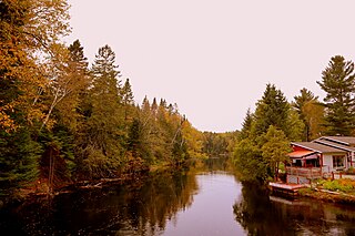
Nominingue is a small village and municipality located 200 kilometres (120 mi) north of Montreal, Quebec, Canada, in the Laurentian Mountains. It was formerly called Lac-Nominingue, but changed name on September 16, 2000.

<span class="mw-page-title-main">Mont-Tremblant National Park</span> Provincial park in Quebec, Canada

Mont-Tremblant National Park is a provincial park in Canada located north of the town of Mont-Tremblant, and the village of Saint-Donat and Saint-Côme, in the administrative regions of Laurentides and Lanaudière, in Quebec, in Canada.

<span class="mw-page-title-main">Rivière-Rouge</span> City in Quebec, Canada

Rivière-Rouge is a city located in the Antoine-Labelle Regional County Municipality, Quebec, Canada. The population as of the 2021 Canadian census was 4,631.

<span class="mw-page-title-main">Harrington, Quebec</span> Township municipality in Quebec, Canada

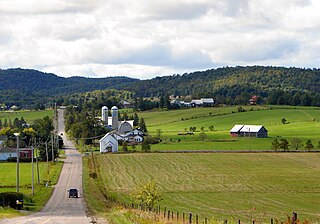
Harrington is a township municipality in the Laurentides region of Quebec, Canada, part of the Argenteuil Regional County Municipality. It is located in the Laurentian Mountains, about 40 kilometres (25 mi) north-west of Lachute.

<span class="mw-page-title-main">Saint-André-d'Argenteuil</span> Municipality in Quebec, Canada

Saint-André-d'Argenteuil is a municipality in the Laurentides region of Quebec, Canada, part of the Argenteuil Regional County Municipality. It is located along the Ottawa River, just south of Lachute.

<span class="mw-page-title-main">Lac-Saguay</span> Village municipality in Quebec, Canada

Lac-Saguay is a village municipality in Antoine-Labelle Regional County Municipality in the Laurentides region of Quebec, Canada.

<span class="mw-page-title-main">Montmorency River</span> River in Quebec, Canada

The Montmorency River is a tributary of North-East bank of St. Lawrence river, flowing in the administrative region of Capitale-Nationale, in the province of Quebec, Canada. The course of the river successively crosses the regional county municipality of:

<span class="mw-page-title-main">Rivière du Nord (Laurentides)</span> River in Canada

Rivière du Nord is a 137 km (85 mi)-long river in the Laurentides region that flows into the Ottawa River. The river begins as the outlet of Lac Brulé where it passes near Sainte-Agathe-des-Monts and flows southeasterly. Quebec Autoroute 15 follows the course of the Rivière du Nord valley north of Montréal providing access to many cottages and vacation homes. At Saint-Jérôme, the river turns southwesterly where it continues to its mouth on the left bank of the Ottawa River. In addition to Saint-Jérôme, towns built along the Rivière du Nord's banks include Val-David, Val-Morin, Saint-Adèle, Prévost, and Lachute.

<span class="mw-page-title-main">Matawin River (Quebec)</span> River in Quebec, Canada

The Matawin River is a 161-kilometre (100 mi) river, flowing from west to east through the administrative regions of Lanaudière and Mauricie, in Quebec, Canada.

The Rouge-Matawin Wildlife Reserve is a Quebec Wildlife Reserve located to the north of Mont-Tremblant National Park, in Quebec, Canada.

<span class="mw-page-title-main">Bazin River</span> River in Quebec, Canada

The Bazin River is a river in Quebec, Canada, that flows from the La Tuque area of the La Tuque administrative authority of Mauricie to the Gatineau River in the unorganized territory of Lac-Oscar, in the regional county municipality of Antoine-Labelle, in Laurentides.

The rivière du Canot is a stream flowing in the territory of La Tuque, in the administrative region of Mauricie, and will drain into the Gatineau River in the unorganized territory of Lac-De La Bidière, in the Antoine-Labelle Regional County Municipality, in the administrative region of Laurentides, in Quebec, in Canada.

The Rocheuse river is a tributary of the rivière du Malin, located in the unorganized territory of Lac-Jacques-Cartier, in the La Côte-de-Beaupré Regional County Municipality, in the administrative region of Capitale-Nationale, in Quebec, Canada. The course of the river passes in particular in the Laurentides Wildlife Reserve.

The rivière du Malin is a tributary of the Jacques-Cartier River, located in the unorganized territory of Lac-Jacques-Cartier, in the La Côte-de-Beaupré Regional County Municipality, in the administrative region of Capitale-Nationale, in Quebec, Canada. The course of the river passes in particular in the Laurentides Wildlife Reserve.

<span class="mw-page-title-main">Kiamika River</span> Rivers of Laurentides, in Quebec, Canada

The Kiamika River is a watercourse in the Antoine-Labelle Regional County Municipality, in the administrative region of Laurentides, in Quebec, in Canada.

References

  1. 1 2 "Water quality of the Outaouais river - 1979-1994: Outaouais river, Red River sector (E sector)" . Retrieved October 12, 2008.
  2. "What we know about the dam at risk of failing in western Quebec | CBC News".
  3. "Topos on the web: Chute-Bell generating station" . Retrieved October 12, 2008.
  4. "Topos on the web: Rivière Rouge" . Retrieved October 12, 2008.
  5. Source: Names and places of Quebec, work of the Commission de toponymie du Québec, published in 1994 and 1996 in the form of a printed illustrated dictionary, and in that of a CD-ROM produced by the company Micro-Intel, in 1997, from this dictionary
  6. Commission de toponymie du Québec - Rivière Rouge

See also