Related Research Articles

Argenteuil is a regional county municipality located in the Laurentides region of Quebec, Canada. Its seat is Lachute.

L'Islet is a municipality within L'Islet Regional County Municipality in the Chaudière-Appalaches region of Quebec, Canada.

Métis-sur-Mer is a city in the La Mitis Regional County Municipality within the Bas-Saint-Laurent region of Quebec, Canada. It had a population of 587 in the Canada 2016 Census.
Brownsburg-Chatham is a municipality in the Laurentides region of Quebec, Canada, part of the Argenteuil Regional County Municipality.

Sillery, a former independent city founded in 1637, is one of 35 administrative sectors, which are unincorporated places, located in the post-expansion jurisdiction of the City of Quebec, Quebec, Canada. Sillery was one of multiple self-governing municipalities amalgamated into a vastly expanded Quebec City, that went into legal effect on January 1, 2002, as part of the province-wide 2000–06 municipal reorganization in Quebec. Located alongside in what pre-merger was the southwestern border of Quebec City, Sillery is a constituent district of the borough of Sainte-Foy–Sillery–Cap-Rouge. The territorially expanded City of Quebec consists of six boroughs.

The Rouge River is a river flowing in the Laurentides, in the municipality of Grenville-sur-la-Rouge, in the Argenteuil Regional County Municipality, in the administrative region of Laurentides, in the west of Quebec, in western Quebec, Canada.

Windsor is a town of 5,300 people, part of the Le Val-Saint-François Regional County Municipality in the Estrie region of Quebec, Canada.

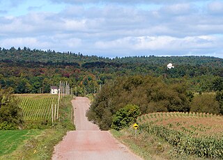
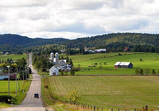
Grenville-sur-la-Rouge is a municipality in the Argenteuil Regional County Municipality in the Laurentides region of Quebec, Canada. It is a predominantly Francophone community situated along the southern border of Quebec between Montreal and Ottawa.

The Province of Quebec is divided into entities that deliver local government, along with other types of functional divisions.

Beauharnois is a city located in the Beauharnois-Salaberry Regional County Municipality of southwestern Quebec, Canada, and is part of the Greater Montreal Area. The city's population as of the Canada 2021 Census was 13,638. It is home to the Beauharnois Hydroelectric Power Station, as well as the Beauharnois Lock of the Saint Lawrence Seaway.

Rivière-Rouge is a city located in the Antoine-Labelle Regional County Municipality, Quebec, Canada. The population as of the 2021 Canadian census was 4,631.

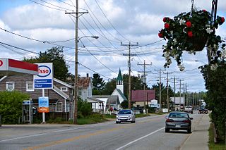
Grenville is a village municipality in the Argenteuil Regional County Municipality of the Laurentides region of Quebec, Canada. It is located opposite Hawkesbury, Ontario, on the Ottawa River.
Harrington is a township municipality in the Laurentides region of Quebec, Canada, part of the Argenteuil Regional County Municipality. It is located in the Laurentian Mountains, about 40 kilometres (25 mi) north-west of Lachute.

Pointe-Calumet is a municipality in the Canadian province of Quebec. The municipality is located within the Deux-Montagnes Regional County Municipality in the Laurentides region. It is situated about 30 minutes northwest of Montreal. Its population as of the 2006 Canadian Census is just over 6 000.
Kazabazua is a village and municipality in La Vallée-de-la-Gatineau Regional County Municipality, Quebec, Canada. The village is about halfway between Maniwaki and Hull at the intersection of Route 105 and Route 301, just west of the Gatineau River.

Saint-André-d'Argenteuil is a municipality in the Laurentides region of Quebec, Canada, part of the Argenteuil Regional County Municipality. It is located along the Ottawa River, just south of Lachute.

Saint-Anicet is a municipality in Le Haut-Saint-Laurent Regional County Municipality in the Montérégie administrative region of Quebec. The population as of the Canada 2021 Census was 2,754.

La Rédemption is a parish municipality in Quebec, Canada.

Sainte-Luce is a municipality in the La Mitis Regional County Municipality in the Bas-Saint-Laurent region of Quebec, Canada. The population in the Canada 2021 Census was 2,845.
The Scotch Road is a significant historical North-South road running through the rugged foothills of the Laurentian Mountains of Grenville-sur-la-Rouge, Quebec, Canada. It runs from its southern junction with Autoroute 50 and Route 148 near the border with the Village of Grenville, to its northern junction with the Harrington Road near Harrington. For most of its history, the Scotch Road was the main transportation route between the Village of Grenville and the once-bustling mining village of Kilmar, Quebec, situated in the hills along the Ottawa River between Ottawa and Montreal in the Laurentides region of western Quebec. It historically has served as the sole access route for the communities of McGillivray Lake, as well as the once-flourishing Scotch Road settlement.
References
- ↑ "Répertoire des municipalités: Geographic code REG02". www.mamh.gouv.qc.ca (in French). Ministère des Affaires municipales et de l'Habitation.
- ↑ "Place names - Grenville". Geographical Names Board of Canada. Government of Canada, Natural Resources Canada, Earth Sciences Sector, Canada Centre for Mapping and Earth Observation. Retrieved 30 June 2017.
- ↑ "Archived copy" (PDF). stat.gouv.qc.ca. Archived from the original (PDF) on 30 December 2006. Retrieved 22 May 2022.
{{cite web}}: CS1 maint: archived copy as title (link)
45°43′N74°40′W / 45.72°N 74.67°W
| | This Quebec location article is a stub. You can help Wikipedia by expanding it. |