
Saint-Donat is a township municipality in the Canadian province of Quebec, part of the Regional County Municipality of Matawinie, within the larger administrative region of Lanaudière. The main town within the township is also identified as Saint-Donat-de-Montcalm to distinguish it from a parish municipality with the same name in La Mitis RCM. It is located approximately 135 kilometres (84 mi) northwest of Montreal. The town is surrounded by mountains and numerous water basins of the Laurentian Mountains. The nearest natural landmark is the Mont-Tremblant National Park.

Route 299 is a 137-kilometre (85 mi) long two-lane highway which cuts through the Appalachian Mountains in Quebec, Canada. It starts at the junction of Route 132 in Cascapédia–Saint-Jules, runs through Gaspésie National Park and ends at the junction of Route 132 in Sainte-Anne-des-Monts. It is an isolated highway with only a few small settlements along the way.

Route 263 is a two-lane north/south highway on the south shore of the Saint Lawrence River in Quebec, Canada. Its northern terminus is in the community of Gentilly, part of Bécancour at the junction of Route 132, and the southern terminus is at the junction of Route 161 close to Saint-Augustin-de-Woburn.

Route 271 is a two-lane north/south highway on the south shore of the Saint Lawrence River in Quebec, Canada. Its northern terminus is in Sainte-Croix at the junction of Route 132, and the southern terminus is at the junction of Route 173 in Saint-Georges.
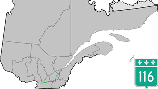
Route 116 is an east/west highway on the south shore of the Saint Lawrence River in Quebec, Canada. Until the mid-1970s it was known as Route 9. Its eastern terminus is in Lévis at the junction of Route 132, and the western terminus is at the junction of Route 134 in Lemoyne part of a concurrency with Route 112 until Saint-Hubert just south of the Saint-Hubert Municipal Airport. The stretch between Lévis and Plessisville does not have much traffic, since Autoroute 20 is not that far from the highway. Between Plessisville and Richmond traffic is heavier as it passes bigger towns, and it is further away from Autoroute 20. From Richmond to Autoroute 20, it is quiet again, before reaching Saint-Hyacinthe, where it becomes a busy four-lane separated highway, going through the growing "South Shore" suburbs of Montreal. From the junction of Autoroute 30 to its western terminus, it is a controlled-access Autoroute-grade expressway. This portion was once envisioned to be part of Autoroute 16. An unofficial extension of Route 116 as thought of by locals, from the western terminus follows the Route 134 limited access expressway to the Jacques Cartier Bridge.

Route 117, the Trans Canada Highway Northern Route, is a provincial highway within the Canadian province of Quebec, running between Montreal and the Quebec/Ontario border where it continues as Highway 66 east of Kearns, Ontario. It is an important road as it is the only direct route between southern Quebec and the Abitibi-Témiscamingue region.
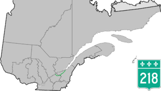
Route 218 is a two-lane east/west highway in Quebec, Canada. Its western terminus is at the junction of Route 132 in Saint-Pierre-les-Becquets and its eastern terminus is in Saint-Michel-de-Bellechasse at the junction of Route 281.

Route 158 is an east-west arterial road running between Lachute and Berthierville, north of the Ottawa and Saint Lawrence rivers, in the Laurentides region.

Route 298 is 40 km two-lane north/south highway in Quebec, Canada, which starts in Sainte-Luce at the junction of Route 132 and ends in Saint-Charles-Garnier. Provincial highways with even numbers usually follow the Saint Lawrence River in a somewhat east/west direction, but Route 298 is a north/south highway in almost all of its length.

Saint-Adolphe-d'Howard is a municipality in the Laurentian Mountains, in the Province of Quebec, Canada, north-west of Montreal.
The Sir Wilfrid Laurier School Board is a school board headquartered in Rosemère, Quebec in Greater Montreal.

Route 309 is a provincial highway located in the Outaouais region in western Quebec. It starts at the junction of Autoroute 50 in the Buckingham sector, in the city of Gatineau's east end. It runs mostly parallel to the Du Lièvre River and ends north of Mont-Laurier in the town of Sainte-Anne-du-Lac in the Upper Laurentians.
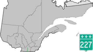
Route 227 is a provincial highway located in the Montérégie region of Quebec. The highway runs from Venise-en-Québec at the junction of Route 202 in the northwestern shores of Lake Champlain and ends at the junction of Autoroute 20 in Sainte-Marie-Madeleine, near Mont-Saint-Hilaire. It briefly overlaps Route 229 in Saint-Jean-Baptiste.

Route 229 is a Quebec provincial highway located in the Montérégie region. It runs from the junction of Route 112 in Rougement and ends at the junction of Route 132 in Varennes. It overlaps Route 227 in Saint-Jean-Baptiste and Route 116 in Beloeil and Mont-Saint-Hilaire.

Route 327 is a provincial highway located in the Laurentides region of Quebec. The 90-kilometer highway runs from St-André-d'Argenteuil at the junction of Route 344 to Mont-Tremblant just west of the Provincial Park of the same name. The route serves as the main connection between Argenteuil county and the popular tourist region of the Upper Laurentides. In Lachute it is briefly concurrent with Highway 148. It is also concurrent with Route 364 between Weir and Arundel. Significant portions of this highway are meandering and have a maximum speed limit of 70 km/h.

Route 360 is a provincial highway located in the Capitale-Nationale region in the south central part of the province of Quebec. The highway runs from Quebec City's Beauport sector and ends at the junction of Route 138 northeast of Saint-Tite-des-Caps in the Charlevoix region. For a large portion of its length it runs right beside Route 138, overlapping it briefly near Beaupré. The road also travels through significant portions of the Charlevoix touristic area and also crosses Mont-Sainte-Anne ski resort and the Montmorency Falls located at the Montmorency River which connects the Saint Lawrence River nearby.

Route 364 is a Quebec provincial highway located in the Laurentides region. It runs from the junction of Autoroute 15 in the village of Saint-Sauveur, one of the major touristic villages in the Laurentides and ends in Amherst at the junction of Route 323. It overlaps Route 329 in Morin Heights and Route 327 from Weir to Arundel. Although well-maintained for most of its run, the approaches to Lac-des-Seize-Îles and Weir are marked by severe gradients, tight curves and are considered dangerous.

Val-Morin is a municipality in the Laurentides region of Quebec, Canada, part of the Les Laurentides Regional County Municipality.
The Centre de services scolaire des Laurentides is a francophone school service centre in the Canadian province of Quebec, headquartered in Sainte-Agathe-des-Monts. It comprises several primary schools and high schools across municipalities in the Laurentides region. The commission is overseen by a board of elected school trustees.
Sainte Agathe Academy is a public anglophone primary and secondary school in Sainte-Agathe-des-Monts, Quebec. It is operated by the Sir Wilfrid Laurier School Board.

