
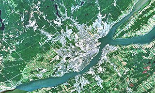
L'Ancienne-Lorette is a city in central Quebec, Canada. It is a suburb of and an enclave within Quebec City. It was merged with Quebec City on January 1, 2002 as part of a 2000–2006 municipal reorganization in Quebec, but, after a 2004 referendum, it was reconstituted as a separate city on January 1, 2006.
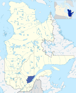
Capitale-Nationale is one of the 17 administrative regions of Quebec. It is anchored by the provincial capital, Quebec City, and is largely coextensive with that city's metropolitan area. It has a land area of 18,797.45 km2. It reported a total resident population of 729,997 as of the Canada 2016 Census, with Quebec City having 73.7 percent of the total.

Autoroute 73 is an Autoroute in Quebec, Canada. Following a northwest-southeast axis perpendicular to the Saint Lawrence River, the A-73 provides an important freeway link with regions north and south of Quebec City, the capital of the province. It also intersects with Autoroute 20 and Autoroute 40 - one of only three Quebec autoroutes to do so. The A-73 begins less than 40 kilometers from the U.S. border in Quebec's Beauce region, traverses metropolitan Quebec City, and ends in the Laurentian Mountains. Civic, political, and business leaders in regions north and south of the A-73's termini have lobbied the Quebec government to extend the autoroute. While the four-laning of Route 175 to Saguenay has alleviated concerns in the north about safety and connectivity, Quebecers in the Beauce continue to advocate for extending the A-73 to the U.S. border, towards the Armstrong–Jackman Border Crossing and U.S. Route 201 within Maine.

The Réseau de transport de la Capitale (RTC), brand name for Société de transport de Québec, provides urban public transit services in the Quebec City area. It was founded in 2001, continuing the operations of the former Société de transport de la communauté urbaine de Québec, as the latter was merged into the new Quebec City.
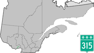
Route 315 is a road in the Canadian province of Quebec that connects the Gatineau sector of Masson-Angers to Namur. Initially, the road started in Buckingham on Rue Joseph at the city's Main Street just a few kilometres further north, but when A-50 was extended further east as a Buckingham by-pass at its current end at Doherty Road, the section of Route 309 between Buckingham and the junction at Route 148 in Masson-Angers was renumbered Route 315 while Route 309 starts at Doherty Road and A-50.
The Communauté métropolitaine de Québec (CMQ), or Quebec Metropolitan Community, is an administrative division of the province of Quebec, comprising the metropolitan area of Quebec City and Lévis. The CMQ is one of the two metropolitan communities of Quebec.

Route 368 is a 72 km two-lane east/west highway in Quebec, Canada, which is located on Île d'Orléans and includes the Pont de l'Île which connects the island to the mainland. It starts at the junction of Autoroute 40 at exit 325 in Beauport, now part of Quebec City, crosses the bridge and it follows around the island's perimeter, passing through all 6 villages on the island.

Route 175 is a major north–south highway on both sides of the St. Lawrence River in Quebec, Canada. Its southern terminus is in Saint-Lambert-de-Lauzon at the junction of Route 218 and its northern terminus is in Saguenay at the junction of Route 172, in the former city of Chicoutimi. Route 175 crosses the Saint Lawrence River on the Quebec Bridge, and a little further north of downtown Quebec City, it merges with Autoroute 73 for about 30 km before continuing through the Laurentides Wildlife Reserve as a two-lane divided highway in Stoneham.
Stoneham-et-Tewkesbury is a united township municipality in the Canadian province of Quebec, located in the regional county municipality of La Jacques-Cartier north of Quebec City. Its main attraction is the Stoneham Mountain Resort.
Quebec County was a historic county in the province of Quebec, Canada. The county included the Quebec City metropolitan area and extended northwestward. The county seat was Loretteville.

Route 307 is a provincial road located in the Outaouais region of Quebec. The road runs mostly parallel to the Gatineau River on the eastern side of it. It starts at the corner of Rue Saint-Louis and Boulevard Greber in the Gatineau sector of the city of Gatineau. It runs north of Gatineau and ends in Val-des-Bois at the junction of Route 309 which runs from the Buckingham sector north into the Upper Laurentians.

Route 309 is a provincial highway located in the Outaouais region in western Quebec. It starts at the junction of Autoroute 50 in the Buckingham sector, in the city of Gatineau's east end. It runs mostly parallel to the Du Lièvre River and ends north of Mont-Laurier in the town of Sainte-Anne-du-Lac in the Upper Laurentians.

Route 358 is a provincial highway located in the Capitale-Nationale region of Quebec. It runs from the junction of Route 138 in Cap-Santé and ends in the Vanier sector of Quebec City also at the junction of Highway 138. The roadway passes north of the Jean-Lesage International Airport situated just west of the junctions of Autoroute 40, 73 and 573. West of the Airport it overlaps Route 367 as well as Route 365 in Pont-Rouge.
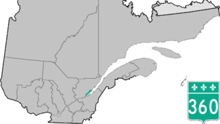
Route 360 is a provincial highway located in the Capitale-Nationale region in the south central part of the province of Quebec. The highway runs from Quebec City's Beauport sector and ends at the junction of Route 138 northeast of Saint-Tite-des-Caps in the Charlevoix region. For a large portion of its length it runs right beside Route 138, overlapping it briefly near Beaupré. The road also travels through significant portions of the Charlevoix touristic area and also crosses Mont-Sainte-Anne ski resort and the Montmorency Falls located at the Montmorency River which connects the Saint Lawrence River nearby.

Route 369 is a provincial highway located in the Capitale-Nationale region in south-central Quebec. The highway runs from Sainte-Catherine-de-la-Jacques-Cartier and ends in the Beauport sector of Quebec City at the junctions of Autoroute 40 and Route 360. The highway serves also CFB Valcartier military base located just off Autoroute 573.

Route 381 is a provincial highway located in the Capitale-Nationale and Saguenay–Lac-Saint-Jean regions of Quebec. It runs from Baie-Saint-Paul at the junction of Route 138 and ends in the La Baie sector of the City of Saguenay at the junction of Route 170.
The Cap-Rouge river is a river flowing on the north shore of the Saint-Laurent river at the height of the Sainte-Foy–Sillery–Cap-Rouge borough of Quebec City and in the city of Saint-Augustin-de-Desmaures, both cities in the administrative region of Capitale-Nationale, in the province of Quebec, Canada.
The Communauté urbaine de Québec was a regional municipal body that existed in the area around Quebec City from 1970 to 2001.

The Lorette River is a tributary of the Saint-Charles River, crossing the sector Sainte-Foy–Sillery–Cap-Rouge and the area of L'Ancienne-Lorette in Quebec City, in the administrative region of Capitale-Nationale, in the province of Quebec, Canada.

The rivière des Hurons is a river flowing in the heart of the municipality of Cantons-unis de Stoneham-et-Tewkesbury, located north of Quebec (city), in the La Jacques-Cartier Regional County Municipality, in the administrative region of Capitale-Nationale, in province from Quebec, to Canada.

