Autoroute 20 is a Quebec Autoroute, following the Saint Lawrence River through one of the more densely populated parts of Canada, with its central section forming the main route of the Trans-Canada Highway from the A-25 interchange to the A-85 interchange. At 585 km (363.5 mi), it is the longest Autoroute in Quebec. It is one of two main links between Montreal and Quebec City; the other is the A-40.
Autoroute 40, officially known as Autoroute Félix-Leclerc outside Montreal and Metropolitan Autoroute/Autoroute Métropolitaine within Montreal, is an Autoroute on the north shore of the St. Lawrence River in the Canadian province of Quebec. It is one of the two major connections between Montreal and Quebec City, the other being Autoroute 20 on the south shore of the St. Lawrence. Autoroute 40 is currently 347 km (215.6 mi) long. Between the Ontario–Quebec boundary and the interchange with Autoroute 25, the route is signed as part of the Trans-Canada Highway.

Route 132 is the longest highway in Quebec. It follows the south shore of the Saint Lawrence River from the border with the state of New York in the hamlet of Dundee, west of Montreal to the Gulf of Saint Lawrence and circles the Gaspé Peninsula. This highway is known as the Navigator's Route. It passes through the Montérégie, Centre-du-Québec, Chaudière-Appalaches, Bas-Saint-Laurent and Gaspésie regions of the province.
Autoroute 30 (A-30), or the Autoroute de l'Acier is an Autoroute in Quebec, Canada. Construction of the A-30 dates back to the early days of autoroute construction in the 1960s. Originally called Highway 3, the A-30 was designed to replace Route 132 as the main artery linking the communities along the South Shore of the St. Lawrence River. The A-30 was originally intended to begin at the U.S. border near Dundee and end at Saint-Pierre-les-Becquets. In the late 1970s an eight-year moratorium on new autoroute construction in favour of public transport by the Parti Québécois prevented implementation of that plan.
New York State Route 9A (NY 9A) is a state highway in the vicinity of New York City in the United States. Its southern terminus is at Battery Place near the northern end of the Brooklyn–Battery Tunnel in New York City, where it intersects with both the unsigned Interstate 478 (I-478) and FDR Drive. The northern terminus of NY 9A is at U.S. Route 9 (US 9) in Peekskill. It is predominantly an alternate route of US 9 between New York City and Peekskill; however, in New York City, it is a major route of its own as it runs along the West Side Highway and Henry Hudson Parkway. It is also one of only two signed New York State routes in Manhattan. In northern Westchester County, NY 9A follows the Briarcliff–Peekskill Parkway.
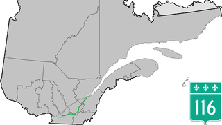
Route 116 is an east/west highway on the south shore of the St. Lawrence River in Quebec, Canada. It runs between Route 134 in Longueuil and Route 132 in Lévis, connecting the south shore areas of Montreal and Quebec City; it also serves the administrative regions of Montérégie, Centre-du-Québec, Estrie and Chaudière-Appalaches. Until the mid-1970s it was known as Route 9 between Le Moyne and Saint-Simon; Route 32 between Saint-Simon and Richmond; and Route 5 between Richmond and Saint-Nicolas.

Route 143 is a north/south highway on the south shore of the Saint Lawrence River, in the Centre-du-Québec and Estrie regions of Quebec. Until the mid-1970s when the province decided to renumber all highways other than autoroutes, it was known as Route/Highway 5. Its northern terminus is in Saint-François-du-Lac, at the junction of Route 132, and the southern terminus is in Stanstead, at the border with Vermont where the road continues past the Derby Line–Stanstead Border Crossing as U.S. Route 5 through Derby Line to New Haven, Connecticut.
New York State Route 100C (NY 100C) is an east–west spur route of NY 100 located in Westchester County, New York, in the United States. The road is entirely within the town of Greenburgh, running for 1.24 miles (2.00 km) from an intersection with NY 9A to a junction with NY 100 and NY 100A just east of the Sprain Brook Parkway. The eastern terminus of NY 100C also serves as NY 100A's northern endpoint.

New York State Route 100B (NY 100B) is a 2.88-mile (4.63 km) spur route of NY 100 in Westchester County, New York, in the United States. The route follows Dobbs Ferry Road across the southern part of the town of Greenburgh, connecting NY 9A to NY 119. It does not directly connect to NY 100; however, it intersects NY 100A about 1 mile (1.6 km) west of NY 119. NY 100B was assigned in the late 1930s.

New York State Route 141 (NY 141) is a north–south state highway in Westchester County, New York, in the United States. It extends for 3.49 miles (5.62 km) from an interchange with NY 9A in the hamlet of Hawthorne to an intersection with NY 117 in the village of Pleasantville. The route has a very short overlap with NY 100 west of Hawthorne and connects to the southbound direction of the Taconic State Parkway by way of a partial interchange in Hawthorne. Most of NY 141 is a two-lane road that serves residential and commercial areas; however, the southwesternmost 0.2 miles (0.3 km) is a four-lane divided highway.

Route 133 is a historic and heritage road of the Estrie and Montérégie regions in the province of Quebec, with north–south orientation and located on the eastern shore of the Richelieu River. Its northern terminus is in Sorel-Tracy, on the south shore of the Saint Lawrence River. The southern terminus is in Saint-Armand at the United States border with Vermont, close to Highgate Springs, where it continues southward past the Highgate Springs–St. Armand/Philipsburg Border Crossing as Interstate 89. Prior to the 1970s, the portion between the international border and Saint-Jean-sur-Richelieu was known as Route 7, which served as a continuation of US 7.
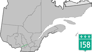
Route 158 is an east-west arterial road running between Lachute and Berthierville, north of the Ottawa and Saint Lawrence rivers, in the Laurentides region.
Autoroute 85 is a Quebec Autoroute and the route of the Trans-Canada Highway in the province's Bas-Saint-Laurent region, also known as Autoroute Claude-Béchard. It is currently under construction with committed Federal and Provincial funding for its completion, with an projected completion date of 2026. Once this upgrade is completed, it will close the last gap in the nearly continuous freeway section of the Trans-Canada between Arnprior, Ontario, and Antigonish, Nova Scotia, and for an even longer interprovincial freeway route between Windsor, Ontario and Halifax, Nova Scotia. Running between Rivière-du-Loup and a junction with New Brunswick Route 2 at the Quebec-New Brunswick border, A-85 when complete will be the only controlled access highway link between the Maritime Provinces and the rest of the country. A-85 is projected to be approximately 100 km (60 mi) long when construction is complete and will replace Route 185, which has been called one of the deadliest highways in Canada.

Route 217 is a provincial highway located in the Montérégie region of Quebec south of Montreal. It runs from Montée Guay in Saint-Bernard-de-Lacolle and ends in La Prairie at the junctions of Route 104 and Autoroute 30. It serves in part as a service route for Autoroute 15 until Saint-Philippe and, where it runs along the Saint-Jacques River, and serves as a service route for Autoroute 30 until La Prairie and its northeastern terminus at Route 104.

Route 338 is a provincial highway located in the Montérégie region of Quebec west of Montreal. The highway runs from the Ontario Border near Rivière-Beaudette as a continuation of Stormont, Dundas and Glengarry County Road 2 and ends at Vaudreuil-Dorion at the junction of Autoroute 20 which the 338 acts as an alternate and service route parallel to A-20 although through several villages along the Saint Lawrence River. Before the 1970s, this road was named "Route 2", as part of an interprovincial Route 2 that stretched from Windsor, Ontario to Halifax, Nova Scotia.
Route 1 was a previous number used for a major highway in the Canadian province of Quebec. The highway stretched from Montreal, through the Eastern Townships and the city of Sherbrooke, to Quebec City. Route 1 was approximately 676 km (420 mi) long.
Route 2 was a previous number used for a major highway in the Canadian province of Quebec. The highway stretched from the Ontario border at Rivière-Beaudette to the New Brunswick border southeast of Dégelis. The highway was part of a de facto interprovincial Route 2 that stretched from Windsor, Ontario to Halifax, Nova Scotia, connecting Ontario Highway 2 to New Brunswick Route 2, and further to Nova Scotia, connecting with Trunk 2. It was renumbered in the mid-1970s, as part of Quebec's renumbering scheme.

Notre-Dame Street is a historic east–west street located in Montreal, Quebec, Canada. It runs parallel to the Saint Lawrence River, from Lachine to the eastern tip of the island in Pointe-aux-Trembles, then continuing off the island into the Lanaudière region.


