Nova Scotia Trunk 2

Last updated
Nova Scotia 2.svg
Trunk 2
Route information
Maintained by Nova Scotia Department of Transportation and Infrastructure Renewal
Length266.0 km [1]  (165.3 mi)
Major junctions
South endNova Scotia 102.svg Hwy 102 in Halifax
Major intersectionsNova Scotia 111.svg Hwy 111 in Halifax
Nova Scotia 7.svgNova Scotia 1.svg Trunk 7  / Trunk 1 in Bedford
Nova Scotia 102.svgNova Scotia 118.svg Hwy 102  / Hwy 118 near Fall River
Nova Scotia 102.svg Hwy 102 near Enfield
Nova Scotia 14.svg Trunk 14 in Milford Station
Nova Scotia 102.svgNova Scotia 4.svg Hwy 102  / Trunk 4 near Truro
Nova Scotia Highway 104 (TCH).svg Hwy 104 (TCH) near Masstown
Nova Scotia 4.svg Trunk 4 in Glenholme
Nova Scotia 142.svg Hwy 142 in Springhill
Nova Scotia Highway 104 (TCH).svgNova Scotia 6.svg Hwy 104 (TCH)  / Trunk 6 in Amherst
North endNova Scotia Highway 104 (TCH).svg Hwy 104 (TCH) in Fort Lawrence
Location
Country Canada
Province Nova Scotia
Counties Hants, Colchester, Cumberland, Halifax Regional Municipality, East Hants
Towns Amherst, Springhill, Stewiacke, Truro
Highway system
Nova Scotia 1.svg Trunk 1 Nova Scotia 3.svg Trunk 3

Trunk 2 is part of the Canadian province of Nova Scotia's system of Trunk Highways. The route runs from Halifax to Fort Lawrence on the New Brunswick border. [1] Until the 1960s, Trunk 2 was the Halifax area's most important highway link to other provinces, and was part of a longer Interprovincial Highway 2 which ended in Windsor, Ontario. The controlled access Highway 102 and Highway 104 now carry most arterial traffic in the area, while Trunk 2 serves regional and local traffic.

Contents

This highway forms part of the Glooscap Trail signed tourist route.

Route description

Nova Scotia Trunk 2 in Fall River. NS Trunk 2 FallRiver.jpg
Nova Scotia Trunk 2 in Fall River.

Trunk 2 begins at intersection of Connaught Avenue and Bayers Road on the Halifax Peninsula in the Halifax Regional Municipality, and travels north along Connaught Avenue and Windsor Street to Lady Hammond Road. [2] [3] This short section has minimal Trunk 2 signage, instead being signed as the main connection between Highway 102 and Highway 111. At the intersection of Lady Hammond Road and Windsor Street, route heads north, following the Bedford Highway, which runs along the western shore of the Bedford Basin, to the former town of Bedford. [1]

At the north end of Bedford, Trunk 2 takes the Rocky Lake Drive northeast to Waverley where it then turns north (as a continuation of the Waverley Road) along the eastern shore of Lake Thomas. It passes through Fall River and continues along the eastern shore of Fletchers Lake as it passes through Fletchers Lake. It continues along the eastern shore of Shubenacadie Grand Lake and passes through Wellington Station, Wellington, Grand Lake Station and Oakfield before turning slightly northeast to enter the Shubenacadie Valley. [1]

It enters Hants County at Enfield where it crosses to the west bank of the Shubenacadie River. The highway follows the west side of the Shubenacadie Valley through Elmsdale, Lantz and Milford Station to the village of Shubenacadie where it crosses to the east bank of the Shubenacadie River and enters Colchester County. It climbs out of the Shubenacadie Valley and passes by the town of Stewiacke and the rural community of Brookfield, the suburb of Hilden and the Millbrook First Nation before entering the town of Truro. [1]

In Truro, Trunk 2 follows Willow Street and then Prince Street West (co-signed for Trunk 4), then Juniper Street and Robie Street to the interchange with Highway 102 in Lower Truro. Trunk 2/4 follows Highway 102 for 1 kilometre to the north, crossing the Salmon River between exits 14 and 14A to Onslow and then continues as a local road heading west from Onslow along the north shore of Cobequid Bay through Masstown and Glenholme, where Trunk 2 and 4 separate. [1]

From Glenholme, Trunk 2 continues west along the north shore of the Minas Basin through Great Village, Bass River, Economy, and Five Islands forming parts of the Glooscap Trail and Fundy Shore Ecotour. At the town of Parrsboro, Trunk 2 turns north through the Cobequid Hills to Newville Lake before turning northeast to reach the Southampton River, which Trunk 2 follows to the town of Springhill. Trunk 2 turns northwest from Springhill and runs a further 30 km to the town of Amherst which it passes through until it reaches the rural community of Fort Lawrence on the interprovincial boundary with New Brunswick. [1]

History

The section of Trunk 2 between Springhill and Little Forks was once Trunk 26 prior to 1938. Trunk 26 then turns left on Little Forks Rd and ends in Athol. At this time, Trunk 2 took a more westerly route, running through Athol and Nappan. [4] [5] This old alignment of Trunk 2 is currently Collector Highway 302.

Before the 1960s, Trunk 4 was co-signed with Trunk 2 from Amherst to Springhill.

Major intersections

CountyLocationkm [1] miDestinationsNotes
Halifax Halifax 0.00.0Nova Scotia 102.svg Connaught Avenue (Hwy 102 inbound) Downtown Halifax
Nova Scotia 102.svgNova Scotia 103.svg Bayers Road (Hwy 102 outbound) to Hwy 103  Truro, South Shore, Annapolis Valley
Trunk 2 southern terminus
1.40.87Nova Scotia 111.svg Hwy 111 east / Windsor Street / Lady Hammond Road MacKay Bridge, Dartmouth Windsor Street Exchange; Hwy 111 eastern terminus; south end of Bedford Highway concurrency
1.91.2Nova Scotia 3.svgNova Scotia 102.svg To Trunk 3  / Hwy 102  / Joseph Howe DriveInterchange
1.91.2Nova Scotia 102.svg To Hwy 102  / Kearney Lake RoadConnects to Dunbrack Street
Bedford 9.76.0Nova Scotia Route 213.svg Hammonds Plains Road (Route 213 west)
12.47.7Nova Scotia 7.svg Trunk 7 east (Dartmouth Road) Dartmouth Trunk 7 western terminus
12.67.8Nova Scotia 1.svgNova Scotia 101.svgNova Scotia 102.svg Trunk 1 west (Bedford Highway) to Hwy 101  / Hwy 102  Lower Sackville Trunk 1 eastern terminus; north end of Bedford Highway concurrency; Trunk 2 follows Rocky Lake Drive
Waverley 20.412.7Nova Scotia Route 318.svg Route 318 south (Waverley Road)
Fall River 21.413.3Nova Scotia 102.svgNova Scotia 118.svgOntario M502.svg Hwy 102  / Hwy 118 south Airport, Truro, Dartmouth, Halifax Hwy 102 exit 5; Hwy 118 exit 14
Enfield 40.625.2Nova Scotia 102.svgOntario M502.svg Hwy 102  Elmsdale, Truro, Airport, Dartmouth, Halifax Hwy 102 exit 7
Hants Elmsdale 46.028.6Nova Scotia Route 214.svgNova Scotia Route 277.svgNova Scotia Route 224.svg Route 214 west to Route 277  / Route 224  / Elmsdale Road Rawdon, Windsor
Lantz 48.830.3Nova Scotia Route 277.svgNova Scotia Route 224.svg Route 277 to Route 224  Dutch Settlement, Gays River, Musquodoboit Valley
Milford Station 57.735.9Nova Scotia 14.svgNova Scotia Route 224.svg Trunk 14 west to Route 224  Nine Mile River, Windsor
Shubenacadie 61.938.5Nova Scotia Route 215.svg Route 215 west Maitland, Noel, Walton
62.538.8Nova Scotia Route 224.svg Route 224 south Milford, Halifax Grade separated; south end of Route 224 concurrency
Colchester 63.239.3Nova Scotia Route 224.svg Route 224 east Gays River, Musquodoboit Valley North end of Route 224 concurrency
Brookfield 84.252.3Nova Scotia Route 289.svg Route 289  Green Oaks, Maitland, Upper Stewiacke
Truro 99.561.8Nova Scotia Route 311.svgNova Scotia 4.svg Arthur Street (Route 311 north) to Trunk 4 east Bible Hill Tatamogouche
99.561.8Prince StreetTo Trunk 4 east / Route 311 north
102.263.5Nova Scotia 102.svg Hwy 102 south Halifax
Nova Scotia Route 236.svg Route 236 west Lower Truro, Old Barns
Hwy 102 exit 14; south end of Hwy 102 concurrency
Onslow 103.764.4Nova Scotia 102.svgNova Scotia Highway 104 (TCH).svg Hwy 102 north to Hwy 104 (TCH)  Amherst, New Glasgow
Nova Scotia Route 311.svg To Route 311  Bible Hill, Tatamagouche
Hwy 102 exit 14A; northbound exit, southbound entrance;
north end of Hwy 102 concurrency; south end of Trunk 4 concurrency
Masstown 118.373.5Nova Scotia Highway 104 (TCH).svg Hwy 104 (TCH)  Oxford, Amherst, Truro, Halifax Hwy 104 exit 12
Glenholme 121.275.3Nova Scotia 4.svg Trunk 4 west Wentworth, Amherst North end of Trunk 4 concurrency
Cumberland Parrsboro 192.5119.6Nova Scotia Route 209.svg Route 209 west Diligent River, Port Greville, Advocate Harbour
Southampton 215.4133.8Nova Scotia Route 302.svg Route 302 north Amherst
Springhill 235.9146.6Nova Scotia Route 321.svg Route 321 north River Philip, Collingwood
236.8147.1Nova Scotia 142.svgNova Scotia Highway 104 (TCH).svg Hwy 142 to Hwy 104 (TCH)  Amherst, Truro Hwy 142 southern terminus
Upper Nappan 255.7158.9Nova Scotia Route 302.svg Route 302 south Maccan, Joggins, Parrsboro
Amherst 258.3160.5Nova Scotia Highway 104 (TCH).svg Hwy 104 (TCH)  Springhill, Truro, Halifax, New Brunswick Hwy 104 exit 7
261.2162.3Nova Scotia Route 204.svg Church Street (Route 204 south) Oxford Trunk 2 follows Church Street
261.6162.6Nova Scotia 6.svg Victoria Street (Trunk 6 west)South end of Trunk 6 concurrency; Trunk 2 follows Victoria Street
261.7162.6Nova Scotia 6.svg Victoria Street (Trunk 6 east) / Havelock Street Tatamagouche South end of Trunk 6 concurrency; Trunk 2 follows Lawrence Street
263.9164.0Nova Scotia Highway 104 (TCH).svg Hwy 104 (TCH) west New Brunswick Hwy 104 westbound entrance only
Fort Lawrence 265.0–
266.0
164.7–
165.3
Nova Scotia Highway 104 (TCH).svg Hwy 104 (TCH)  Truro, Halifax, New Brunswick Trunk 2 northern terminus; exit 1 on Hwy 104
1.000 mi = 1.609 km; 1.000 km = 0.621 mi

Related Research Articles

<span class="mw-page-title-main">Truro, Nova Scotia</span> Town in Nova Scotia, Canada

Truro is a town in central Nova Scotia, Canada. Truro is the shire town of Colchester County and is located on the south side of the Salmon River floodplain, close to the river's mouth at the eastern end of Cobequid Bay.

<span class="mw-page-title-main">Minas Basin</span> Body of water

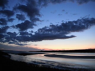
The Minas Basin is an inlet of the Bay of Fundy and a sub-basin of the Fundy Basin located in Nova Scotia, Canada. It is known for its extremely high tides.

Fall River is a suburban community located in Nova Scotia, Canada within the Halifax Regional Municipality. It is located north-northeast of the Bedford Basin, northeast of Bedford and Lower Sackville and north of Waverley.

<span class="mw-page-title-main">Shubenacadie Canal</span> Manmade watercourse in Canada

The Shubenacadie Canal is a canal in central Nova Scotia, Canada. It links Halifax Harbour with the Bay of Fundy by way of the Shubenacadie River and Shubenacadie Grand Lake. Begun in 1826, it was not completed until 1861 and was closed in 1871. Currently small craft use the river and lakes, but only one lock is operational. Three of the nine locks have been restored to preserve their unique fusion of British and North American construction techniques. More extensive restoration is planned.

<span class="mw-page-title-main">Nova Scotia Highway 102</span> Highway in Nova Scotia

Highway 102 is a north-south highway in the Canadian province of Nova Scotia that runs from Halifax to Onslow, immediately north of the town of Truro. It is the busiest highway in Atlantic Canada.

<span class="mw-page-title-main">Nova Scotia Highway 104</span> Highway in Nova Scotia

Highway 104 in Nova Scotia, Canada, runs from Fort Lawrence at the New Brunswick border near Amherst to River Tillard near St. Peter's. Except for the portion on Cape Breton Island between Port Hawkesbury and St. Peter's, it forms the main route of the Trans-Canada Highway across the province.

<span class="mw-page-title-main">Nova Scotia Highway 107</span> Highway in Nova Scotia

Highway 107 in Nova Scotia runs through the eastern suburbs of the Halifax Regional Municipality, from the Burnside Industrial Park in Dartmouth to an intersection with Trunk 7 in Musquodoboit Harbour. It is 43.2 km (26.8 mi) long, and is mostly two lane, controlled access highway.

The Shubenacadie Valley is a Canadian rural region in central Nova Scotia.

Nova Scotia Trunk 7 is part of the Canadian province of Nova Scotia's system of Trunk Highways. The route runs from Bedford to Antigonish, along the Eastern Shore for a distance of 269 kilometres (167 mi). Part of Trunk 7 is known as the Marine Drive.

<span class="mw-page-title-main">Nova Scotia Trunk 1</span> Highway in Nova Scotia

Trunk 1 is part of the Canadian province of Nova Scotia's system of Trunk Highways.

Nova Scotia Trunk 3 is an east-west trunk highway in Nova Scotia. The route runs from Halifax to Yarmouth, along the South Shore. Trunk 3's status as an important regional highway link has been superseded by the parallel Highway 103.

<span class="mw-page-title-main">Nova Scotia Trunk 4</span> Highway in Nova Scotia

Trunk 4 is part of the Canadian province of Nova Scotia's system of Trunk Highways. The route runs from Highway 104 exit 7 near Thomson Station to Glace Bay. Until the construction of the Trans-Canada Highway, Trunk 4 was a major traffic link in northern Nova Scotia and Cape Breton, and is still used on Cape Breton as an alternative to Highway 105. The highway was originally called the King's Highway, however, this name is no longer applied to the entire road. The only remaining historic section of the highway that maintains the name "King" is King's Road in Sydney.

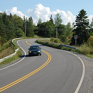
The Glooscap Trail is a scenic roadway in the Canadian province of Nova Scotia.

Nova Scotia Route 224

Route 224 is a collector road in the Canadian province of Nova Scotia. It is located in the Halifax Regional Municipality and Colchester County, connecting Sheet Harbour at Trunk 7 with Milford Station at Exit 9 of Highway 102 and Trunk 14. The route passes through the upper half of the Musquodoboit Valley.

The Fundy Shore Ecotour is a former scenic drive and network of tourist destinations in the Canadian province of Nova Scotia and encircles several sub-basins of the Bay of Fundy, which contains the highest tidal range on the planet.

Nova Scotia Route 215

Route 215 is collector road in the Canadian province of Nova Scotia.

The Bedford Highway is a highway in the Halifax Regional Municipality, Nova Scotia that is part of Trunk 2. It runs around the western side of the Bedford Basin. The highway starts at the Windsor Street intersection on the Halifax Peninsula and passes by the communities of Fairview, Rockingham, and Bedford, where it becomes part of Trunk 1 to Highway 101.

The Wentworth Valley is a valley in the Cobequid Mountains of northwestern Nova Scotia, Canada. It comprises the lowest elevation pass through the Cobequids. It was named after the colonial governor John Wentworth (1792-1808).

<span class="mw-page-title-main">Transportation in Halifax, Nova Scotia</span>

Halifax, Nova Scotia, is a major multi-modal transportation centre for freight and passengers in Atlantic Canada. Halifax, formally known as the Halifax Regional Municipality (HRM), is the capital and largest municipality of the Canadian province of Nova Scotia.

References

  1. 1 2 3 4 5 6 7 8 Google (January 28, 2020). "Nova Scotia Trunk 2" (Map). Google Maps . Google. Retrieved January 28, 2020.
  2. GM Johnson. "Halifax & Dartmouth" (Map). Halifax Street Map (2018 ed.). 1:25000. G.M. Johnson and Associates Ltd. §§ G-35, H-35. ISBN   978-1-77068-647-2.
  3. "Nova Scotia Trunk 2". Google Streetview . 2018. Retrieved January 28, 2020.
  4. Highway Map Nova Scotia (Map). Department of Highways, Nova Scotia. 1936.
  5. Highway Map Nova Scotia (Map). Department of Highways, Nova Scotia. 1938.
Preceded by Highway 2
Nova Scotia
Succeeded by
terminus