The Cabot Trail is a highway and scenic roadway in northern Victoria County and Inverness County on Cape Breton Island in Nova Scotia, Canada.
The Ceilidh Trail is a scenic roadway in the Canadian province of Nova Scotia.

Joggins is a Canadian rural community located in western Cumberland County, Nova Scotia. On July 7, 2008 a 15-km length of the coast constituting the Joggins Fossil Cliffs was officially inscribed on the World Heritage List.

Trunk 1 is part of the Canadian province of Nova Scotia's system of Trunk Highways.
Route 322 is a collector road in the Canadian province of Nova Scotia.
Trunk 8 is part of the Canadian province of Nova Scotia's system of Trunk Highways. The route runs from Liverpool to Annapolis Royal, a distance of 113 kilometres (70 mi). Trunk 8 is also known as the Kejimkujik Scenic Drive.
The Lighthouse Route is a scenic roadway in the Canadian province of Nova Scotia. It follows the province's South Shore for 585 km (364 mi) from Halifax to Yarmouth.
The Marconi Trail is a scenic roadway in the Canadian province of Nova Scotia.

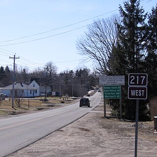
Route 217 is a collector road in the Canadian province of Nova Scotia.
The Glooscap Trail is a scenic roadway in the Canadian province of Nova Scotia.
The Bras d'Or Lakes Scenic Drive is a scenic roadway on Nova Scotia's Cape Breton Island. It extends around the perimeter of Bras d'Or Lake.

Route 209 is a collector road in the Canadian province of Nova Scotia.
The Fundy Shore Ecotour is a former scenic drive and network of tourist destinations in the Canadian province of Nova Scotia and encircles several sub-basins of the Bay of Fundy, which contains the highest tidal range on the planet.

Route 302 is a collector road in the Canadian province of Nova Scotia.
The Maccan River is a small tidal river contained completely within Cumberland County, Nova Scotia. The river terminates at the confluence of River Hebert at Amherst Point, and empties into the Cumberland Basin. The river's tidal bore may be viewed from the Tidal Wetlands Park in Maccan. According to estimates by the Province of Nova Scotia, there are 9,092 people resident within the Maccan/Kelly/Hebert watershed in 2011.

Maccan is a small community in the Canadian province of Nova Scotia, located in Cumberland County 10 minutes away from Amherst, Nova Scotia on Route 302.

The Joggins Formation is a geologic formation in Nova Scotia. It preserves fossils dating back to the Carboniferous period, including Hylonomus, the earliest known reptile. In addition to fossils, the Joggins Formation was a valuable source of coal from the 17th century until the mid-20th century.

Nova Scotia has two major national parks, Cape Breton Highlands National Park and Kejimkujik National Park. Nova Scotia is also home to three UNESCO world heritage sites. The two cultural and one natural site are the town of Old Lunenberg, the Grand-Pré National Historic Site, and the Joggins fossil cliffs. Nova Scotia is also famous for its numerous historical sites, museums, and natural areas.
The Fundy Shore Scenic Drive is a scenic drive in the Canadian province of Nova Scotia. It located along the northeastern portion of the Bay of Fundy, following the Chignecto Peninsula which separates Chignecto Bay and Minas Basin, an area which contains the highest tidal range on the planet.


