| Highway | Length (km) | Length (mi) | Destinations | Notes |
|---|
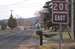
 Route 201 Route 201 | 38 | 24 | Annapolis Royal - Bridgetown - Lawrencetown - Middleton - Greenwood - Kingston | |
 Route 202 Route 202 | 38 | 24 | Mount Uniacke - Upper Rawdon - Nine Mile River | |
 Route 203 Route 203 | 83 | 52 | Carleton - Welshtown - Shelburne | |
 Route 204 Route 204 | 54 | 34 | Amherst - Salem - Streets Ridge | |
 Route 205 Route 205 | 9 | 5.6 | Baddeck - MacAulays Hill | |
 Route 206 Route 206 | 12 | 7.5 | Arichat - West Arichat - Martinique | |
 Route 207 Route 207 | 39 | 24 | Dartmouth - Cole Harbour - Upper Lawerencetown - West Lawerencetown - Lawerencetown - Porters Lake | |
 Route 208 Route 208 | 38 | 24 | South Brookfield - Colpton - Nineveh - New Germany | |
 Route 209 Route 209 | 98 | 61 | Parrsboro - Advocate Harbour - Joggins | |
 Route 210 Route 210 | 32 | 20 | Greenfield - Chelsea - Newcombville | |
 Route 211 Route 211 | 35 | 22 | Isaac's Harbour North - Stormont II (Country Harbour Ferry) - Port Bickerton - Stillwater | |
 Route 212 Route 212 | 31 | 19 | Halifax Stanfield International Airport - Goffs - Elderbank | |
 Route 213 Route 213 | 22 | 14 | Upper Tantallon - Hammonds Plains - Bedford | |
 Route 214 Route 214 | 10 | 6.2 | Elmsdale - Belnan - Lower Nine Mile River | |
 Route 215 Route 215 | 120 | 75 | Newport Corner - Noel - Maitland - Shubenacadie | |
 Route 216 Route 216 | 42 | 26 | Christmas Island - Eskasoni - East Bay | |
 Route 217 Route 217 | 64 | 40 | Freeport - East Ferry - Tiddville - Digby | |
 Route 219 Route 219 | 20 | 12 | Dunvegan - Margaree Harbour | |
 Route 221 Route 221 | 63 | 39 | Kingsport - Canning - Centreville- Spa Springs | |
 Route 223 Route 223 | 72 | 45 | North Side Whycocomagh Bay - Grand Narrows - Christmas Island - Leitches Creek Station | |
 Route 224 Route 224 | 96 | 60 | Shubenacadie - Gays River - Middle Musquodoboit - Upper Musquodoboit - Sheet Harbour | |
 Route 236 Route 236 | 77 | 48 | Scotch Village - Kennetcook - Green Oaks - Truro | |
 Route 239 Route 239 | 14 | 8.7 | North West Arm - Edwardsville - Westmount | |
 Route 242 Route 242 | 16 | 9.9 | Joggins - River Hebert - Maccan | |
 Route 245 Route 245 | 63 | 39 | Sutherlands River - Malignant Cove - Antigonish | |
 Route 246 Route 246 | 25 | 16 | Wentworth - West New Annan - Tatamagouche | |
 Route 247 Route 247 | 11 | 6.8 | St. Peters - Grand River - Lower L'Ardoise | |
 Route 252 Route 252 | 28 | 17 | Mabou - Skye Glen - Whycocomagh | |
 Route 253 Route 253 | 12 | 7.5 | Armdale - Purcell's Cove - Herring Cove | |
 Route 255 Route 255 | 35 | 22 | Glace Bay - Mira Gut - Hornes Road | |
 Route 256 Route 256 | 49 | 30 | West New Annan - The Falls - River John - Lyons Brook | |
 Route 276 Route 276 | 5 | 3.1 | South Lochaber - Goshen | |
 Route 277 Route 277 | 15 | 9.3 | Lantz - Dutch Settlement - Gays River | |
 Route 289 Route 289 | 98 | 61 | Green Oaks - Brookfield - Middle Stewiacke - Upper Stewiacke - Lansdowne - Westville - New Glasgow - Little Harbour | |
 Route 301 Route 301 | 17 | 11 | Oxford - Kolbec - Port Howe | |
 Route 302 Route 302 | 23 | 14 | Southampton - Athol - Maccan - Nappan | |
 Route 303 Route 303 | 11 | 6.8 | Conway - Digby - Digby Ferry | |
 Route 304 Route 304 | 10 | 6.2 | Yarmouth, Yarmouth Bar, Cape Forchu, Yarmouth Light | |
 Route 305 Route 305 | 27 | 17 | Boularderie East - North Sydney - Sydney - Sydney Mines | |
 Route 306 Route 306 | 19 | 12 | Spryfield - Harrietsfield - Williamswood - Sambro | |
 Route 307 Route 307 | 19 | 12 | Wentworth Centre via Wentworth Valley - Six Mile Road - Wallace Station - Wallace | |
 Route 308 Route 308 | 45 | 28 | Morris Island - Surette's Island - Amiraults Hill - Tusket - Quinan | |
 Route 309 Route 309 | 29 | 18 | Barrington - Eel Bay - Clyde River | |
 Route 311 Route 311 | 49 | 30 | Truro - North River - Nuttby - Earltown - Tatamagouche | |
 Route 312 Route 312 | 13 | 8.1 | South Haven - Englishtown - River Bennet | |
 Route 316 Route 316 | 132 | 82 | Half Island Cove - Larry's River - Goldboro - Cross Roads Country Harbour - Goshen - Frasers Mills - St. Andrews - Lower South River | |
 Route 318 Route 318 | 11 | 6.8 | Dartmouth - Port Wallace - Portobello - Waverley | |
 Route 320 Route 320 | 23 | 14 | Arichat - Martinique - Lennox Passage - Louisdale | |
 Route 321 Route 321 | 38 | 24 | Springhill - River Philip - Oxford - Kolbec - Port Howe | |
 Route 322 Route 322 | 22 | 14 | Dartmouth - Woodside - Shearwater - Eastern Passage - Cole Harbour | |
 Route 324 Route 324 | 11 | 6.8 | Lunenburg - Fauxburg - Blockhouse | |
 Route 325 Route 325 | 46 | 29 | Colpton - Wileville - Bridgewater - Maitland - Blockhouse - Mahone Bay | |
 Route 326 Route 326 | 19 | 12 | Earltown - Denmark - Brule Corner | |
 Route 327 Route 327 | 44 | 27 | Gabarus - Big Ridge - Marion Bridge - Membertou - Sydney | |
 Route 328 Route 328 | 3 | 1.9 | Upper Lawrencetown - Lake Major | |
 Route 329 Route 329 | 42 | 26 | East River - Bayswater - Northwest Cove - Mill Cove - Hubbards | |
 Route 330 Route 330 | 17 | 11 | Cape Sable Island - Clarks Harbour - Barrington Passage | |
 Route 331 Route 331 | 57 | 35 | East Port Medway - Petite Riviere - Dublin Shore - LaHave - Pleasantville - Bridgewater | |
 Route 332 Route 332 | 37 | 23 | Upper LaHave - Riverport - Lunenburg | |
 Route 333 Route 333 | 63 | 39 | Beechville - Hatchet Lake - Peggys Cove - Upper Tantallon | |
 Route 334 Route 334 | 20 | 12 | Lower Wedgeport - Arcadia | |
 Route 335 Route 335 | 14 | 8.7 | Lower West Pubnico - Pubnico | |
 Route 336 Route 336 | 23 | 14 | Upper Musquodoboit - Dean - Springside | |
 Route 337 Route 337 | 52 | 32 | Antigonish - Cape George - Malignant Cove | |
 Route 340 Route 340 | 80 | 50 | Hebron - Carleton - Pleasant Valley - Weymouth | |
 Route 341 Route 341 | 10 | 6.2 | Kentville - Canard | |
 Route 344 Route 344 | 47 | 29 | Auld's Cove - Mulgrave - Sand Point - St. Francis Harbour - Boylston | |
 Route 347 Route 347 | 66 | 41 | New Glasgow - Priestville - Garden of Eden - Aspen | |
 Route 348 Route 348 | 101 | 63 | Little Harbour - Pictou Landing - Trenton - New Glasgow - Glenelg - Melrose | |
 Route 349 Route 349 | 25 | 16 | Armdale - Spryfield - Herring Cove - Sambro | |
 Route 354 Route 354 | 70 | 43 | Middle Sackville - Beaver Bank - Upper Rawdon - Gore - Kennetcook - Noel | |
 Route 357 Route 357 | 39 | 24 | Musquodoboit Harbour - Meaghers Grant - Elderbank - Middle Musquodoboit | |
 Route 358 Route 358 | 30 | 19 | Greenwich - Canard - Canning - The Lookoff - Scots Bay | |
 Route 359 Route 359 | 16 | 9.9 | Kentville - Aldershot - Centreville - Halls Harbour | |
 Route 360 Route 360 | 22 | 14 | Morristown - Berwick - Welsford - Harbourville | |
 Route 362 Route 362 | 47 | 29 | Middleton - Spa Springs - Margaretsville - East Margaretsville | |
 Route 366 Route 366 | 47 | 29 | East Amherst - Tidnish Bridge - Lorneville - Northport - Port Howe | |
 Route 368 Route 368 | 17 | 11 | Mahoneys Corner - Streets Ridge - Middleboro - Head of Wallace Bay | |
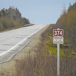
 Route 374 Route 374 | 86 | 53 | New Glasgow - Stellarton - Lorne - Trafalgar - Sheet Harbour | |
 Route 376 Route 376 | 17 | 11 | West River - Haliburton | |
 Route 395 Route 395 | 37 | 23 | Southwest Margaree - Upper Margaree - Ainslie Glen - Churchview | |
|