
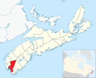
Shelburne County is a county in the Canadian province of Nova Scotia.
Argyle, officially named the Municipality of the District of Argyle, is a district municipality in Yarmouth County, Nova Scotia. Statistics Canada classifies the district municipality as a municipal district.
Barrington, officially named the Municipality of the District of Barrington, is a district municipality in western Shelburne County, Nova Scotia, Canada. Statistics Canada classifies the district municipality as a municipal district.
Highway 103 is an east-west highway in Nova Scotia that runs from Halifax to Yarmouth.

Shelburne, officially named the Municipality of the District of Shelburne, is a district municipality comprising the eastern section of Shelburne County, Nova Scotia, Canada. Statistics Canada classifies the district municipality as a municipal district.
The Tobeatic Wilderness Area, located in Nova Scotia, Canada, is the largest protected area in the Canadian Maritimes. It is in the south western central part of the province, near Kejimkujik National Park. It was formerly known as the Tobeatic Wildlife Management Area, and the Tobeatic Game Reserve.

Trunk 1 is part of the Canadian province of Nova Scotia's system of Trunk Highways.
Nova Scotia Trunk 3 is an east-west trunk highway in Nova Scotia. The route runs from Halifax to Yarmouth, along the South Shore. Trunk 3's status as an important regional highway link has been superseded by the parallel Highway 103.

Yarmouth, officially named the Municipality of the District of Yarmouth, is a district municipality in Yarmouth County, Nova Scotia, Canada. Statistics Canada classifies the district municipality as a municipal district.
The Lighthouse Route is a scenic roadway in the Canadian province of Nova Scotia. It follows the province's South Shore for 585 km (364 mi) from Halifax to Yarmouth.

Route 309 is a collector road in the Canadian province of Nova Scotia.
The Shelburne River is a 53 km long river in Nova Scotia, Canada. It is a wilderness river and is a tributary of Mersey River. It starts in the Tobeatic Wilderness Area.

Kemptville is a rural community in the Canadian province of Nova Scotia, located in the Yarmouth Municipal District and Yarmouth County. It is located approximately 38 kilometers northeast of the town of Yarmouth.
East Kemptville is a community in the Canadian province of Nova Scotia, located in the Argyle Municipal District. East Kemptville is the site of Trout Point Lodge, Relais & Chateaux, a wilderness resort, as well as a now-closed tin mine owned by Rio Algom. East Kemptville is a practical exclave of Argyle, as it cannot be directly accessed by road from the rest of Argyle except through the Municipality of Yarmouth or the Municipality of Shelburne.

The Tusket River is a Canadian river located in Nova Scotia's Yarmouth County.
Indian Fields, Nova Scotia is an unincorporated community and provincial park reserve in the Municipality of the District of Shelburne, Nova Scotia, Canada, on Route 203 at an elevation of about 70m. There is an area of meadows. The few households that make up the community are not serviced by Nova Scotia Power. There is an abandoned airfield near the junction of Indian Fields Road and Route 203.
The Southwest Nova Biosphere Reserve was designated in 2001 under the UNESCO Man and the Biosphere Programme. The Southwest Nova Biosphere Reserve spans a total of 1.5 million hectares consisting of five counties in Nova Scotia, Canada: Annapolis, Digby, Queens, Shelburne and Yarmouth. The core protected areas of the biosphere reserve are Kejimkujik National Park and the Tobeatic Wilderness Area.
Southern Nova Scotia or the South Shore is a region of Nova Scotia, Canada. The area has no formal identity and is variously defined by geographic, county and other political boundaries. Statistics Canada, defines Southern Nova Scotia as an economic region, composed of Lunenburg County, Queens County, Shelburne County, Yarmouth County, and Digby County. According to Statistics Canada, the region had the highest decrease of population in Canada from 2009 to 2010, with a -10.2% growth rate per thousand. The region also has the second highest median age in Canada at 47.1 years old.