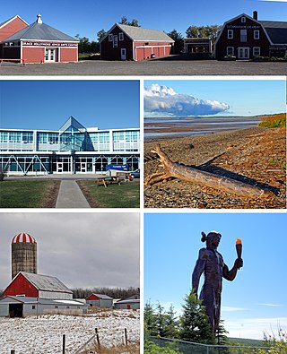
Colchester County is a county in the Canadian province of Nova Scotia. With a population of 51,476 the county is the fourth largest in Nova Scotia. Colchester County is located in north central Nova Scotia.

Cumberland County is a county in the Canadian province of Nova Scotia.
Highway 103 is an east-west highway in Nova Scotia that runs from Halifax to Yarmouth.
Highway 101 is an east-west highway in Nova Scotia that runs from Bedford to Yarmouth.
Highway 102 is a north–south highway in the Canadian province of Nova Scotia that runs from Halifax to Onslow, immediately north of the town of Truro. It is the busiest highway in Atlantic Canada.
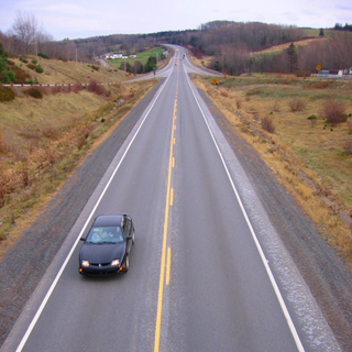
Highway 104 in Nova Scotia, Canada, runs from Fort Lawrence at the New Brunswick border near Amherst to River Tillard near St. Peter's. Except for the portion on Cape Breton Island between Port Hawkesbury and St. Peter's, it forms the main route of the Trans-Canada Highway across the province.
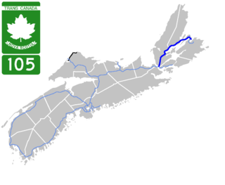
Highway 105 in Nova Scotia represents the Cape Breton Island leg of the Trans-Canada Highway. It runs from the Port Hastings Rotary just east of the Canso Causeway in Port Hastings to the Marine Atlantic ferry terminal in North Sydney, representing a distance of 142 kilometres (88 mi).
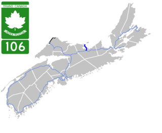
Highway 106 is a 19 km (12 mi) 2-lane limited-access highway located within Pictou County, in the Canadian province of Nova Scotia. The provincial government named the highway the Jubilee Highway on December 21, 2012 in honour of Queen Elizabeth II's Diamond Jubilee.

Highway 107 in Nova Scotia runs through the eastern suburbs of the Halifax Regional Municipality, from the Bedford, Nova Scotia-Lower Sackville Border Line off Nova Scotia Highway 107 an intersection with Trunk 7 in Musquodoboit Harbour. It is 52.1 km (32.4 mi) long, and is mostly two lane, controlled access highway.
Nova Scotia Trunk 7 is part of the Canadian province of Nova Scotia's system of Trunk Highways. The route runs from Bedford to Antigonish, along the Eastern Shore for a distance of 269 kilometres (167 mi). Part of Trunk 7 is known as the Marine Drive.

Trunk 4 is part of the Canadian province of Nova Scotia's system of Trunk Highways. The route runs from Highway 104 exit 7 near Thomson Station to Glace Bay. Until the construction of the Trans-Canada Highway, Trunk 4 was a major traffic link in northern Nova Scotia and Cape Breton, and is still used on Cape Breton as an alternative to Highway 105. The highway was originally called the King's Highway, however, this name is no longer applied to the entire road. The only remaining historic section of the highway that maintains the name "King" is King's Road in Sydney.
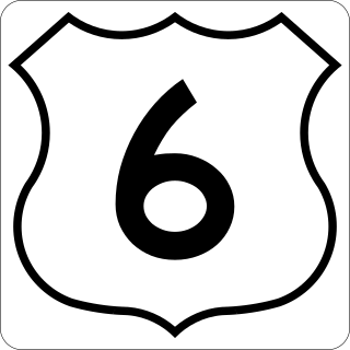
Trunk 6 is part of the Canadian province of Nova Scotia's system of trunk highways. The route runs from Highway 104 exit 3 at Amherst to the rotary at Pictou, a distance of 136 kilometres (85 mi). It is part of the Sunrise Trail, a designated tourist route.
The Sunrise Trail is a scenic roadway in the Canadian province of Nova Scotia. It is located along the province's North Shore on the Northumberland Strait for 333 km (207 mi) from Amherst to the Canso Causeway.

Route 256 is a collector road in the Canadian province of Nova Scotia.

Route 302 is a collector road in the Canadian province of Nova Scotia.
Route 307 is a collector road in the Canadian province of Nova Scotia.
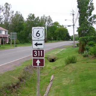
Route 311 is a collector road in the Canadian province of Nova Scotia.
Oliver is a community in the Canadian province of Nova Scotia, located in Colchester County on Nova Scotia Route 246. It is in the valley of the French River and surrounded by the communities of Tatamagouche, New Truro Road, Central New Annan, West New Annan, Millbrook and French River.
