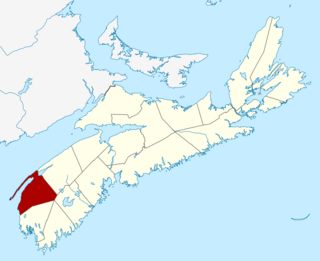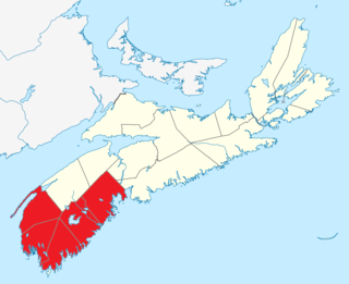
Annapolis County is a county in the Canadian province of Nova Scotia located in the western part of the province located on the Bay of Fundy. The county seat is Annapolis Royal.

Digby County is a county in the Canadian province of Nova Scotia.
Route 2 is a major provincial highway in the Canadian province of New Brunswick, carrying the main route of the Trans-Canada Highway in the province. The highway connects with Autoroute 85 at the border with Quebec and Highway 104 at the border with Nova Scotia, as well as with traffic from Interstate 95 in the U.S. state of Maine via the short Route 95 connector. A core route in the National Highway System, Route 2 is a four-lane freeway in its entirety, and directly serves the cities of Edmundston, Fredericton, and Moncton.
Brier Island is an island in the Bay of Fundy in Digby County, Nova Scotia.

The Annapolis Basin is a sub-basin of the Bay of Fundy, located on the bay's southeastern shores, along the northwestern shore of Nova Scotia and at the western end of the Annapolis Valley.
Freeport is a village in Digby County, Nova Scotia and it is located on Long Island in the Bay of Fundy.

District of Shelburne, officially named the Municipality of the District of Shelburne, is a district municipality comprising the eastern section of Shelburne County, Nova Scotia, Canada, but does not include the Towns of Shelburne or Lockeport. Statistics Canada classifies the district municipality as a municipal district. It is home to the Bowers Meadows Wilderness Area.

Trunk 1 is part of the Canadian province of Nova Scotia's system of Trunk Highways.
The Lighthouse Route is a scenic roadway in the Canadian province of Nova Scotia. It follows the province's South Shore for 585 km (364 mi) from Halifax to Yarmouth.
The Bras d'Or Lakes Scenic Drive is a scenic roadway on Nova Scotia's Cape Breton Island. It extends around the perimeter of Bras d'Or Lake.
Route 216 is a collector road in the Canadian province of Nova Scotia.

St. Marys Bay south western Nova Scotia, Canada, is surrounded by the modern municipal districts of Clare Municipal District and Digby.

Long Island is a Canadian island in Digby County, Nova Scotia.
Digby Neck is a Canadian peninsula extending into the Bay of Fundy in Digby County, Nova Scotia.

Digby, officially named the Municipality of the District of Digby, is a district municipality in Digby County, Nova Scotia, Canada. Statistics Canada classifies the district municipality as a municipal district.
Smith's Cove is a community in the Canadian province of Nova Scotia, located in the Municipality of the District of Digby. in Digby County. It is one of several villages in the Annapolis Valley district of Nova Scotia.

Southern Nova Scotia or the South Shore is a region of Nova Scotia, Canada. The area has no formal identity and is variously defined by geographic, county and other political boundaries. Statistics Canada, defines Southern Nova Scotia as an economic region, composed of Lunenburg County, Queens County, Shelburne County, Yarmouth County, and Digby County. According to Statistics Canada, the region had the highest decrease of population in Canada from 2009 to 2010, with a population decrease of 10.2 residents per thousand. The region also has the second-highest median age in Canada at 47.1 years old.

Route 470, also known as La Poile Highway, is a highway on the West Coast of the Canadian province of Newfoundland and Labrador. It is the last provincial highway off Route 1 before approaching the Marine Atlantic Ferry to Nova Scotia, in Channel-Port aux Basques. The route is 42.8 kilometres (26.6 mi) in length. During much of the journey, there is plenty of barren land on both sides of the road, until arriving at its final community, Rose Blanche. Route 470 also carries the designation of Granite Coast Scenic Drive.


