Route 239 | ||||
---|---|---|---|---|
Route information | ||||
Maintained by Nova Scotia Department of Transportation and Infrastructure Renewal | ||||
Length | 14.0 km [1] (8.7 mi) | |||
Major junctions | ||||
West end | ||||
East end | ||||
Location | ||||
Counties | Cape Breton Regional Municipality | |||
Highway system | ||||
Provincial highways in Nova Scotia
|
Route 239 is a collector road in the Canadian province of Nova Scotia.
Canada is a country in the northern part of North America. Its ten provinces and three territories extend from the Atlantic to the Pacific and northward into the Arctic Ocean, covering 9.98 million square kilometres, making it the world's second-largest country by total area. Canada's southern border with the United States, stretching some 8,891 kilometres (5,525 mi), is the world's longest bi-national land border. Its capital is Ottawa, and its three largest metropolitan areas are Toronto, Montreal, and Vancouver. As a whole, Canada is sparsely populated, the majority of its land area being dominated by forest and tundra. Consequently, its population is highly urbanized, with over 80 percent of its inhabitants concentrated in large and medium-sized cities, with 70% of citizens residing within 100 kilometres (62 mi) of the southern border. Canada's climate varies widely across its vast area, ranging from arctic weather in the north, to hot summers in the southern regions, with four distinct seasons.
Nova Scotia is one of Canada's three Maritime Provinces, and one of the four provinces that form Atlantic Canada. Its provincial capital is Halifax. Nova Scotia is the second-smallest of Canada's ten provinces, with an area of 55,284 square kilometres (21,300 sq mi), including Cape Breton and another 3,800 coastal islands. As of 2016, the population was 923,598. Nova Scotia is Canada's second-most-densely populated province, after Prince Edward Island, with 17.4 inhabitants per square kilometre (45/sq mi).
It is located in the Cape Breton Regional Municipality and connects Gibbon at Route 305 with North West Arm at Route 305.
Cape Breton Regional Municipality, often referred to as simply CBRM, is the Canadian province of Nova Scotia's second largest municipality and the economic heart of Cape Breton Island. As of 2016 the municipality has a population of 94,285. The municipality was created in 1995 through the amalgamation of eight municipalities located in Cape Breton County.
Route 305 is a collector road in the Canadian province of Nova Scotia.
North West Arm is a community in the Canadian province of Nova Scotia, located in the Cape Breton Regional Municipality.
Local residents often refer to the road as the "Edwardsville Highway" or the "Westmount Road."
Westmount is a suburban community in the Cape Breton Regional Municipality.
Edwardsville is a community in the Canadian province of Nova Scotia, located in the Cape Breton Regional Municipality on Cape Breton Island.
Point Edward is a community in Nova Scotia's Cape Breton Regional Municipality.
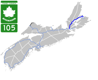
Highway 105 in Nova Scotia represents the Cape Breton Island leg of the Trans-Canada Highway. It runs from the Port Hastings Rotary just east of the Canso Causeway in Port Hastings to the Marine Atlantic ferry terminal in North Sydney, representing a distance of 142 kilometres (88 mi).
Cape Breton South is a former provincial electoral district in Nova Scotia, Canada which existed from 1933-2013. It elected one member of the Nova Scotia House of Assembly. In its last configuration, the district included Sydney and its western suburbs until the North West Arm and south along the Sydney River until Blacketts Lake.
Route 374 is a collector road in the Canadian province of Nova Scotia. It connects New Glasgow at Exit 24 of Nova Scotia Highway 104 with Sheet Harbour at Trunk 7. The highway runs through the Halifax Regional Municipality, Guysborough County & Pictou County.
Trunk 8 is part of the Canadian province of Nova Scotia's system of Trunk Highways. The route runs from Liverpool to Annapolis Royal, a distance of 115 kilometres (71 mi). Trunk 8 is also known as the Kejimkujik Scenic Drive.
Route 318 is a collector road in the Canadian province of Nova Scotia.
Route 289 is a collector road in the Canadian province of Nova Scotia.
Route 206 is a collector road in the Canadian province of Nova Scotia.
Route 376 is a collector road in the Canadian province of Nova Scotia.
Route 223 is a collector road in the Canadian province of Nova Scotia.
Route 246 is a collector road in the Canadian province of Nova Scotia.
Route 256 is a collector road in the Canadian province of Nova Scotia.
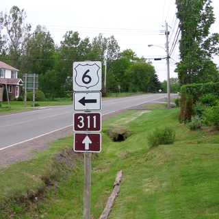
Route 311 is a collector road in the Canadian province of Nova Scotia.
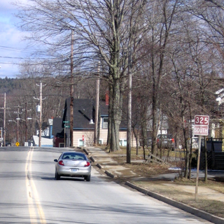
Route 325 is a collector road in the Canadian province of Nova Scotia. It is located in Lunenburg County and connects Colpton at Route 208 with Mahone Bay at Trunk 3.
Route 331 is a collector road in the Canadian province of Nova Scotia.
Route 348 is a collector road in the Canadian province of Nova Scotia.
Halifax Armdale is a provincial electoral district in Nova Scotia, Canada, that elects one member of the Nova Scotia House of Assembly. This Halifax district covers the growing population of the Fairmount, Armdale and Cowie Hill areas. The northern boundary is Highway 102, the eastern boundary is Joseph Howe Drive and the Northwest Arm, while the southern boundary is Frog Pond Park in Armdale.
Northside-Westmount is a provincial electoral district in Nova Scotia, Canada, that elects one member of the Nova Scotia House of Assembly.
This Nova Scotia road, road transport or highway-related article is a stub. You can help Wikipedia by expanding it. |