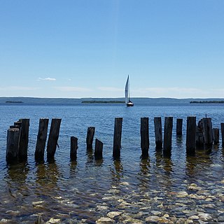
Nova Scotia Route 305

Last updated

Nova Scotia Route 305.svg

Route 305
Route information
Maintained by Nova Scotia Department of Transportation and Infrastructure Renewal
Length 27 km [1] (17 mi)
Major junctions
South endNova Scotia 4.svg Trunk 4 in Sydney River
 Nova Scotia Route 239.svg Route 239 in Westmount
Nova Scotia 125.svg Hwy 125 in Leitches Creek Station
North endNova Scotia Highway 105 (TCH).png Hwy 105 (TCH) in Little Bras d'Or
Location
Counties Cape Breton Regional Municipality
Highway system

Provincial highways in Nova Scotia

Nova Scotia Route 304.svg Route 304 Route 306 Nova Scotia Route 306.svg

Route 305 is a collector road in the Canadian province of Nova Scotia.

Canada Country in North America

Canada is a country in the northern part of North America. Its ten provinces and three territories extend from the Atlantic to the Pacific and northward into the Arctic Ocean, covering 9.98 million square kilometres, making it the world's second-largest country by total area. Canada's southern border with the United States, stretching some 8,891 kilometres (5,525 mi), is the world's longest bi-national land border. Its capital is Ottawa, and its three largest metropolitan areas are Toronto, Montreal, and Vancouver. As a whole, Canada is sparsely populated, the majority of its land area being dominated by forest and tundra. Consequently, its population is highly urbanized, with over 80 percent of its inhabitants concentrated in large and medium-sized cities, with 70% of citizens residing within 100 kilometres (62 mi) of the southern border. Canada's climate varies widely across its vast area, ranging from arctic weather in the north, to hot summers in the southern regions, with four distinct seasons.
Nova Scotia Province of Canada

Nova Scotia is one of Canada's three Maritime Provinces, and one of the four provinces that form Atlantic Canada. Its provincial capital is Halifax. Nova Scotia is the second-smallest of Canada's ten provinces, with an area of 55,284 square kilometres (21,300 sq mi), including Cape Breton and another 3,800 coastal islands. As of 2016, the population was 923,598. Nova Scotia is Canada's second-most-densely populated province, after Prince Edward Island, with 17.4 inhabitants per square kilometre (45/sq mi).

Contents

It is located in the Cape Breton Regional Municipality and connects Little Bras d'Or at Highway 105 with Westmount at Trunk 4. It was originally known as Trunk 5 until 1970. In the 1960s between Point Edward and Sydney River this highway was also used for Nova Scotia Highway 125.

Cape Breton Regional Municipality Regional Municipality in Nova Scotia, Canada

Cape Breton Regional Municipality, often referred to as simply CBRM, is the Canadian province of Nova Scotia's second largest municipality and the economic heart of Cape Breton Island. As of 2016 the municipality has a population of 94,285. The municipality was created in 1995 through the amalgamation of eight municipalities located in Cape Breton County.
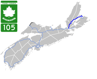
Nova Scotia Highway 105 highway in Nova Scotia

Highway 105 in Nova Scotia represents the Cape Breton Island leg of the Trans-Canada Highway. It runs from the Port Hastings Rotary just east of the Canso Causeway in Port Hastings to the Marine Atlantic ferry terminal in North Sydney, representing a distance of 142 kilometres (88 mi).

Westmount is a suburban community in the Cape Breton Regional Municipality.

Communities

Florence, Nova Scotia

Florence is a community in the Cape Breton Regional Municipality, Nova Scotia, Canada. The community is located north of Highway 105 and west of Sydney Mines.

North Sydney, Nova Scotia Community in Nova Scotia, Canada

North Sydney is a former town and current community in Nova Scotia's Cape Breton Regional Municipality.
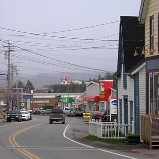
Coxheath, Nova Scotia Community in Nova Scotia, Canada

Coxheath is a community in the Canadian province of Nova Scotia, located north of the Sydney River in the Cape Breton Regional Municipality on Cape Breton Island. The community is home to Riverview Rural High School, a secondary school with approximately 900 students in Grades 10-12 and Coxheath Elementary.

See also

Related Research Articles

Cape Breton Island Island in Nova Scotia

Cape Breton Island is an island on the Atlantic coast of North America and part of the province of Nova Scotia, Canada.

Cabot Trail highway in Nova Scotia

The Cabot Trail is a highway and scenic roadway in northern Victoria County and Inverness County on Cape Breton Island in Nova Scotia, Canada.

Bras dOr Lake Lake in Nova Scotia, Canada

Bras d'Or Lake is an inland sea, or large body of partially fresh/salt water in the centre of Cape Breton Island in the province of Nova Scotia, Canada. Bras d'Or Lake is sometimes referred to as the Bras d'Or Lakes or the Bras d'Or Lakes system; however, its official geographic name is Bras d'Or Lake, as it is a singular entity. Canadian author and yachtsman Silver Donald Cameron describes Bras d'Or Lake as "A basin ringed by indigo hills laced with marble. Islands within a sea inside an island." The lake is connected to the North Atlantic by natural channels; the Great Bras d'Or Channel north of Boularderie Island and the Little Bras d'Or Channel to south of Boularderie Island connect the northeastern arm of the lake to the Cabot Strait. The Bras d'Or is also connected to the Atlantic Ocean via the Strait of Canso by means of a lock canal completed in 1869—the St. Peters Canal, at the southern tip of the lake.

St. Peters, Nova Scotia Village in Nova Scotia, Canada

St. Peter's is a small incorporated village located on Cape Breton Island in Richmond County, Nova Scotia, Canada.

Nova Scotia Highway 104 highway in Nova Scotia

Highway 104 in Nova Scotia, Canada, runs from Fort Lawrence at the New Brunswick border near Amherst to River Tillard near St. Peter's. Except for the portion on Cape Breton Island between Port Hawkesbury and St. Peter's, it is part of the Trans-Canada Highway.

Nova Scotia Highway 125 highway in Nova Scotia

Highway 125 is a 28 km long controlled-access highway located in Nova Scotia's Cape Breton Regional Municipality. The provincial government named it Peacekeepers Way on August 18, 2008. Part of the provincial 100-series arterial highway network, Highway 125 encircles the west side of Sydney Harbour, from an interchange with Highway 105 at Sydney Mines to Trunk 4 immediately east of Sydney.

Nova Scotia Trunk 7 is part of the Canadian province of Nova Scotia's system of Trunk Highways. The route runs from Bedford to Antigonish, along the Eastern Shore for a distance of 269 kilometres (167 mi). Part of Trunk 7 is known as the Marine Drive.

Trunk 4 is part of the Canadian province of Nova Scotia's system of Trunk Highways. The route runs from Highway 104 exit 7 at Thomson Station to Glace Bay. Until the construction of the Trans-Canada Highway, Trunk 4 was a major traffic link in northern Nova Scotia and Cape Breton, and is still used on Cape Breton as an alternative to Highway 105. The highway was originally called the King's Highway, however, this name is no longer applied to the entire road. The only remaining historic section of the highway that maintains the name "King" is King's Road in Sydney.

Trunk 22 is part of the Canadian province of Nova Scotia's system of trunk highways. The route runs from Sydney to Louisbourg, a distance of 37 kilometres.

100-series highways (Nova Scotia) highway system in Nova Scotia

The 100-Series Highways are a series of arterial highways in the Canadian province of Nova Scotia.

Route 204 is a collector road in the Canadian province of Nova Scotia.

Route 216 is a collector road in the Canadian province of Nova Scotia.

Route 376 is a collector road in the Canadian province of Nova Scotia.

Route 223 is a collector road in the Canadian province of Nova Scotia.

Route 239 is a collector road in the Canadian province of Nova Scotia.

Route 327 is a collector road in the Canadian province of Nova Scotia.

Northside-Westmount

Northside-Westmount is a provincial electoral district in Nova Scotia, Canada, that elects one member of the Nova Scotia House of Assembly.

References

  1. Atlantic Canada Back Road Atlas ISBN   978-1-55368-618-7 Page 42