Nova Scotia Route 330

Last updated

Nova Scotia Route 330.svg

Route 330
Route information
Maintained by Nova Scotia Department of Transportation and Infrastructure Renewal
Length 17 km [1] (11 mi)
Major junctions
South end Hawk Point Road in Lower Clarks Harbour
North endNova Scotia 3.svg Trunk 3 in Barrington Passage
Location
Counties Shelburne
Highway system

Provincial highways in Nova Scotia

Nova Scotia Route 329.svg Route 329 Route 331 Nova Scotia Route 331.svg

Route 330 is a collector road in the Canadian province of Nova Scotia.

Canada Country in North America

Canada is a country in the northern part of North America. Its ten provinces and three territories extend from the Atlantic to the Pacific and northward into the Arctic Ocean, covering 9.98 million square kilometres, making it the world's second-largest country by total area. Canada's southern border with the United States, stretching some 8,891 kilometres (5,525 mi), is the world's longest bi-national land border. Its capital is Ottawa, and its three largest metropolitan areas are Toronto, Montreal, and Vancouver. As a whole, Canada is sparsely populated, the majority of its land area being dominated by forest and tundra. Consequently, its population is highly urbanized, with over 80 percent of its inhabitants concentrated in large and medium-sized cities, with 70% of citizens residing within 100 kilometres (62 mi) of the southern border. Canada's climate varies widely across its vast area, ranging from arctic weather in the north, to hot summers in the southern regions, with four distinct seasons.

Nova Scotia Province of Canada

Nova Scotia is one of Canada's three Maritime Provinces, and one of the four provinces that form Atlantic Canada. Its provincial capital is Halifax. Nova Scotia is the second-smallest of Canada's ten provinces, with an area of 55,284 square kilometres (21,300 sq mi), including Cape Breton and another 3,800 coastal islands. As of 2016, the population was 923,598. Nova Scotia is Canada's second-most-densely populated province, after Prince Edward Island, with 17.4 inhabitants per square kilometre (45/sq mi).

Contents

It is located in Shelburne County and connects Barrington Passage at Trunk 3 with Clark's Harbour.

Shelburne County, Nova Scotia County in Nova Scotia, Canada

Shelburne County is a county in the Canadian province of Nova Scotia.

Barrington Passage, Nova Scotia Community in Nova Scotia, Canada

Barrington Passage is a community in the Canadian province of Nova Scotia, located in the Barrington municipal district of Shelburne County. It is named after William Barrington, 2nd Viscount Barrington.

Nova Scotia Trunk 3 is an east-west trunk highway in Nova Scotia. The route runs from Halifax to Yarmouth, along the South Shore. Trunk 3's status as an important regional highway link has been superseded by the parallel Highway 103.

It crosses the Barrington Passage to Cape Sable Island on a causeway that opened in 1949, replacing a ferry service.

Ferry type of ship

A ferry is a merchant vessel used to carry passengers, and sometimes vehicles and cargo, across a body of water. A passenger ferry with many stops, such as in Venice, Italy, is sometimes called a water bus or water taxi.

Communities

Lower Clarks Harbour, Nova Scotia Community in Nova Scotia, Canada

Lower Clarks Harbour is a community on Cape Sable Island in the Canadian province of Nova Scotia, located in the Barrington municipal district of Shelburne County.

Centreville, Shelburne, Nova Scotia Community in Nova Scotia, Canada

Centreville is a community on Cape Sable Island in the Canadian province of Nova Scotia, located in the Barrington municipal district of Shelburne County.

History

Nova Scotia 30.svg

The entirety of Collector Highway 330 was once designated as Trunk Highway 30. This is not to be confused with the current alignment of the Trunk 30, also known as the Cabot Trail.

Cabot Trail highway in Nova Scotia

The Cabot Trail is a highway and scenic roadway in northern Victoria County and Inverness County on Cape Breton Island in Nova Scotia, Canada.

See also

Related Research Articles

Municipality of the District of Barrington District municipality in Nova Scotia, Canada

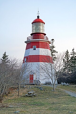
Barrington, officially named the Municipality of the District of Barrington, is a district municipality in western Shelburne County, Nova Scotia, Canada. Statistics Canada classifies the district municipality as a municipal district.
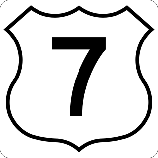
Route 322 is a collector road in the Canadian province of Nova Scotia.

Route 374 is a collector road in the Canadian province of Nova Scotia. It connects New Glasgow at Exit 24 of Nova Scotia Highway 104 with Sheet Harbour at Trunk 7. The highway runs through the Halifax Regional Municipality, Guysborough County & Pictou County.

100-series highways (Nova Scotia) highway system in Nova Scotia

The 100-Series Highways are a series of arterial highways in the Canadian province of Nova Scotia.

Nova Scotia Route 333 highway in Nova Scotia

Route 333 is a collector road in the Canadian province of Nova Scotia.

Lighthouse Route

The Lighthouse Route is a scenic roadway in the Canadian province of Nova Scotia. It follows the province's South Shore for 339 km (211 mi) from Halifax to Yarmouth.

Nova Scotia Route 357 highway in Nova Scotia

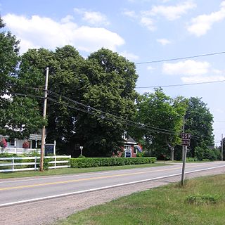
Route 357 is a collector road in the Canadian province of Nova Scotia. It is located in the Halifax Regional Municipality and connects Musquodoboit Harbour at Trunk 7 with Middle Musquodoboit at Route 224.

Nova Scotia Route 224 highway in Nova Scotia

Route 224 is a collector road in the Canadian province of Nova Scotia. It is located in the Halifax Regional Municipality and Colchester County, connecting Sheet Harbour at Trunk 7 with Milford Station at Exit 9 of Highway 102 and Trunk 14. The route passes through the upper half of the Musquodoboit Valley.

Route 289 is a collector road in the Canadian province of Nova Scotia.

Nova Scotia Route 211 highway in Nova Scotia

Route 211 is a collector road in the Canadian province of Nova Scotia. It is located in Guysborough County and connects Stillwater on Trunk 7 to Isaac's Harbour North on Route 316.

Route 219 is a collector road approximately 20.3 km long in the Canadian province of Nova Scotia.

Nova Scotia Route 316 highway in Nova Scotia

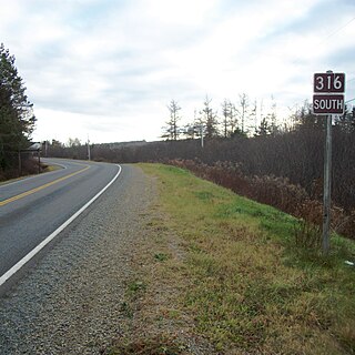
Route 316 is a collector road in the Canadian province of Nova Scotia. It is located in Antigonish County and Guysborough County, connecting Lower South River at Highway 104 with Half Island Cove at Trunk 16.

Nova Scotia Route 309 highway in Nova Scotia

Route 309 is a collector road in the Canadian province of Nova Scotia.

Route 320 is a collector road in the Canadian province of Nova Scotia.

Route 344 is a collector road in the Canadian province of Nova Scotia.

Nova Scotia Route 359 highway in Nova Scotia

Route 359 is a collector road in the Canadian province of Nova Scotia.

Route 348 is a collector road in the Canadian province of Nova Scotia.

References

  1. Atlantic Canada Back Road Atlas ISBN   978-1-55368-618-7 Page 89