Pictou County is a county in the province of Nova Scotia, Canada. It was established in 1835, and was formerly a part of Halifax County from 1759 to 1835. It had a population of 43,748 people in 2016, a decline of 4.2 percent from 2011. Furthermore, its 2016 population is only 88.11% of the census population in 1991. It is the sixth most populous county in Nova Scotia.
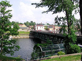
New Glasgow is a town in Pictou County, in the province of Nova Scotia, Canada. It is situated on the banks of the East River of Pictou, which flows into Pictou Harbour, a sub-basin of the Northumberland Strait.
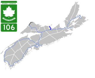
Highway 106 is a 19 km (12 mi) 2-lane limited-access highway located within Pictou County, in the Canadian province of Nova Scotia.
Nova Scotia Trunk 7 is part of the Canadian province of Nova Scotia's system of Trunk Highways. The route runs from Bedford to Antigonish, along the Eastern Shore for a distance of 269 kilometres (167 mi). Part of Trunk 7 is known as the Marine Drive.

Trunk 1 is part of the Canadian province of Nova Scotia's system of Trunk Highways.
Trunk 2 is part of the Canadian province of Nova Scotia's system of Trunk Highways. The route runs from Halifax to Fort Lawrence on the New Brunswick border. Until the 1960s, Trunk 2 was the Halifax area's most important highway link to other provinces, and was part of a longer Interprovincial Highway 2 which ended in Windsor, Ontario. The controlled access Highway 102 and Highway 104 now carry most arterial traffic in the area, while Trunk 2 serves regional and local traffic.
Route 374 is a collector road in the Canadian province of Nova Scotia. It connects New Glasgow at Exit 24 of Nova Scotia Highway 104 with Sheet Harbour at Trunk 7. The highway runs through the Halifax Regional Municipality, Guysborough County & Pictou County.
Trunk 8 is part of the Canadian province of Nova Scotia's system of Trunk Highways. The route runs from Liverpool to Annapolis Royal, a distance of 113 kilometres (70 mi). Trunk 8 is also known as the Kejimkujik Scenic Drive.
Trunk 4 is part of the Canadian province of Nova Scotia's system of Trunk Highways. The route runs from Highway 104 exit 7 near Thomson Station to Glace Bay. Until the construction of the Trans-Canada Highway, Trunk 4 was a major traffic link in northern Nova Scotia and Cape Breton, and is still used on Cape Breton as an alternative to Highway 105. The highway was originally called the King's Highway, however, this name is no longer applied to the entire road. The only remaining historic section of the highway that maintains the name "King" is King's Road in Sydney.
Trunk 6 is part of the Canadian province of Nova Scotia's system of trunk highways. The route runs from Highway 104 exit 3 at Amherst to the rotary at Pictou, a distance of 136 kilometres (85 mi). It is part of the Sunrise Trail, a designated tourist route.
Trunk 10 is part of the Canadian province of Nova Scotia's system of Trunk Highways. This rural road runs from Bridgewater to Middleton, a distance of 88 kilometres (55 mi).
The Sunrise Trail is a scenic roadway in the Canadian province of Nova Scotia. It is located along the province's North Shore on the Northumberland Strait for 333 km (207 mi) from Amherst to the Canso Causeway.
Route 204 is a collector road in the Canadian province of Nova Scotia.
Route 245 is a collector road in the Canadian province of Nova Scotia. Route 245 is part of the Sunrise Trail.
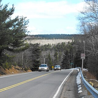
Route 321 is a collector road in the Canadian province of Nova Scotia.
Route 307 is a collector road in the Canadian province of Nova Scotia.
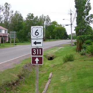
Route 311 is a collector road in the Canadian province of Nova Scotia.
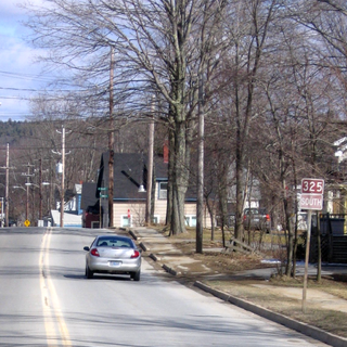
Route 325 is a collector road in the Canadian province of Nova Scotia. It is located in Lunenburg County and connects Colpton at Route 208 with Mahone Bay at Trunk 3.
Route 348 is a collector road in the Canadian province of Nova Scotia.
