Nova Scotia Route 247

Last updated

Nova Scotia Route 247.svg

Route 247
Route information
Maintained by Nova Scotia Department of Transportation and Infrastructure Renewal
Length 11 km [1] (7 mi)
Major junctions
West endNova Scotia 4.svg Trunk 4 in St. Peter's
East end Westside Grand River Road
in Lower L'Ardoise
Highway system

Provincial highways in Nova Scotia

Nova Scotia Route 246.svg Route 246 Route 252 Nova Scotia Route 252.svg

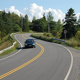
Route 247 is a collector road in the Canadian province of Nova Scotia.

Canada Country in North America

Canada is a country in the northern part of North America. Its ten provinces and three territories extend from the Atlantic to the Pacific and northward into the Arctic Ocean, covering 9.98 million square kilometres, making it the world's second-largest country by total area. Canada's southern border with the United States, stretching some 8,891 kilometres (5,525 mi), is the world's longest bi-national land border. Its capital is Ottawa, and its three largest metropolitan areas are Toronto, Montreal, and Vancouver. As a whole, Canada is sparsely populated, the majority of its land area being dominated by forest and tundra. Consequently, its population is highly urbanized, with over 80 percent of its inhabitants concentrated in large and medium-sized cities, with 70% of citizens residing within 100 kilometres (62 mi) of the southern border. Canada's climate varies widely across its vast area, ranging from arctic weather in the north, to hot summers in the southern regions, with four distinct seasons.
Nova Scotia Province of Canada

Nova Scotia is one of Canada's three Maritime Provinces, and one of the four provinces that form Atlantic Canada. Its provincial capital is Halifax. Nova Scotia is the second-smallest of Canada's ten provinces, with an area of 55,284 square kilometres (21,300 sq mi), including Cape Breton and another 3,800 coastal islands. As of 2016, the population was 923,598. Nova Scotia is Canada's second-most-densely populated province, after Prince Edward Island, with 17.4 inhabitants per square kilometre (45/sq mi).

Contents

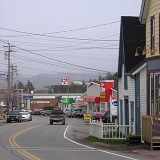
It is located on Cape Breton Island in Richmond County and connects St. Peters at Trunk 4 with Lower L'Ardoise.

Cape Breton Island Island in Nova Scotia

Cape Breton Island is an island on the Atlantic coast of North America and part of the province of Nova Scotia, Canada.

Richmond County, Nova Scotia County in Nova Scotia, Canada

Richmond County is a county in the Canadian province of Nova Scotia. For a list of communities in Richmond County, see the eponymous page.

Trunk 4 is part of the Canadian province of Nova Scotia's system of Trunk Highways. The route runs from Highway 104 exit 7 at Thomson Station to Glace Bay. Until the construction of the Trans-Canada Highway, Trunk 4 was a major traffic link in northern Nova Scotia and Cape Breton, and is still used on Cape Breton as an alternative to Highway 105. The highway was originally called the King's Highway, however, this name is no longer applied to the entire road. The only remaining historic section of the highway that maintains the name "King" is King's Road in Sydney.
Communities

St. Peters, Nova Scotia Village in Nova Scotia, Canada

St. Peter's is a small incorporated village located on Cape Breton Island in Richmond County, Nova Scotia, Canada.

Point Michaud, Nova Scotia human settlement in Nova Scotia, Canada

Point Michaud is a small community in the Canadian province of Nova Scotia, located in Richmond County.

LArdoise human settlement in Nova Scotia, Canada

L'Ardoise is a small community located on Nova Scotia Route 247 in Richmond County on Cape Breton Island, in Nova Scotia, Canada.

Parks

See also

Related Research Articles

Cabot Trail highway in Nova Scotia

The Cabot Trail is a highway and scenic roadway in northern Victoria County and Inverness County on Cape Breton Island in Nova Scotia, Canada.

Sunrise Trail

The Sunrise Trail is a scenic roadway in the Canadian province of Nova Scotia.

The Fleur-de-lis Trail is a scenic roadway located on Nova Scotia's Cape Breton Island. It is approximately 263 km long and runs along the southeastern part of the island through an Acadian region.

Route 203 is a collector road in the Canadian province of Nova Scotia.

Nova Scotia Route 215 highway in Nova Scotia

Route 215 is collector road in the Canadian province of Nova Scotia.

Route 223 is a collector road in the Canadian province of Nova Scotia.

Route 239 is a collector road in the Canadian province of Nova Scotia.


Route 245 is a collector road in the Canadian province of Nova Scotia. Route 245 is part of the Sunrise Trail.

Nova Scotia Route 246 highway in Nova Scotia

Route 246 is a collector road in the Canadian province of Nova Scotia.

Route 344 is a collector road in the Canadian province of Nova Scotia.

Route 329 is a collector road in the Canadian province of Nova Scotia.

Grandique Ferry, Nova Scotia human settlement in Nova Scotia, Canada

Grandique Ferry is a former community in Richmond County, Nova Scotia.

Joseph Matheson Canadian politician

Joseph Matheson was a merchant and political figure in Nova Scotia, Canada. He represented Richmond County in the Nova Scotia House of Assembly from 1886 to 1897. He was a Liberal member of the House of Commons of Canada for the Richmond riding from 1900 to 1904.

Grand River, Nova Scotia human settlement in Nova Scotia, Canada

Grand River is a small town in the Canadian province of Nova Scotia, located in Richmond County. Its geographical coordinates are 45° 38' 0" North, 60° 40' 0" West

Lower LArdoise, Nova Scotia human settlement in Nova Scotia, Canada

Lower L'Ardoise is a small community in the Canadian province of Nova Scotia, located in Richmond County.

MacCormack Beach Provincial Park provincial park in Nova Scotia

MacCormack Beach Provincial Park is a small picnic park overlooking the Bras d'Or Lake, in the community of Plaster Cove, in the Canadian province of Nova Scotia, located in Victoria County on Cape Breton Island. The park entrance is off of St. Columba Road, just 0.3 kilometres (0.19 mi) north of Iona, Nova Scotia. Civic address: 2481 St. Columba Rd, Iona, Nova Scotia.

Cabots Landing Provincial Park provincial park in Nova Scotia, Canada

Cabots Landing Provincial Park is a small picnic and beach park on the shore of Aspy Bay in the community of Sugarloaf, 10 kilometres (6.2 mi) north of the Cabot Trail on Cape Breton Island, Nova Scotia, Canada.

Strait Area Transit

Strait Area Transit is a provider of public transportation based in Inverness County and Richmond County, Nova Scotia, Canada. Established in 2008, it operates not as a government-sponsored agency, but rather as a non-profit cooperative charity. The organization offers daily fixed route, and Dial-A-Ride services in the South-Central Inverness County, Richmond County area.

References

  1. Atlantic Canada Back Road Atlas ISBN   978-1-55368-618-7 Page 57