
Cumberland County is a county in the Canadian province of Nova Scotia.

Oxford is a town in Cumberland County, Nova Scotia, Canada. It is 32 km (20 mi) east of Amherst. The town is directly serviced by Routes 104, 204, 301, and 321. Despite its small size and demographic, Oxford is the world's largest processor and distributor of individually quick frozen (IQF) wild blueberries.

Highway 102 is a north-south highway in the Canadian province of Nova Scotia that runs from Halifax to Onslow, immediately north of the town of Truro. It is the busiest highway in Atlantic Canada.
Highway 104 in Nova Scotia, Canada, runs from Fort Lawrence at the New Brunswick border near Amherst to River Tillard near St. Peter's. Except for the portion on Cape Breton Island between Port Hawkesbury and St. Peter's, it forms the main route of the Trans-Canada Highway across the province.

Highway 125 is a 28 km long controlled-access highway located in Nova Scotia's Cape Breton Regional Municipality. The provincial government named it Peacekeepers Way on August 18, 2008. Part of the provincial 100-series arterial highway network, Highway 125 encircles the west side of Sydney Harbour, from an interchange with Highway 105 at Sydney Mines to Trunk 4 immediately east of Sydney.

Trunk 1 is part of the Canadian province of Nova Scotia's system of Trunk Highways.
Trunk 2 is part of the Canadian province of Nova Scotia's system of Trunk Highways. The route runs from Halifax to Fort Lawrence on the New Brunswick border. Until the 1960s, Trunk 2 was the Halifax area's most important highway link to other provinces, and was part of a longer Interprovincial Highway 2 which ended in Windsor, Ontario. The controlled access Highway 102 and Highway 104 now carry most arterial traffic in the area, while Trunk 2 serves regional and local traffic.
Route 213 is a collector road in the Canadian province of Nova Scotia. It is located in the Halifax Regional Municipality, connecting Bedford at Trunk 2 with Upper Tantallon at Trunk 3 with interchanges with Highway 102 and Highway 103 located near the termini.
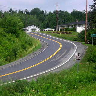
Route 354 is a collector road in the Canadian province of Nova Scotia.
Trunk 4 is part of the Canadian province of Nova Scotia's system of Trunk Highways. The route runs from Highway 104 exit 7 near Thomson Station to Glace Bay. Until the construction of the Trans-Canada Highway, Trunk 4 was a major traffic link in northern Nova Scotia and Cape Breton, and is still used on Cape Breton as an alternative to Highway 105. The highway was originally called the King's Highway, however, this name is no longer applied to the entire road. The only remaining historic section of the highway that maintains the name "King" is King's Road in Sydney.
Trunk 6 is part of the Canadian province of Nova Scotia's system of trunk highways. The route runs from Highway 104 exit 3 at Amherst to the rotary at Pictou, a distance of 136 kilometres (85 mi). It is part of the Sunrise Trail, a designated tourist route.
The Bedford Bypass, internally designated as Trunk 33, is a highway in the Canadian province of Nova Scotia.
Route 368 is a collector road in the Canadian province of Nova Scotia.
Route 301 is a collector road in the Canadian province of Nova Scotia.
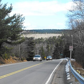
Route 321 is a collector road in the Canadian province of Nova Scotia.

Route 302 is a collector road in the Canadian province of Nova Scotia.
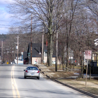
Route 325 is a collector road in the Canadian province of Nova Scotia. It is located in Lunenburg County and connects Colpton at Route 208 with Mahone Bay at Trunk 3.
Route 348 is a collector road in the Canadian province of Nova Scotia.

LaPlanche Street is the historic connector between Nova Scotia and New Brunswick, Canada. Located on the Isthmus of Chignecto, LaPlanche crosses the Tantramar Marshes between Amherst, NS and Sackville, NB. Historically, it hosted the key forts of peninsular Nova Scotia and continental Acadia and witnessed the Battle of Fort Beauséjour, the key battle between the two colonies during the Seven Years' War, and the Battle of Fort Cumberland of the American Revolutionary War.
