
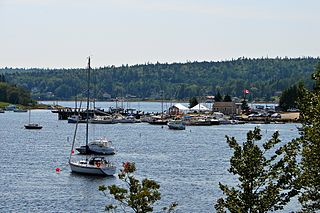
Bridgewater is a town in Lunenburg County, Nova Scotia, Canada, at the navigable limit of the LaHave River. With a 2021 population of 8,790, Bridgewater is the largest town in the South Shore region.
Petite Rivière is a rural community on Route 331 in Lunenburg County on the South Shore of Nova Scotia in Canada. It was formerly known as Petite Rivière Bridge.
Highway 103 is an east-west highway in Nova Scotia that runs from Halifax to Yarmouth.
Nova Scotia Trunk 3 is an east-west trunk highway in Nova Scotia. The route runs from Halifax to Yarmouth, along the South Shore. Trunk 3's status as an important regional highway link has been superseded by the parallel Highway 103.
The Marine Drive is a designated scenic route along Nova Scotia's Eastern Shore. It closely follows the coast of the Atlantic Ocean and the Strait of Canso from the Canso Causeway to the junction of Route 322 and Highway 111 in Dartmouth.
Nova Scotia Route 253 is a collector road in the Canadian province of Nova Scotia.

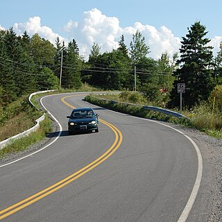
Route 333 is a collector road in the Canadian province of Nova Scotia.
The Lighthouse Route is a scenic roadway in the Canadian province of Nova Scotia. It follows the province's South Shore for 585 km (364 mi) from Halifax to Yarmouth.

The Sunrise Trail is a scenic roadway in the Canadian province of Nova Scotia. It is located along the province's North Shore on the Northumberland Strait for 333 km (207 mi) from Amherst to the Canso Causeway.
Route 215 is collector road in the Canadian province of Nova Scotia.
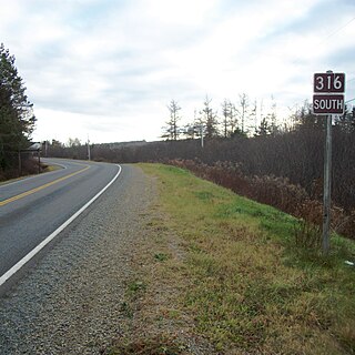
Route 316 is a collector road in the Canadian province of Nova Scotia. It is located in Antigonish County and Guysborough County, connecting Lower South River at Highway 104 with Half Island Cove at Trunk 16.
Route 223 is a collector road in the Canadian province of Nova Scotia.
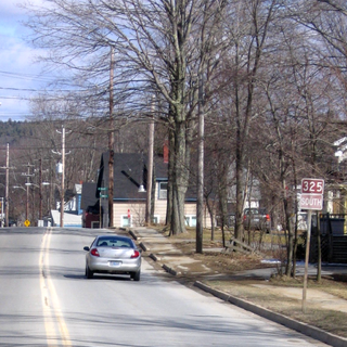
Route 325 is a collector road in the Canadian province of Nova Scotia. It is located in Lunenburg County and connects Colpton at Route 208 with Mahone Bay at Trunk 3.
Route 344 is a collector road in the Canadian province of Nova Scotia.

Route 332 is a collector road in the Canadian province of Nova Scotia. It is located in Lunenburg County, connecting Bridgewater at Trunk 3 with Lunenburg at Trunk 3. It is commonly referred to residences as Riverport Road as the village appears on all major road signage in the county.
Route 329 is a collector road in the Canadian province of Nova Scotia.
Hubbards is an unincorporated Canadian rural community on the South Shore of Nova Scotia.
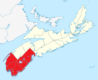
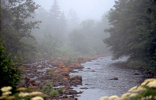
Southern Nova Scotia or the South Shore is a region of Nova Scotia, Canada. The area has no formal identity and is variously defined by geographic, county and other political boundaries. Statistics Canada, defines Southern Nova Scotia as an economic region, composed of Lunenburg County, Queens County, Shelburne County, Yarmouth County, and Digby County. According to Statistics Canada, the region had the highest decrease of population in Canada from 2009 to 2010, with a population decrease of 10.2 residents per thousand. The region also has the second-highest median age in Canada at 47.1 years old.
Route 100 is a major highway in Newfoundland and Labrador. The highway begins at its northern terminus at the Trans-Canada Highway in the town of Whitbourne, runs for 108 kilometres (67 mi) until it ends at its southern terminus, the town of Branch, where it transitions into Route 92. Motorists can drive along the coast of Placentia Bay and eventually the Atlantic Ocean once traveling south of Point Verde.

