| Route 303 | ||||
|---|---|---|---|---|
| Route information | ||||
| Maintained by Nova Scotia Department of Transportation and Infrastructure Renewal | ||||
| Length | 11 km [1] (7 mi) | |||
| Major junctions | ||||
| South end | ||||
| North end | Bayview Shore Road - Digby Ferry | |||
| Location | ||||
| Counties | Digby | |||
| Highway system | ||||
Provincial highways in Nova Scotia
| ||||
Route 303 is a collector road in the Canadian province of Nova Scotia.

Canada is a country in the northern part of North America. Its ten provinces and three territories extend from the Atlantic to the Pacific and northward into the Arctic Ocean, covering 9.98 million square kilometres, making it the world's second-largest country by total area. Canada's southern border with the United States, stretching some 8,891 kilometres (5,525 mi), is the world's longest bi-national land border. Its capital is Ottawa, and its three largest metropolitan areas are Toronto, Montreal, and Vancouver. As a whole, Canada is sparsely populated, the majority of its land area being dominated by forest and tundra. Consequently, its population is highly urbanized, with over 80 percent of its inhabitants concentrated in large and medium-sized cities, with 70% of citizens residing within 100 kilometres (62 mi) of the southern border. Canada's climate varies widely across its vast area, ranging from arctic weather in the north, to hot summers in the southern regions, with four distinct seasons.
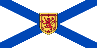
Nova Scotia is one of Canada's three Maritime Provinces, and one of the four provinces that form Atlantic Canada. Its provincial capital is Halifax. Nova Scotia is the second-smallest of Canada's ten provinces, with an area of 55,284 square kilometres (21,300 sq mi), including Cape Breton and another 3,800 coastal islands. As of 2016, the population was 923,598. Nova Scotia is Canada's second-most-densely populated province, after Prince Edward Island, with 17.4 inhabitants per square kilometre (45/sq mi).
Contents
It is located in Digby County and connects the Bay Ferries Limited terminal at Pollys Point where the ferry to Saint John, New Brunswick docks, with Conway at Exit 26 on Highway 101.
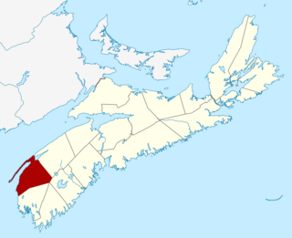
Digby County is a county in the Canadian province of Nova Scotia.

Saint John is the coastal port city of the Bay of Fundy in the Canadian province of New Brunswick. The port is Canada’s third largest port by tonnage with a cargo base that includes dry and liquid bulk, break bulk, containers, and cruise. In 2016, after more than 40 years of population decline, the city became the second most populous city in the province for the first time, with a population of 67,575 over an area of 315.82 square kilometres (121.94 sq mi). Greater Saint John covers a land area of 3,362.95 square kilometres (1,298.44 sq mi) across the Caledonia Highlands, with a population of 126,202. After the partitioning of the colony of Nova Scotia in 1784, the new colony of New Brunswick was thought to be named 'New Ireland' with the capital to be in Saint John before being vetoed by Britain's King George III. Saint John is the oldest incorporated city in Canada. During the reign of George III, the municipality was created by royal charter in 1785.

Conway is a community in the Canadian province of Nova Scotia, located in The Municipality of the District of Digby in Digby County.

