Coordinates: 46°12′15.9″N60°4′6.4″W / 46.204417°N 60.068444°W

A geographic coordinate system is a coordinate system that enables every location on Earth to be specified by a set of numbers, letters or symbols. The coordinates are often chosen such that one of the numbers represents a vertical position and two or three of the numbers represent a horizontal position; alternatively, a geographic position may be expressed in a combined three-dimensional Cartesian vector. A common choice of coordinates is latitude, longitude and elevation. To specify a location on a plane requires a map projection.
| ||||
|---|---|---|---|---|
| Victoria Road (Whitney Pier) | ||||
| Route information | ||||
| Length | 39 km (24 mi) | |||
| Major junctions | ||||
| East end | Glace Bay | |||
| West end | ||||
| Location | ||||
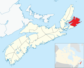
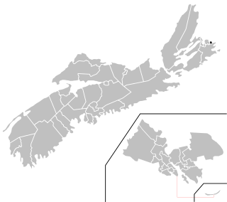
| Counties | Cape Breton | |||
| Highway system | ||||
Provincial highways in Nova Scotia
| ||||

Trunk 28 is part of the Canadian province of Nova Scotia's system of trunk highways. The route runs from Sydney to Glace Bay, a distance of 39 kilometres.

Canada is a country in the northern part of North America. Its ten provinces and three territories extend from the Atlantic to the Pacific and northward into the Arctic Ocean, covering 9.98 million square kilometres, making it the world's second-largest country by total area. Canada's southern border with the United States, stretching some 8,891 kilometres (5,525 mi), is the world's longest bi-national land border. Its capital is Ottawa, and its three largest metropolitan areas are Toronto, Montreal, and Vancouver. As a whole, Canada is sparsely populated, the majority of its land area being dominated by forest and tundra. Consequently, its population is highly urbanized, with over 80 percent of its inhabitants concentrated in large and medium-sized cities, with 70% of citizens residing within 100 kilometres (62 mi) of the southern border. Canada's climate varies widely across its vast area, ranging from arctic weather in the north, to hot summers in the southern regions, with four distinct seasons.

Nova Scotia is one of Canada's three Maritime Provinces, and one of the four provinces that form Atlantic Canada. Its provincial capital is Halifax. Nova Scotia is the second-smallest of Canada's ten provinces, with an area of 55,284 square kilometres (21,300 sq mi), including Cape Breton and another 3,800 coastal islands. As of 2016, the population was 923,598. Nova Scotia is Canada's second-most-densely populated province, after Prince Edward Island, with 17.4 inhabitants per square kilometre (45/sq mi).

Sydney is an urban community located in the Cape Breton Regional Municipality of Cape Breton Island, Nova Scotia, Canada. Situated on Cape Breton Island's east coast, it belongs administratively to the Cape Breton Regional Municipality. Sydney was founded in 1785 by the British, was incorporated as a city in 1904, and dissolved on 1 August 1995, when it was amalgamated into the regional municipality.
From near downtown Sydney, Trunk 28 takes Victoria Road northward through the Whitney Pier neighbourhood, continuing along Sydney Harbour through South Bar and New Victoria to New Waterford. Trunk 28 turns south towards Lingan Bay, then east through Dominion entering Glace Bay in the Bridgeport area and following Main Street and terminating downtown at the intersection with Commercial Street.
Whitney Pier is a Canadian urban neighbourhood in Nova Scotia's Cape Breton Regional Municipality.

South Bar is a small community near Sydney, Nova Scotia. It derives its name from the nearby Southeast Bar which extends over 1.7 kilometres (1.1 mi) out into Sydney Harbour, sheltering the community and its small fishing harbour from the open waters of Spanish Bay. The community's harbour is managed by the South Bar Fishermen's Harbour Authority. The local Fire Department, the South Bar Volunteer Fire Department, was established in 1982.
New Victoria is a community in Nova Scotia's Cape Breton Regional Municipality.
| Preceded by | Trunk 28 Nova Scotia | Succeeded by South Street Glace Bay |