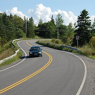
Hants County is a historical county and census division of Nova Scotia, Canada. Local government is provided by the West Hants Regional Municipality, and the Municipality of the District of East Hants.

East Hants, officially named the Municipality of the District of East Hants, is a district municipality in Hants County, Nova Scotia, Canada. Statistics Canada classifies the district municipality as a municipal district.

The Chignecto-Central Regional Centre for Education is a Canadian public school district in Nova Scotia.

Trunk 1 is part of the Canadian province of Nova Scotia's system of Trunk Highways.
Elmsdale is an unincorporated Canadian village and community located on the boundary of Hants County and Halifax County in Nova Scotia.

Trunk 2 is part of the Canadian province of Nova Scotia's system of Trunk Highways. The route runs from Halifax to Fort Lawrence on the New Brunswick border. Until the 1960s, Trunk 2 was the Halifax area's most important highway link to other provinces, and was part of a longer Interprovincial Highway 2 which ended in Windsor, Ontario. The controlled access Highway 102 and Highway 104 now carry most arterial traffic in the area, while Trunk 2 serves regional and local traffic.

Trunk 14 is part of the Canadian province of Nova Scotia's system of Trunk Highways. The route runs from Chester to Milford Station through the Windsor area, for a distance of 121 kilometres (75 mi).
Route 214 is a short collector road in the Canadian province of Nova Scotia.
Route 224 is a collector road in the Canadian province of Nova Scotia. It is located in the Halifax Regional Municipality and Colchester County, connecting Sheet Harbour at Trunk 7 with Milford Station at Exit 9 of Highway 102 and Trunk 14. The route passes through the upper half of the Musquodoboit Valley.

Route 215 is collector road in the Canadian province of Nova Scotia.

Gore is a rural Canadian community in central Hants County, Nova Scotia. It is located just 25 minutes from Elmsdale; 30 minutes from Halifax Stanfield International Airport; and 45 minutes from Truro. It was named after Sir Charles Stephen Gore. The community was settled primarily by the 84th Regiment of Foot.
Belnan is a small community in Nova Scotia, located on Route 214. Belnan is located between Elmsdale and Nine Mile River. It is located in the Rawdon/Maitland region of the Glooscap Trail, Hants County.
Upper Rawdon is a community in the Canadian province of Nova Scotia, located in the Municipal District of East Hants, which is in Hants County, Nova Scotia. This community was originally part of the Rawdon Township.
South Rawdon is a community in the Canadian province of Nova Scotia, located in the Municipality of East HantsIt is a beautiful wooded area where the locals enjoy fishing, hunting, off-roading and other outdoor activities. It is the home of the Herbert River, where people enjoy swimming and tubing.
Rawdon is a former township in the Canadian province of Nova Scotia. The township was the eventual destination of Loyalists fleeing the Siege of Ninety Six during the American Revolutionary War. In 1861, along with the township of Douglas, Nova Scotia, the Rawdon township became part of the newly formed Municipal District of East Hants, along with neighbouring townships.
Nine Mile River is a community in the Canadian province of Nova Scotia, located in the Municipal District of East Hants. It takes its name from the river which flows through it. It is District 9 for the Municipality of East Hants, and currently served by Councillor Eldon Hebb.
Hardwoodlands is a community in the province of Nova Scotia, Canada, located in The Municipality of the District of East Hants in Hants County. Hardwoodlands remains a rural community today. The main road Highway 14 connects the community to the Trans-Canada Highway and to the other rural community Nine Mile River.
Lakelands is a community in the Canadian province of Nova Scotia, located in the Municipal District of East Hants
Douglas is a former township in the Canadian province of Nova Scotia. The township was the eventual destination of Loyalists fleeing the Siege of Ninety Six during the American Revolutionary War. In 1861, along with the township of Rawdon, Nova Scotia, the Douglas township became part of the newly formed Municipal District of East Hants, along with neighbouring townships.


