
Eastern Passage is an unincorporated suburban community in Halifax Regional Municipality Nova Scotia, Canada.

Cole Harbour is a former village and current community located in Nova Scotia, Canada, that is part of the Halifax Regional Municipality.

Highway 107 in Nova Scotia runs through the eastern suburbs of the Halifax Regional Municipality, from the Burnside Industrial Park in Dartmouth to an intersection with Trunk 7 in Musquodoboit Harbour. It is 43.2 km (26.8 mi) long, and is mostly two lane, controlled access highway.

Highway 125 is a 28 km long controlled-access highway located in Nova Scotia's Cape Breton Regional Municipality. The provincial government named it Peacekeepers Way on August 18, 2008. Part of the provincial 100-series arterial highway network, Highway 125 encircles the west side of Sydney Harbour, from an interchange with Highway 105 at Sydney Mines to Trunk 4 immediately east of Sydney.

The Eastern Shore is a region of the Canadian province of Nova Scotia. It is the Atlantic coast running northeast from Halifax Harbour to the eastern end of the peninsula at the Strait of Canso.

Nova Scotia Trunk 7 is part of the Canadian province of Nova Scotia's system of Trunk Highways. The route runs from Bedford to Antigonish, along the Eastern Shore for a distance of 269 kilometres (167 mi). Part of Trunk 7 is known as the Marine Drive.

Trunk 2 is part of the Canadian province of Nova Scotia's system of Trunk Highways. The route runs from Halifax to Fort Lawrence on the New Brunswick border. Until the 1960s, Trunk 2 was the Halifax area's most important highway link to other provinces, and was part of a longer Interprovincial Highway 2 which ended in Windsor, Ontario. The controlled access Highway 102 and Highway 104 now carry most arterial traffic in the area, while Trunk 2 serves regional and local traffic.

Nova Scotia Trunk 3 is an east-west trunk highway in Nova Scotia. The route runs from Halifax to Yarmouth, along the South Shore. Trunk 3's status as an important regional highway link has been superseded by the parallel Highway 103.
Route 318 is a collector road in the Canadian province of Nova Scotia.

Route 207 is a collector road in the Canadian province of Nova Scotia. It is located in the Halifax Regional Municipality and connects Dartmouth to Porters Lake on the Eastern Shore.
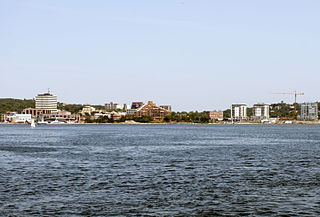
Downtown Dartmouth is the main central business district of Dartmouth in Halifax, Nova Scotia, Canada. It is part of the Capital District of the Province.
The Marine Drive is a designated scenic route along Nova Scotia's Eastern Shore. It closely follows the coast of the Atlantic Ocean and the Strait of Canso from the Canso Causeway to the junction of Route 322 and Highway 111 in Dartmouth.
Imperoyal is a small neighbourhood on the eastern side of Halifax Harbour in the community of Dartmouth, Nova Scotia. The area is mostly taken up by the former Dartmouth Refinery and by petroleum storage and transfer facility owned by Irving Oil Limited. A book on the topic is written by John D. Hartley entitled Imperoyal Village.
West Lawrencetown is a residential community within the Halifax Regional Municipality Nova Scotia on the Eastern Shore on Route 207 along the scenic route Marine Drive.
Porters Lake is a rural community in the Eastern Shore region of the Halifax, Nova Scotia, Canada, between Trunk 7 and Route 207, 27.8 km from Halifax. The residents mainly commute to jobs in Dartmouth, Burnside Industrial Park or in Downtown Halifax. The community is built around the lake from which it takes its name.

Pleasant Harbour is a rural community located on the Eastern Shore of Nova Scotia, Canada. The community is situated on the Marine Drive, on Nova Scotia Trunk 7, about 30 km (19 mi) west of Sheet Harbour, Nova Scotia. The community is located on the shores of Shoal Bay, an inlet of the Atlantic Ocean. The mi'kmaq name for the area was Wospegeak, translating to "the sunshine is reflected from the water". Settlement of the area began around 1812, and the present name for the community was adopted in 1886.
The Musquodoboit Trailway is a 14.5-kilometre-long (9.0 mi) multiuse rail trail located in Halifax County, Nova Scotia, running the distance from Gibralter to Musquodoboit Harbour. The entire route is part of the Halifax spur of The Great Trail, and follows Nova Scotia Route 357 for its length.
Eastern Passage is a provincial electoral district in the Canadian province of Nova Scotia that came into effect at the 2021 Nova Scotia general election. It elects one member to the Legislative Assembly of Nova Scotia.
 Sign for Route 322
 Sign for Marine Drive Trail
