Eastern Passage, Nova Scotia

Last updated
Eastern Passage
Community
Eastern Passage town centre.png
The town centre of Eastern Passage (1 July 2016)
Novascotiahrm-easternpassage.png
Cow Bay & Eastern Passage planning area of municipal Halifax.
Coordinates: 44°36′42″N63°29′39″W / 44.611656°N 63.494098°W / 44.611656; -63.494098
CountryFlag of Canada (Pantone).svg  Canada
ProvinceFlag of Nova Scotia.svg  Nova Scotia
Municipality Halifax Regional Municipality
District3 - Dartmouth South - Eastern Passage
Foundedcirca 1798
Government
  TypeRegional Council
  Governing Council Halifax Regional Council
  Community CouncilHarbour East - Marine Drive Community Council
Area
[1]
  Total13.72 km2 (5.30 sq mi)
Elevation
0−36 m (−118 ft)
Population
 (2011) [2]
  Total11,738
  Density855/km2 (2,210/sq mi)
Time zone UTC-4 (AST)
  Summer (DST) UTC-3 (ADT)
Canadian Postal code
B3G
Area code 902
GNBC CodeCAKQU
Website easternpassage.ca
Places in Nova Scotia

Eastern Passage is an unincorporated suburban community in Halifax Regional Municipality Nova Scotia, Canada.

Contents

Eastern Passage has historically been tied to the fishing industry. Its waterfront has several small wharves and piers. The construction of CFB Shearwater, a military air base, at the northern boundary of the community during World War I, and the construction of the Imperial Oil (later Esso), Texaco (later Ultramar) oil refineries, the Volvo Halifax Assembly plant and automobile import/export facility following World War II redefined the local economy. New highway connections have resulted in the majority of area residents commuting to Downtown Halifax or Dartmouth.

History

Prior to the European settlers, Eastern Passage was a season home to the Mi'kmaq for thousands of years. Europeans began seasonal use of the channel starting about 1712 while the Mi'kmaq shifted to McNab's island. The Eastern Passage area was granted to ranger Joseph Gorham, but he did not settle the passage and the land was regranted in 1798 to Jacob Horn, the first recorded settler who was soon followed by other families. [3] The first European settlers who moved there were mainly German, French, Irish and English. These ethnic groups continue to make up a large portion of the population of Eastern Passage.

Fort Clarence (formerly the Eastern Battery), a large gun battery was constructed beside Eastern Passage in 1754 at the beginning of the French and Indian War. Built to defend the harbour, the battery provided a cross fire with batteries on Georges Island and McNabs Island. In the late 1790s a Martello Tower was built at each of the three sites. [4] [5]

During the American Civil War, The iron Confederate naval cruiser Tallahassee sailed into Halifax Harbour on August 18, 1864, to take on bunker coal and water and then used the Eastern Passage channel to escape, for it was believed that Union naval forces were waiting at the main harbour entrance.

An American naval air station was constructed at Eastern Passage during World War I to patrol against German submarines. It was taken over by the Royal Canadian Air Force in the 1920s and became a large air base during World War II.

In the 1920s and 1930s, a number of Eastern Passage residents from the Hartlan and Henneberry families proved important sources of Canadian folk songs and stories to Nova Scotia folklorist Helen Creighton.

During the second world war Hartlen's Point was bought out in order to build a military complex at the mouth of the harbor. This complex was called the Devil's Battery and is located underground. [6]

Serious reductions to the CFB Shearwater base in the 1990s and the shutdown of the Ultramar Refinery challenged the economy of Eastern Passage in the 1990s. One response was the redevelopment of the small craft harbor, long known as "the Crick" or "the cove" but rechristened in 1996 as "Fisherman's Cove", a tourist attraction which combines a working fishing harbour with gift shops and restaurants.

In 1996 Fisherman's Cove opened as a tourist attraction. The attraction had things such as shops and restaurants. [7]

In the summer of 2003, the fourth season of Trailer Park Boys was filmed in Eastern Passage. It was the last season of the show filmed in a privately held park.

Geography

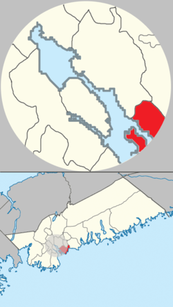
Located at the southeastern edge of Halifax Harbour, fronting the Atlantic Ocean, Eastern Passage derives its name from the narrow strait separating the mainland from Lawlor Island and McNabs Island, both of which lie several hundred metres west of the community. This "Eastern Passage" into the harbour is not the main shipping channel due to its shallow depths; the main shipping channel lies west of McNabs Island. The Eastern Passage is largely used by small recreational boats and fishing vessels during inclement weather as the island affords shelter from prevailing winds.

The community is south--south-west of Cow Bay, and south-east of Shearwater, and has 1,372 hectares (13.72 km2) of landmass.

Schools

Ocean View Elementary School

Horizon Elementary School

Seaside Elementary

Eastern Passage Education Centre

Island View High School

Island View High School opened its doors to students on September 8, 2018, after a long fight from the community for their own High School.

Parks and recreation

Beaches

Several beaches are in the area. McCormick's Beach is located at Fisherman's Cove near the boardwalk. A salt water beach (Rainbow Haven Beach), is located towards the Cow Bay area of the community. A large serviced beach (MacDonald Beach) is located between Eastern Passage and Cole Harbour. There is also a smaller beach located down the road from MacDonald Beach.

Clubs, groups, and organizations

Hartlen Point Golf Club [8] is also located in Eastern Passage. Opened in 1965 the club is located next to the Devils Battery which is a military complex including tunnels and bunkers.

Guides and Scouts

There are several active Scouts Canada and Girl Guides of Canada groups in Eastern Passage, such as 2nd and 3rd Eastern Passage Archived 2014-03-10 at the Wayback Machine Scouting Groups.

Sea Cadets

Eastern Passage is home to Royal Canadian Sea Cadet Corps Iroquois and 24 magnificent, recipient of the Convoy Shield for the most proficient Sea Cadet Corps in the Maritime area.

Community centres

Fields

There is a large playing field at Eastern Passage Education Centre, and numerous baseball and general purpose fields located within the vicinity of the three elementary schools.

A public tennis court is located near Seaside Elementary. The Horizon Recreation Centre (located in the Horizon Community School building) often has various activities going on year-round.

Parks

There are several parks and playgrounds in the area. Two playgrounds are located in the Heritage Hills subdivision (on Melrose and Serop Crescent, respectively), and there are playgrounds at Horizon, Oceanview, and Seaside schools. In August 2006, a new skateboard park opened near Seaside Elementary. Around 2016 a dirt BMX park, originally promised by at the time MLA, Becky Kent, was built.

Youth sports

Eastern Passage hosts a variety of youth sport programs that includes baseball, basketball, soccer, and softball.

Eastern Passage Tigers Basketball is a youth basketball organization.

United DFC was formed in 2016, when four former soccer clubs (Cole Harbour Soccer, Dartmouth F.C., Dartmouth United, and Eastern Passage Soccer) merged and created United DFC. It is organized by Soccer Nova Scotia and features both mini--and--youth leagues. Mini soccer includes Under-6, U-8 and U-10 teams, which are composed of both boys and girls. Youth soccer is divided by gender; it includes U-12, U-14, U-16 and U-18 teams. Registration for soccer starts in February and is open until June for both mini and youth leagues, and the soccer season ends in August. For years, the former Eastern Passage Soccer hosted the Dartmouth region’s year-end mini festival, which is called Soccer By The Sea.

Trails

Demographics

Although there is not any recent information that regards population from the 2016 census, or 2021 census, there is information from the 2011 census that records 11,738 people lived within the boundaries of Eastern Passage. [9] In 2011, the population density of the community was 855 people per km2.

Services

Water

While much of the community is serviced by municipal water, areas on the outer edges of the community require the use of well water and septic systems.

Telecommunications

All of Eastern Passage is served by Aliant (Telephone and DSL Broadband) and Eastlink (Telephone, Cable Internet access, Cable TV). The area has cellular coverage for both GSM (Rogers/Fido) and CDMA (Telus/Aliant).

Health and fitness

The Tallahassee Recreation Centre periodically offers fitness programs and includes a fitness centre for drop-in use. Outdoor fitness equipment is also available in the adjacent park.

Public transportation

Eastern Passage is served by Halifax Transit routes 6B and 6C, which link the community to the Woodside Ferry Terminal as well as the Bridge Terminal in Dartmouth. [10]

Related Research Articles

<span class="mw-page-title-main">Dartmouth, Nova Scotia</span> Urban community in Canada

Dartmouth is a built-up community of Halifax Regional Municipality, Nova Scotia, Canada. Located on the eastern shore of Halifax Harbour, Dartmouth has 72,139 residents as of 2021.

<span class="mw-page-title-main">Citadel Hill (Fort George)</span> Historic site in Nova Scotia, Canada

Citadel Hill is a hill that is a National Historic Site in Halifax, Nova Scotia, Canada. Four fortifications have been constructed on Citadel Hill since the city was founded by the English in 1749, and were referred to as Fort George—but only the third fort was officially named Fort George. According to General Orders of October 20, 1798, it was named after King George III. The first two and the fourth and current fort, were officially called the Halifax Citadel. The last is a concrete star fort.

<span class="mw-page-title-main">Halifax, Nova Scotia</span> Capital and most populous municipality of Nova Scotia, Canada

Halifax is the capital and largest municipality of the Canadian province of Nova Scotia, and the largest municipality in Atlantic Canada. As of 2022, it is estimated that the population of the Halifax CMA was 480,582, with 348,634 people in its urban area. The regional municipality consists of four former municipalities that were amalgamated in 1996: Halifax, Dartmouth, Bedford, and Halifax County.

<span class="mw-page-title-main">CFB Halifax</span> Naval base in Halifax, Nova Scotia, Canada

Canadian Forces Base (CFB) Halifax is Canada's east coast naval base and home port to the Royal Canadian Navy Atlantic fleet, known as Canadian Fleet Atlantic (CANFLTLANT), that forms part of the formation Maritime Forces Atlantic (MARLANT).

Shearwater is an unincorporated Nova Scotia suburban community in the Halifax Regional Municipality between Woodside and Eastern Passage occupied by Shearwater heliport. Shearwater is divided into two sections by Main Road, referred to locally as the Upper and Lower Base but part of the same complex. The Upper Base, on the east side of Main Road, houses the airfield and administrative buildings of 12 Wing Shearwater as well as a skate park, pool, gym, and youth centre. The Lower Base, a thin strip between Main Road and Eastern Passage, holds some maintenance buildings, the Atlantic fleet diving unit, training facilities, and a yacht club. Both Bases contain PMQ military housing.

<span class="mw-page-title-main">Halifax Harbour</span> Harbour in Nova Scotia, Canada

Halifax Harbour is a large natural harbour on the Atlantic coast of Nova Scotia, Canada, located in the Halifax Regional Municipality. Halifax largely owes its existence to the harbour, being one of the largest and deepest ice-free natural harbours in the world. Before Confederation it was one of the most important commercial ports on the Atlantic seaboard. In 1917, it was the site of the world's largest man-made accidental explosion, when the SS Mont-Blanc blew up in the Halifax Explosion of December 6.

<span class="mw-page-title-main">Eastern Shore (Nova Scotia)</span> Region of Nova Scotia

The Eastern Shore is a region of the Canadian province of Nova Scotia. It is the Atlantic coast running northeast from Halifax Harbour to the eastern end of the peninsula at the Strait of Canso.

The Halifax Regional Municipality (HRM) in Nova Scotia, Canada has a widely varied geography.

<span class="mw-page-title-main">McNabs Island</span> Island in Halifax Harbour in Nova Scotia, Canada

McNabs Island is the largest island in Halifax Harbour located in Halifax Regional Municipality, Nova Scotia, Canada. It played a major role in defending Halifax Harbour and is now a provincial park. The island was settled by Britons in the 1750s and later by Peter McNab, and McNab family members lived on the island until 1934.

The Marine Drive is a designated scenic route along Nova Scotia's Eastern Shore. It closely follows the coast of the Atlantic Ocean and the Strait of Canso from the Canso Causeway to the junction of Route 322 and Highway 111 in Dartmouth.

<span class="mw-page-title-main">York Redoubt</span> Historic site in Nova Scotia, Canada

York Redoubt is a redoubt situated on a bluff overlooking the entrance to Halifax Harbour at Ferguson's Cove, Nova Scotia, Canada, originally constructed in 1793. It was designated a National Historic Site of Canada in 1962.

West Lawrencetown is a residential community within the Halifax Regional Municipality Nova Scotia on the Eastern Shore on Route 207 along the scenic route Marine Drive.

Cow Bay is an unincorporated rural community within Halifax Regional Municipality Nova Scotia on the Eastern Shore on Route 322 along the Marine Drive scenic route.

<span class="mw-page-title-main">Musquodoboit Harbour, Nova Scotia</span> Place in Nova Scotia, Canada

Musquodoboit Harbour is a rural community located in Nova Scotia, Canada within the Halifax Regional Municipality. The community is situated on the Eastern Shore at the mouth of the Musquodoboit River. The community lies 45 kilometres east of downtown Halifax. With a hospital, RCMP detachment, postal outlet, schools, recreational center, library, municipal office and other services, Musquodoboit Harbour is a serve centre for many of the surrounding communities.

<span class="mw-page-title-main">Tufts Cove, Nova Scotia</span> Neighbourhood in Halifax Regional Municipality, Nova Scotia, Canada

Tufts Cove is an urban neighbourhood in the community of Dartmouth, Nova Scotia, Canada. It is situated on the eastern shore of Halifax Harbour in the North End of Dartmouth. The neighbourhood boundaries of Tufts Cove are approximately from Albro Lake Road in the south to Highway 111 in the north, and from Victoria Road in the east with the harbour to the west.

<span class="mw-page-title-main">Devils Island Light (Nova Scotia)</span> Lighthouse

The Devils Island Light is a Nova Scotia lighthouse located at the eastern shore entrance to Halifax Harbour on Devils Island, Nova Scotia. First lit in 1852, it was succeeded by a second lighthouse in 1877 which survives today. The lighthouse has influenced regional folklore and remains an important community landmark although it is currently neglected and threatened.

Devils Battery or Devils Point Battery, Hartlen Point or Hartlen Point Tunnels, was a complex military installation at the mouth of Halifax Harbour in the community of Eastern Passage at Hartlen Point, Canada. It was built between 1940 and 1945 to protect the Halifax area against the German navy. It was operational until the 1950s. The site had three 9.2 inch (234 mm) breech-loading Mark X guns, operated by the 53rd Heavy Battery of the 1st (Halifax) Coast Regiment. It is now a golf course; the original underground armaments remain buried. Devils Battery was named for Devils Island which is adjacent to the embankment of Hartlen's Point.

<span class="mw-page-title-main">Tourism on the Eastern Shore (Nova Scotia)</span>

The Eastern Shore is a tourism region of the province of Nova Scotia, Canada. It provides two percent of the revenue for the province's tourism economy. One of its key features is an archipelago known as the 100 Wild Islands area.

Eastern Passage is a provincial electoral district in the Canadian province of Nova Scotia that came into effect at the 2021 Nova Scotia general election. It elects one member to the Legislative Assembly of Nova Scotia.

References

  1. "Halifax Regional Municipality Urban Forest Master Plan" (PDF). halifax.ca. Government of the Municipality of Halifax. Retrieved 4 February 2021.
  2. "COMMUNITY PROFILE FOR JANUARY: EASTERN PASSAGE". novascotia.ca. Government of Nova Scotia. 2 January 2015. Retrieved 31 October 2022.
  3. Alfreda Withrow, One City, Many Communities, Nimbus Publishing, 1999, pp. 21–23.
  4. "Fort Clarence". The Royal Engineers in Halifax. Public Archives of Nova Scotia. Archived from the original on 2007-12-03. Retrieved 2013-11-18.
  5. "Sherbrooke". Chebucto.ns.ca. Archived from the original on 2008-10-14. Retrieved 2008-10-24.
  6. Naftel, William (2008). Halifax at war : searchlights, squadrons and submarines, 1939-1945. Halifax, N.S.: Formac Pub. Co. ISBN   978-0-88780-739-8. OCLC   233522178.
  7. "Welcome to Eastern Passage Online". Eastern Passage Nova Scotia. Retrieved 1 December 2016.
  8. "History of the Club - Hartlen Point Golf Club". hartlenpoint.ca. Retrieved 2022-10-13.
  9. "COMMUNITY PROFILE FOR JANUARY: EASTERN PASSAGE". novascotia.ca. Government of Nova Scotia. 2 January 2015. Retrieved 31 October 2022.
  10. "Routes & Schedules". Halifax Transit . Retrieved 19 February 2022.